Bay County to repave 132 miles of roads damaged in Michael's wake. Is yours on the list?
BAY COUNTY — After debris-carrying trucks damaged dozens of roads following Hurricane Michael in 2018, county leaders finally are getting the solution they have been awaiting.
More than 132 miles of roads in Bay County will be paved with the help of $40 million in Federal Emergency Management Agency funding.
County commissioners announced the resurfacing project during their Tuesday meeting and awarded construction contracts for the first two phases. The project will be completed in 10 phases and officials said work should begin in the upcoming months.
Plan ahead for IRONMAN: Expect traffic delays: 2,500 IRONMAN triathletes taking over Bay County's roads on Saturday
23rd Street Plaza Road: Box culverts installed. What's next for Panama City to reopen 23rd Street Plaza Road?
The combined cost for the first two phases is about $7.5 million and will cover 19 miles of roads throughout the county.
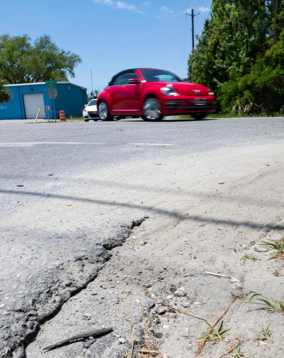
The damage inflicted on the roads came from hundreds of trucks carrying debris left in Hurricane Michael's wake. Almost 30 million cubic yards of hurricane debris was collected countywide.
County Commissioner Doug Moore said the hundreds of debris trucks took a heavy toll on roads.
"Those trucks were on the road for about six months, and they were constantly stopping and going back and forth and hauling debris away. They were a typical heavy truck, about the same as 10 cars," Moore said. "And we had hundreds of those debris trucks here."
Moore said the repaving project has been a long time coming, describing grueling talks Bay County officials had with FEMA for the past two years.
"With FEMA trying not to do it, but our staff had gone out and had laser-graded all of these roads just before the hurricane hit. And so, we were able to show by metrics how much the damage, with the roads being used by the trucks for the debris removal, how much it had harmed these roads," Moore said. "And so, we were ultimately able to get FEMA to cover the costs of resurfacing these 132 miles worth of roads throughout the county."
With FEMA covering the roads project, Moore said county officials can use the money originally planned for resurfacing to be used on other infrastructure.
Residents have been traveling the damaged roads for more than three years, so Moore said the project finally will give them some relief.
"Cracks in the roads, chunks coming out of it. If you ride down certain roads, you'll feel the waves as you're going through, you'll feel the ruts," Moore said. "It's working on roads like that, that are in unincorporated Bay County, that will allow us to be able to resurface and improve the quality of life for our citizens."
List of roads for Phases 1 and 2
Phase 1:
Kingslee Drive
Walton Avenue
Riley Road
Fanning Bayou Drive
Toepfer Boulevard
Doe Run
Doe Circle
Silverleaf Avenue
Frederickson Street
Gravelle Drive
Resota Lane
Joanna Lane
De Len Drive
Harlan Hope Road
Earl Sapp Road
Bollinger Road
Cabin Road
Ard Drive
Sunshine Drive
Jaycee Road
Pine Avenue
Bay Avenue
Osceola Street
Blanche Avenue
Fargo Street
Deep Water Court
South Lake Joanna Drive
Diane Lane
Betty Lane
Glensway Road
Frank Hough Road
Star Avenue
Plantation Road
Tracey Drive
Phase 2:
Joan Avenue
Moylan Road
Fireside Court
Kings Street
Robinson Bayou Drive
Foxworth Circle
West 27th Street
West 25th Street
West 30th Street
Jamedon Drive
Cornell Drive
Pinetree Lane
Northshore Circle
West 33rd Place
Pine Ridge Drive
Ashland Drive
16th Street
Placido Place
Kirklin Avenue
North Grey Avenue
East 16th Street
Bob Loftin Avenue
East 13th Street
East 13th Court
Rita Street
Chelsea Lane
Washington Street
Trinity Street
East Ninth Street
Margaret Circle
Bob Jones Drive
Eisenhower Circle
Santa Anita Drive
Rainelli Court
Pittsburg Street
Valla Street
Nelson Street
37th Plaza
Eagle Lane
Lark Lane
Cocoa Avenue
North Harris Avenue
Pipeline Road
Titus Road
Stewart Drive
This article originally appeared on The News Herald: Bay County getting 132 miles of road repaved after Hurricane Michael

