Bayocean hike shows where lost Oregon Coast town fell into the sea
Not quite Atlantis, but the lost town of Bayocean does have its similarities.
Surrounded by the coast on one side and Tillamook Bay on the other, the peninsula used to be home to a town of about 2,000. Harsh weather and even harsher waves destroyed Bayocean over the course of 40 years until it completely washed away in the 1970s.
Decades later, nature has reclaimed the area, and the 7.8-mile Bayocean Spit Loop hike around the peninsula features a unique mix of scenery from sandy dunes to heavily forested areas.
With the views of the coast and bay, it’s easy to understand why so many once called Bayocean home years ago.
The town that fell into the sea
The history of Bayocean started in 1907, after a Kansas City real estate developer and his son decided to construct a resort on Bayocean Spit. Over time, materials were hauled in by boat and a town was built around the resort. At least a 1,000 to 2,000 visitors made the trip to Bayocean each weekend over the summer.
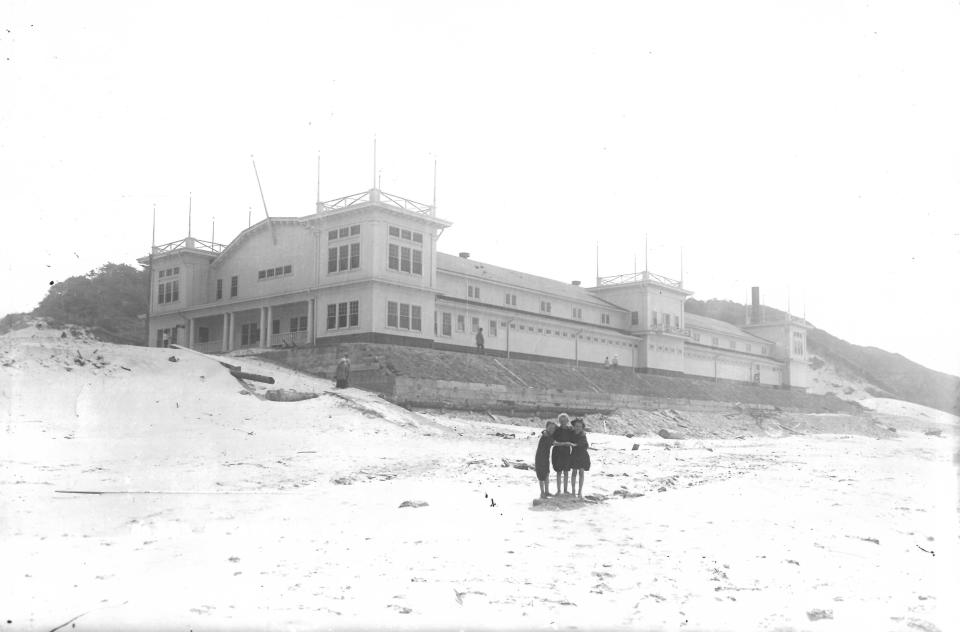
Bayocean, also nicknamed the “Atlantic City of the West” featured several stores, a bakery, dance pavilion, tennis courts and more than 50 homes by 1950. The poster child of the town was a natatorium that featured artificial waves and real seawater.
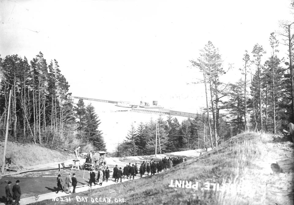
Access to the area was limited to boats at the start, then a railroad and a road were built in 1928. By 1914, nearby towns scraped together enough money for the U.S. Army Corps of Engineers to construct a jetty along the opening of Tillamook Bay to help shipping. World War I interrupted plans to construct a second jetty and another $450 from each resident was unattainable at the time.
By only building one jetty, the change in wave patterns led to erosion of the sand Bayocean sat on. In 1932, a large storm completely destroyed the natatorium. Though residents had already started abandoning the area, 59 homes disappeared just a few years later in 1938. In 1952, the sea broke into the spit, causing the once-connected Bayocean to become an island.
In a panic, the nearby towns and ports quickly provided funds to build a second jetty, which was completed in the 1960s. The breach in the spit was stabilized, and over the past 50 years, a buildup of dredged sand has repaired the peninsula and reconnected it to the mainland.
Still, the last structure of Bayocean was destroyed in 1971. No remains of the buildings or town are visible anywhere on the peninsula today.
Hike where Bayocean once stood
You’ll start your hike at Bayocean Peninsula Park. There’s a $10 fee for parking, which can be paid at the trailhead. As soon as you pull up to the park, there’s a gorgeous view that stretches across Tillamook Bay.
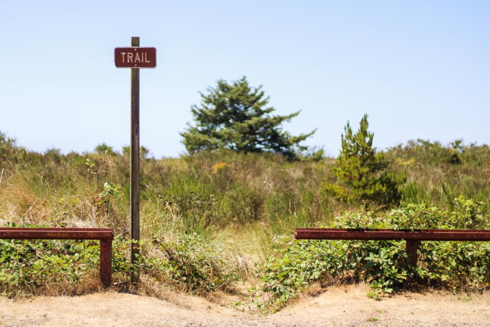
Turning away from the water and toward the dunes, a trail sign sits in between two rusted fence posts. The sandy trail is the start of the loop and is outlined in spiky patches of Marram grass. In between dunes, you’ll catch a glimpse of Cape Meares to your left as you go further down the path.

Over one final steep dune, you’ll drop down to the beach and see the neon emergency locator #29 sign behind you. Facing the ocean, turn right and continue down the beach.
It’s a long stretch, a little more than 4 miles, but you can base your progress off four other trail signs to your right. Those looking to shorten the hike can cut across any of the trails to get to the gravel trail across the peninsula.
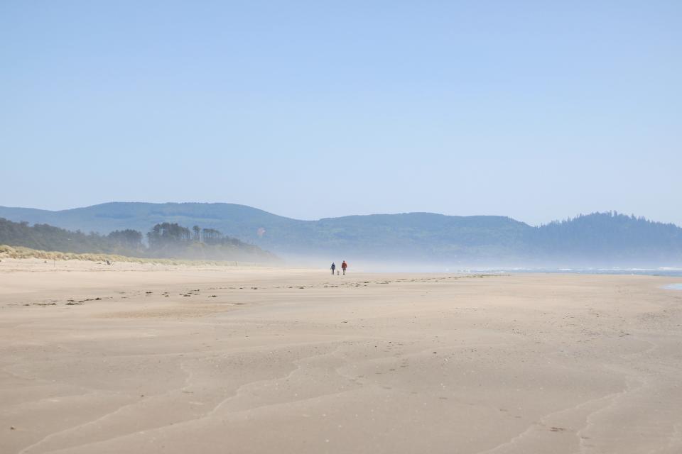
As you near the end of the beach, be sure to walk on wet sand. From March through September, restrictions are in place on the beach and dunes to protect snowy plover nesting areas.
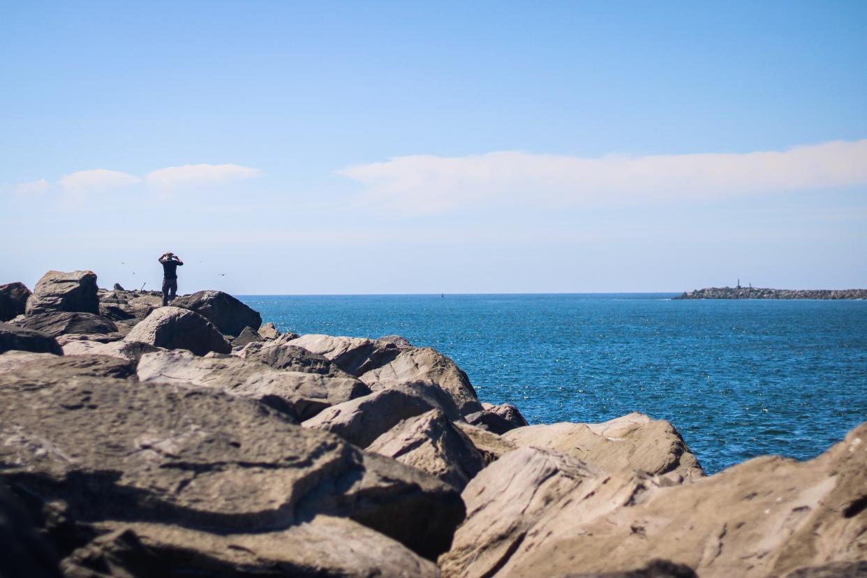
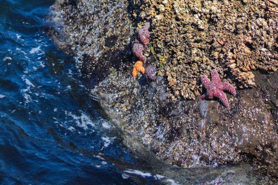
If you stick with the full loop, a large stack of gray rocks will slowly come into view. From the rocks, you’ll have a view of the Barview Jetty Beacon sitting above and you can see the south jetty and north jetty at the mouth of Tillamook Bay.
Since 1979, the south jetty has been part of the beach and serves as a home for some sea life. That includes starfish, mussels and barnacles. A number of seabirds also frequent the rocks, especially pelicans and gulls.
From here, you’ll turn right down the beach and head up a sandy dune marked by driftwood. The sand path will slowly switch over to gravel, and the scenery will follow with shrubs and short pine trees. The Three Graces, three large rock formations near Barview, are visible across the mouth of Tillamook Bay.
As you turn a corner between the brush, the trail completely falls off into a small rocky cove overlooking a channel of the bay. Returning to the traditional path, you then follow a curve back into a thicket of trees.
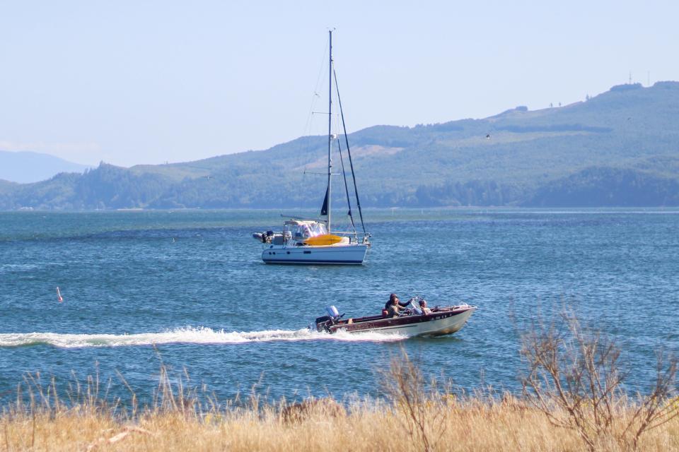
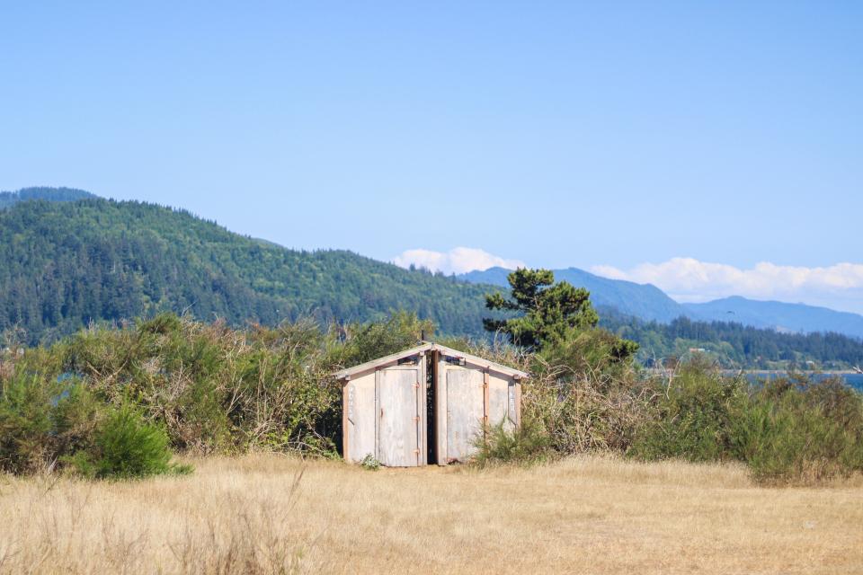
Grassy openings come back into view as you continue, and a small wooden outhouse sits in between your first full view of Tillamook Bay. A number of boats dot the waters, especially in Crab Harbor. Just a few feet down the trail, those looking to get closer to the bay will find more opportunities to walk down to the rocky beaches.
A lookout over the bay is present to your left and trees line the right side for a little less than a mile before the trail sharply turns into a path laid behind forested dunes. Tall spruces and pines dominate the scene, complete with dense green shrubbery on both sides of the trail.
Just as quickly as you went into the green, the trail switches to a sandy open scene. To the right, a telephone pole sticks up near a trail with a “Bayocean Townsite” sign. The path goes to the beach, but most of the townsite is now gone or under the surf. No pipes, cement, wood, or any sign of what used to be a bustling town is visible.
Returning back to the main trail, Bayocean Peninsula Park will come back into view once you finish the loop.
Bayocean Spit Loop hike
The stats: A longer but rewarding hike, offering a mix of environments from sandy dunes to thick and covered forest trails. By following the gravel trail, the area can be a good biking trip too.
Trip: The full loop is 7.8 miles. If you’re looking for a quicker trek, the hike can be shortened by cutting across the peninsula through four different trails that lead from the coast to the bay.
Trailhead: Bayocean Spit Trailhead.
Weather: Dress accordingly for wind or some chillier temperatures and bring water and sunscreen for sunny days.
When to go: Relatively quiet hike. On the weekends and Fridays, the gravel trail can get popular with families and bikers.
Fee: $10 parking fee, which can be paid at the trailhead.
Map: Bayocean Peninsula Park and the trail can be found at bit.ly/43TGDwG.
Directions: From Salem, follow OR-22 west for 25.5 miles before taking the ramp to the Oregon Coast. Merge onto OR-18 west/OR-22 west, then in about 3 miles turn right for OR-22 west/southwest Hebo Road. Follow that road for another 25 miles then turn right onto U.S. Highway 101 north. Turn left onto Tillamook River Loop, then right onto Tillamook River Road. After about 2 miles, turn left onto Burton-Fraser Road. After another 2 miles, turn right onto OR-131 east. Turn left onto Bayocean Road and follow signs for Three Capes Scenic Route/Cape Meares. Turn right onto Bayocean Dike Road and pull into the park.
Abigail Landwehr is an outdoors journalism intern for the Statesman Journal. She can be reached at alandwehr@gannett.com
This article originally appeared on Salem Statesman Journal: Bayocean hike shows where lost Oregon Coast town fell into the sea

