Beaufort Co. dodged thunderstorms over July Fourth. Here’s what’s coming this week
While Beaufort County residents braced for potential thunderstorms and heavy rain on July 4, it was spared the event-shuttering rain and flooding that was seen in Horry County. And forecasts say it’ll stay that way for the next few days.
Summer forecasts for the Lowcountry have been all over the map, as it tends to go. Alerts for heavy rains, flooding risk, high winds, whipping waves and severe thunderstorms have dotted predictions nearly each week this summer. On Saturday, there were predictions of a pop-up tropical storm that did not materialize. Last week, a waterspout was spotted by Hilton Head Island beach-goers. And still in the thick of hurricane season, storm spontaneity remains.
High temperatures and cloying humidity aren’t going anywhere, and neither will the rain and thunderstorms. Heat indices will continue to needle to over 100. And as the week presses on, the chance for thunderstorms will increase, according to the National Weather Service.
So, headed to the beach this week? Here’s what to expect:
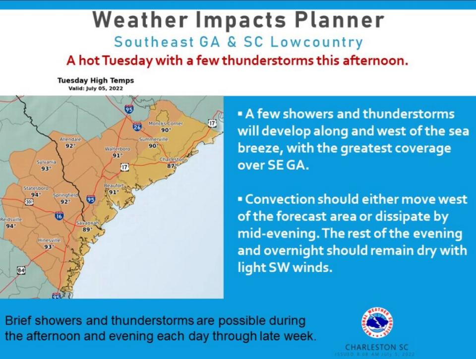
Tuesday: 20% chance of rain and thunderstorms after noon. High near 89.
Wednesday: 20% chance of showers and thunderstorms after 1 p.m., ending before 10 p.m. High near 92 with heat index values as high as 105. South wind 7-9 mph.
Thursday: 30% chance of showers and thunderstorms after 2 p.m. and ending before 8 p.m. High near 93. Southwest wind 7-9 mph.
Friday: 40% showers and thunderstorms, after 2 p.m. that will quell in the evening. High near 93.
Saturday: 50% chance of showers and thunderstorms, which will happen before 2 a.m. and continue after. High near 94. The evening will bring a 70% chance of rain.
Sunday: Showers and thunderstorms likely, with a 70% chance of precipitation. High near 88.

What does percent chance really mean?
Meteorologist call precipitation probability one of the “least understood” type of forecasts.
To get precipitation probability, meteorologists take into account several aspects. In short, the National Weather Service summarizes it this way: the probability of precipitation is a statistical probability of 0.01” inch or more of precipitation in the given forecast area in the time period specified.
This is what precipitation probability doesn’t mean
If forecasters say there’s a 40% chance of rain, that doesn’t mean that 40% of the area will be inundated by precipitation during that time in the specific location, or that a person will see rain 40% of the time in the specific location during the forecast time.
Here’s the math behind the number
Forecaster certainty that precipitation will form or move into the area x (times) areal coverage of precipitation that is expected (and then moving the decimal point two places to the left) = (equals) percent chance of rain.
This is what is meant by a 40% chance of rain
So, say the meteorologist was 80% sure that rain would develop but only expected it to cover 50% of a specific area. The day’s forecast would read “a 40% chance of rain” for that area.
That means if a forecast says there’s a 40% chance of showers in the afternoon in Beaufort County, then there is a 40% chance of rain developing from noon to 6 p.m. at any given point in the county.

