As snow melts, freeze hazards remain through Sunday

Noon: Black Ice Threat
Temperatures have picked up in the area slightly but ice still remains on roads causing some slick spots in Craven County and New Bern.
Neuse and Trent River bridges each saw several accidents on Friday night before being shutdown, said Craven County Emergency Services Director Stanley Kite.
"We had a good number of accidents," Kite said. "There were about four or five on the bridges around 6:30 p.m. and they finally got it back under control."
Kite warned residents to take precaution Saturday night into Sunday morning as driving conditions could worsen. Temperatures are expected to drop below freezing again and cause a refreeze of melted snow on roads.
"I think the most dangerous driving conditions are probably gonna be tomorrow morning and tonight as those temperatures get back down into the low 20s and teens," Kite said. "Everybody's got to use an abundance of extreme caution. Tomorrow morning is gonna be very tough."
On Sunday, the National Weather Services predicts temperatures to rise up to 46 degrees, so the wintry weather conditions should fade quickly.
This will be our final live update of the day unless breaking news occurs related to the weather.
10 a.m.: Snow scene
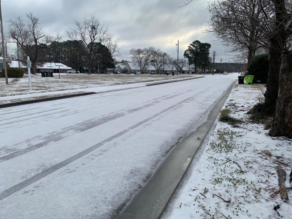
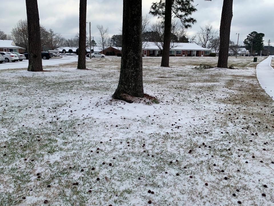
Residents are waking up to a mix of ice and snow in the New Bern and Craven County area.
The end of wintry precipitation Friday night left the roads frozen with hazardous slick conditions in some areas. About a 1/2 inch of snow and ice was last reported, according to city of New Bern.
The sun has come out, but the temperature remains below freezing at 26 degrees. Temperatures are expected to pick up through out the day with a high of 36 degrees.
Black ice remains a concern as temperatures begin to drop below freezing tonight.
According to the city of New Bern, they predict the roads will stay frozen today and locals should stay home as crews are on the scene to plow snow and reapply salt and ice-melt.
7. a.m.: Icy roads
Wintry precipitation was reported overnight in New Bern leaving about a 1/4 inch of ice and some snow.
"Not a whole lot of ice accumulation reports in Craven over the last few hours," said Casey Dail, meteorologist for NWS. "Maybe up to a quarter of an inch in some spots."
Temperatures are expected to rise above freezing with a high of 37 degrees. Wind gusts could get as high as 22 m.p.h.
Though some ice is expected to melt as temperatures warm slightly, anything that doesn't melt has the potential to refreeze tonight.
Temperatures could drop as low as 18 degrees causing concern for black ice over the next 24 hours, Dail said. Hazardous road conditions remain in the area.
A coastal flood advisory is in effect for the Craven County area until 1 p.m., according to National Weather Services.
— Symone Graham
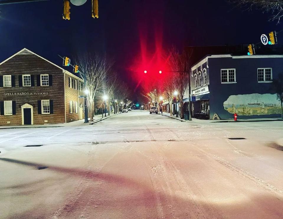
6:45 p.m.: Light freezing rain reported
At 6:45 p.m., the National Weather Service reported light freezing rain and 29 degree temperatures at the Craven County Regional Airport. A wintry mix is expected overnight, it said.
Freezing rain is expected to continue until about 11 p.m., when sleet is expected for about four hours. Snow is expected to fall after 3 a.m., but total accumulations will likely be less than an inch, it said.
A north wind of about 14 mph is expected, with gusts as high as 21 mph possible.
3 p.m.: Start of winter weather
Beginning at 3 p.m. freezing rain and sleet will begin to fall in most parts of Eastern North Carolina.
The forecast for when the winter weather will hit continues to be pushed back, now forecasting freezing rain before midnight, sleet between midnight and 4 a.m., then snow after 4 a.m., according to the National Weather Service in Newport.
There is a 100% chance of precipitation for residents in Craven County throughout Friday night and into Saturday morning. Temperatures are expected to drop to 26 degrees before climbing to the mid 30 degrees on Saturday afternoon.
Noon: Heavy winter weather still expected
After some light precipitation Friday morning, heavy snow and ice are still expected Friday night into Saturday morning.
The National Weather Service in Newport said the best chance for snow is overnight Friday. Snowfall accumulation in Northern Craven County and New Bern is expected to be between one and four inches.
With the cold and wet conditions, the NWS continues to get some reports of light icing, especially along with elevated surfaces (car tops, decks) across Eastern North Carolina.
There are no major changes to the forecast.
9 a.m. update
There were several power outages overnight Thursday in James City and Trent Woods, according to city officials.
Approximately 1,196 were without power at 11:37 p.m. with power being restored by 12:13 a.m. Friday morning in James City. The cause of the power outage in James City is still being investigated, while the outage in Trent Woods was caused by a lightning arrester, according to city officials.
Residents are waking up to chilly temperatures throughout New Bern and Craven County. Current temperatures are 31 degrees with a wind chill at 21 degrees. The forecast for the rest of the day is expected to hover above freezing before getting colder Friday night.
Public Works is out this morning on Hazel Avenue addressing a leaning tree limb. Hazel Avenue will be closed for a couple of hours while crews take care of it.
At 9 a.m. Public Works crews will begin salting and sanding roadways and they'll continue rounds until the city runs out of supply.
7 a.m.: Wintery mix could hit Eastern North Carolina
Eastern North Carolina is expected to receive a wintry mix of snow and sleet Friday and Saturday.
The New Bern area can expect to see freezing rain after 2 p.m. with potential snow around midnight Saturday.
Significant amounts of ice and snow are expected across most of the area, according to the National Weather Service Newport/Morehead City.
An ice storm warning is in effect from 4 a.m. Friday through 7 a.m. Saturday.
On Thursday evening about 5 p.m., city officials declared a State of Emergency due to the potential for winter ice and snow.
The NWS is calling for between one to two inches of snow for Northern Craven, Jones, and Pamlico counties . Southern Craven and Jones counties are expecting a dusting.
A high of 31 degrees is expected.
Heading into tonight, freezing rain and sleet are expected before 2 a.m. before turning into snow.
This article originally appeared on Sun Journal: New Bern, NC sees snow

