Bertha unloads tropical downpours over waterlogged Carolinas

The official start of the 2020 Atlantic hurricane season is still a few days away, but a tropical storm just made landfall in the United States.
AccuWeather meteorologists were closely monitoring an area of low pressure over Florida earlier this week that showed the potential to spin up into a tropical storm, and on Wednesday morning, Tropical Storm Bertha was born.
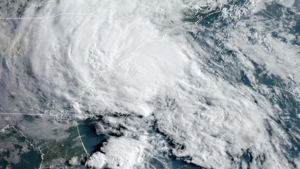
Bertha took shape shortly after 8 a.m. EDT Wednesday just off the coast of South Carolina with maximum sustained winds of 45 mph. A little over one hour later, it made landfall just east of Charleston, South Carolina.
This was the first tropical system to make landfall in the U.S. this year.
 |
This GOES-16 satellite image taken Wednesday, May 27, 2020, at 11:40 UTC and provided by The National Oceanic and Atmospheric Administration (NOAA), shows Tropical Storm Bertha approaching the South Carolina coast. (NOAA via AP) |
Flooding downpours have been the primary threat from Bertha with the storm unloading more than 4 inches of rain in some areas of South Carolina.
Highway 521 near Rembert, South Carolina, was one of several roads that were underwater on Wednesday afternoon as a result of the tropical downpours.
"The problem is this rain will fall on saturated ground from prior heavy rainfall this month, so there could be flooding problems all the way from the Carolina coast to at least southwestern Virginia and West Virginia," ]AccuWeather Senior Meteorologist Randy Adkins said.
The Pee Dee River near Florence, South Carolina, had just crested near major flood stage before Bertha's arrival, but the additional rain from the tropical system caused the water level to tick closer to major flood stage by Wednesday evening. The nearby Lynches River also had recorded a jump in water levels.
 |
Flooding will continue to be a concern in parts of Virginia and the Ohio Valley through the balance of the week as Bertha moves farther inland. This includes Roanoke, Virginia; Charleston, West Virginia; and areas south and west of Pittsburgh.
CLICK HERE FOR THE FREE ACCUWEATHER APP
This has been an active start to what is forecast to be a busy hurricane season in the Atlantic Basin. Earlier in May, Tropical Storm Authur developed in the same area where Bertha took shape; however, Arthur curved out to sea and never made landfall.
"The 2020 season will be very active, but not as active as the real hyperactive season of 2005," AccuWeather Hurricane Expert Dan Kottlowski said. "There is a growing concern," he added, "that this season will be another very active one, at least on par what we have seen the past four years."
Another tropical storm could brew in the coming weeks, but this time in a different part of the Atlantic Basin.
"There has been some indication that a tropical system may spin up over the western Caribbean Sea to near the Yucatan Peninsula sometime during the first week of June," Kottlowski said. "But, this far out, it is something we will just keep an eye on."
Keep checking back on AccuWeather.com and stay tuned to the AccuWeather Network on DirecTV, Frontier and Verizon Fios.
