Bitter temperatures, wind chills ahead for northeast, central Wisconsin
Wisconsinites entered Day 2 of a winter storm Friday, with snow replaced by strong winds and extreme wind-chill temperatures.
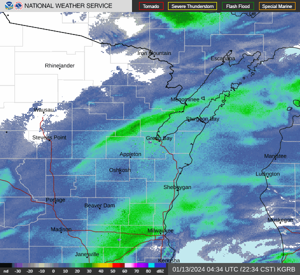
The National Weather Service summary of Wisconsin's weather conditions looks bleak:
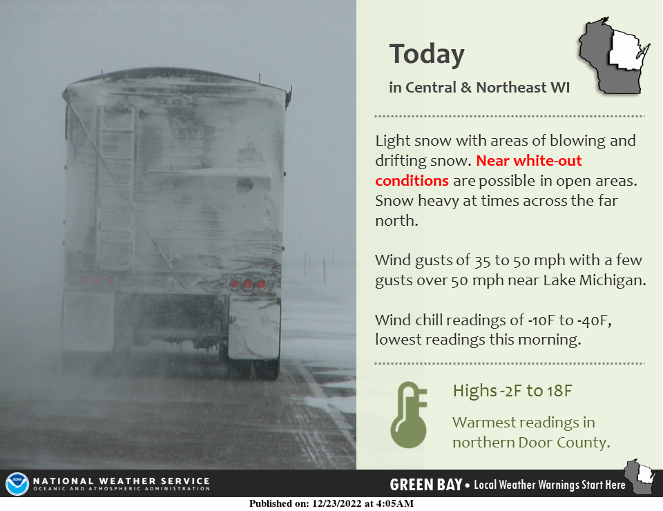
"Winds are forecast to increase today, particularly this afternoon ... some blowing snow will be possiblein rural/open areas today."
Road conditions could get more hazardous entering into Friday night. The Brown County Sheriff's Office urged the public Friday afternoon to avoid all unnecessary travel.
"Roadways that appear to be clear are likely covered with ice and the salt is either getting blown off by the wind or having little effect because of the temperatures," Lt. Joseph Patenaude said in a news release.
Winnebago County asked drivers Friday afternoon to avoid the Butte des Morts causeway on Interstate 41 in Oshkosh because of whiteout conditions.
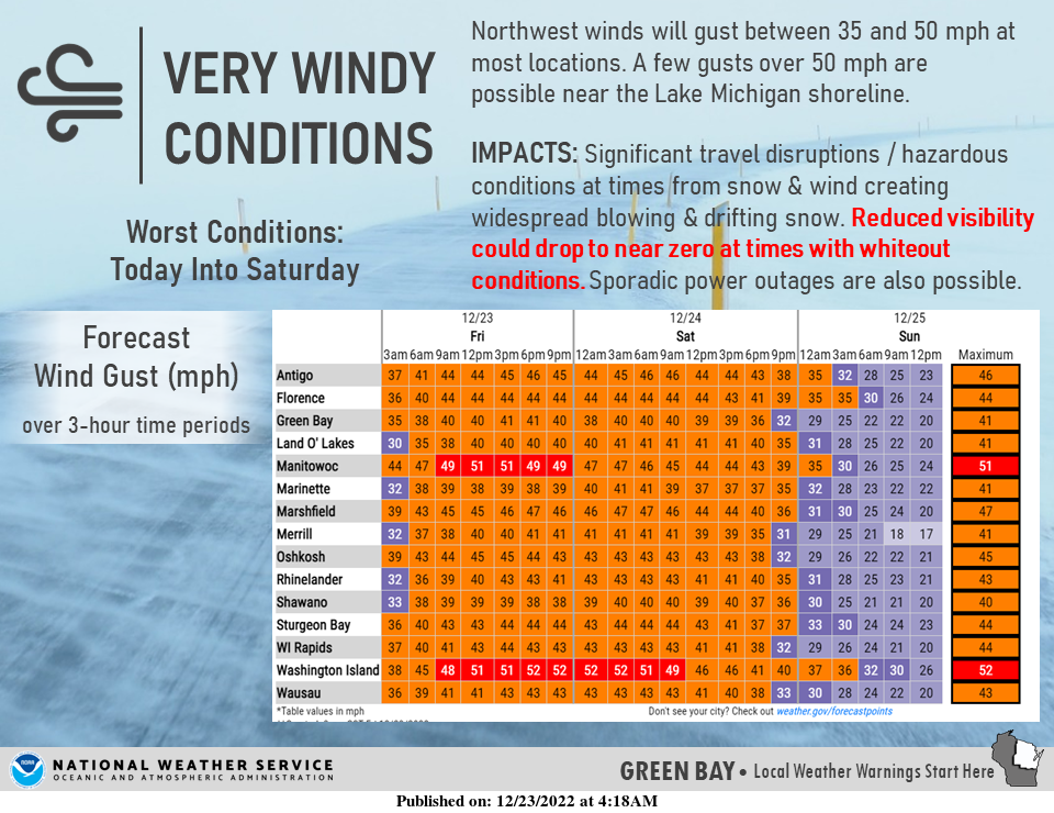
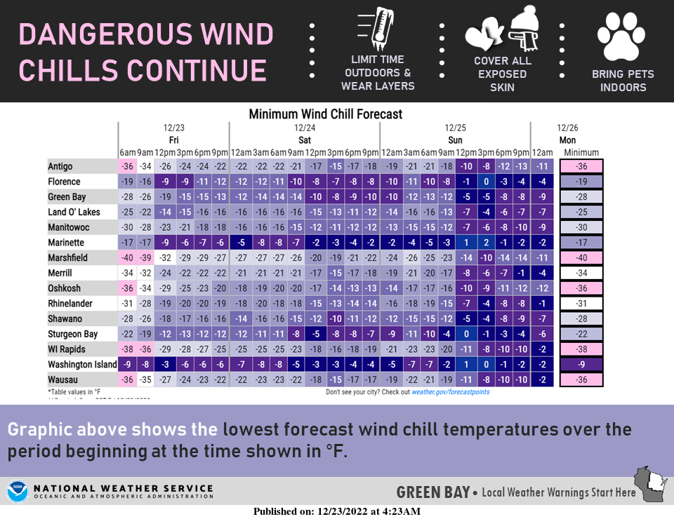
The forecast calls for 40- and 50-mph gusts possible into Friday night. Wind chill figures across the state will reach minus-20 to minus-40, with them "climbing" into the minus-20-to-minus-30 range Saturday and Sunday.
Timm Uhlmann, a National Weather Service meteorologist in Green Bay, said the snow that fell in central Wisconsin was not too much different from the amount forecast. But the fact that it wasn't heavy snow landing on northeastern and central Wisconsin, and fell at a reasonable rate, meant snowplow drivers could stay ahead of the storm.
"But the main thing going forward here," he warned, "is that we could get some wind gusts of 35 to 40 mph."
The specific forecasts for northeastern and central Wisconsin:
Green Bay/Appleton: All of northeastern Wisconsin remains under a winter storm warning until 6 a.m. Saturday. Wind gusts as high as 50 mph will cause blowing snow, with wind chills in the minus-25 range. People in some areas will experience dangerously cold figures reaching near minus-40. Staying outside for as little as 15 minutes could mean the risk of frostbite.
Travel, to say the least, "could be difficult." As the wind slowly diminishes during the weekend, there will be gradual improvement in the weather conditions.
Highs are predicted to be 5 Friday, 8 Saturday and 8 on Sunday. Weekend lows are expected to be 3 Saturday and minus-1 Sunday.
Wausau/Central Wisconsin: The warnings are similar, though the air temperature is colder.
High temperatures will be zero Friday, 3 Saturday and 8 Sunday. Low temps aren't expected to exceed minus-2, the National Weather Service says.
If you need to hear something positive, it's that the change of flurries are only 40 percent today, and 30 percent tonight. The chance of snow will continue to shrink during the weekend.
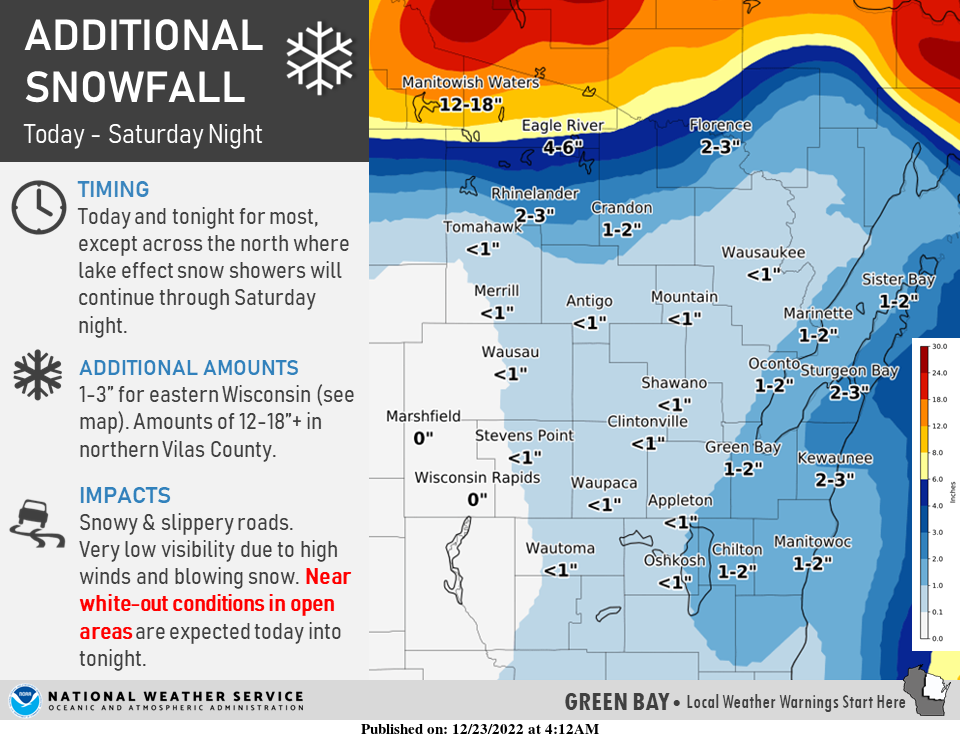
Wisconsin snowfall totals were heaviest in Door County; two areas reported at least 9 inches
Two Door County sites, Washington Island and Carlsville, reported snowfalls of 9.1 and 9 inches, respectively, according to the National Weather Service.
Here's a rundown of reported snowfall totals throughout the state:
Appleton, 6.5 inches
Eau Claire, 5.5 inches
Fond du Lac, 3.5 inches
Green Bay, 4.3 inches
Janesville, 1.4 inches
Kenosha, 1.1 inches
La Crosse, 3.1 inches
Madison, 4 inches
Milwaukee, 2.3 inches
Racine, 1 inch
Rhinelander, 6 inches
Sheboygan, 2.8 inches
Wausau, 4.6 inches
DOT warns about blowing and drifting snow on Wisconsin highways
Most major highways in northeast and central Wisconsin have slippery sections, according to the state Department of Transportation’s 511 road conditions website.
The DOT warns drivers, “Travel could be very difficult throughout the day as strong winds will cause blowing/drifting snow and reduced visibility.”
More canceled flights at Appleton than Green Bay
At Green Bay Austin Straubel International Airport, only a few flights were canceled or delayed Friday.
It's a different situation at Appleton International Airport, where more than half of the arrivals scheduled through Friday night and more than half of the departures scheduled through Saturday morning have been canceled.
Appleton International reported cancelling multiple scheduled arrivals Thursday night, while Green Bay-bound flights continued to fly as scheduled.
Central Wisconsin Airport in Mosinee, near Wausau, had just a few cancellations Friday.
Cold causes many school cancellations
Many school districts were already off for their winter break Friday, but those across northeast Wisconsin and central Wisconsin that had planned classes canceled them because of the cold temperatures and wind chills.
Cancellations today also included many public libraries, government offices and businesses. If you’re venturing out to a specific location, it’d be a good idea to check their social media in advance to make sure they’re open.
Few power outages reported in northeast, central Wisconsin
Though there were concerns about the potential for widespread power outages, they've been scattered and localized across northeast and central Wisconsin.
The electric utilities serving the region — We Energies, Wisconsin Public Service and Alliant Energy — are reporting few outages.
Email Doug Schneider at dschneid@gannett.com, call him at (920) 265-2070 and follow him on Twitter @PGDougSchneider
This article originally appeared on Green Bay Press-Gazette: Northeast Wisconsin, central Wisconsin expects bitter temperatures, wind chills

