Black Fire continues to char Gila National Forest, creeps closer to Truth or Consequences
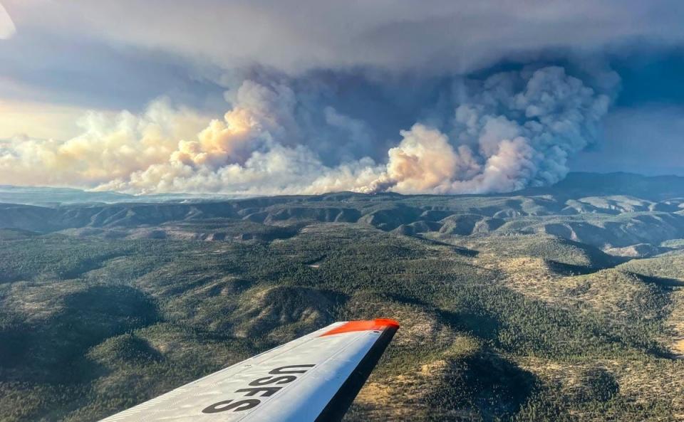
SILVER CITY – About 12,000 more acres of wilderness land is burning in the Gila National Forest Friday as the Black Fire continues to ravage the southwest area of New Mexico and creep closer to Truth or Consequences.
The extreme wildfire is burning a total of 104,969 acres in the Gila as of Friday morning, May 20, according to the U.S. Forest Service. The fire started a week ago, on May 13, in the Aldo Leopold Wilderness, north of Mimbres. Containment is still at 0%.
Growth of the fire now places it an estimated 31 miles northwest of Truth or Consequences. Fire personnel are holding a community meeting at 7 p.m. Friday night at the Ralph Edward Civic Center at 400 W. 4th St. in T or C. The meeting will also be livestreamed on the Gila National Forest Facebook page at www.facebook.com/GilaNForest.
Black Fire: Blaze now second largest wildfire currently burning in New Mexico
The forest service reported Friday morning that fire behavior was active Thursday with uphill runs and spotting on the northern, eastern and southern flanks. Activity along the eastern flank increased Thursday evening to before sunrise Friday morning.
More: Fire prompts mission to save tree seeds, seedlings at NMSU forestry center
According to the official report, the fire is moving to the east, northeast and southeast. Crews of 475 personnel are working to construct direct and indirect control lines. Point protection tactics are being used to protect private property and infrastructure.
A red flag warning remains in place for much of the state as weather conditions remain dry and windy. The forest service announced that a low pressure system is expected to move out of the Great Basin in California and Nevada and head East toward New Mexico. Temperature highs will range from 78 to 82 degrees with winds blowing around 20 miles per hour southwest to west. Gust can reach up to 35 or 40 miles per hour.
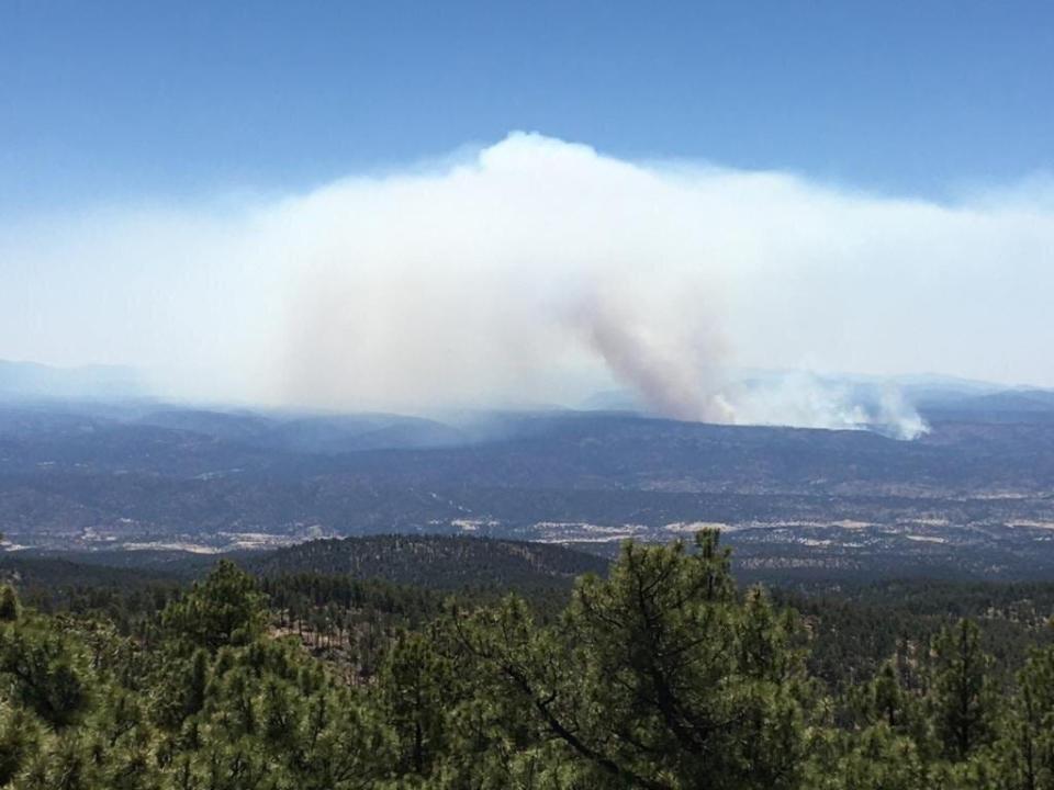
Winds are forecast to die down Saturday as temperatures lower as well. Smoke from the fire remains visible throughout much of southern New Mexico, however the Air Quality Index places most areas within the good or healthy range.
Winston, in Sierra County, is the only area Friday morning listed in the unhealthy range, meaning smoke may affect sensitive groups such as children, older adults, people with heart or lung disease and pregnant women. All groups are encouraged to consider lighter, shorter outdoor activities.
Evacuations in Grant, Catron and Sierra counties are still in place and updated evacuation readiness statuses were announced Friday morning. Ready, Set, Go conditions include:
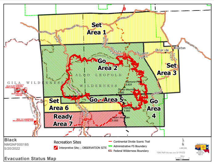
GO – Area 2: Encompasses part of Catron and Sierra Counties, including Round Mountain, Diamond Bar Ranch, Me Own Work Center, Links Ranch, Lookout Mountain and Sugar Loaf Peak.
GO – Area 4: Areas in Sierra County, including Hermosa and Mud Spring Mountain.
SET – Area 1: Encompasses parts of Catron and Sierra Counties, including Beaverhead and Poverty Creek.
GO – Area 5: Areas in Grant County, including 150 corridor 1.5 south of Tom Moore Trailhead.
SET – Area 3: Areas in Sierra County, including Winston and Chloride.
SET – Area 6: Areas in Grant County, including the Dispersed area south of Black Canyon Access point along the 150 corridor.
READY – Area 7: Areas in Grant County, including 150 corridor Rocky Point Continental Divide National Scenic Trail and Rocky Canyon Campground.
Road closures include County Road 59, between Beaverhead and the 59/52 junction and portions of Forest Road 150 (also known as North Star Mesa Road or Wall Lake Road). I-25 and other state highways remain open.
Temporary flight restrictions over the fire remain in place as airtankers, helicopters and water scoopers assist suppression efforts. Unauthorized aircraft, including drones, are prohibited for use by the public.
Up-to-date information on the fire and other forest news can be found on the Gila National Forest’s Facebook page at www.facebook.com/GilaNForest or on New Mexico Fire Information at nmfireinfo.com.
More fire coverage:
Fire prompts mission to save tree seeds, seedlings at NMSU forestry center
As feds stay quiet on state’s largest-ever wildfire, theories circulate about its cause
Leah Romero is the trending reporter at the Las Cruces Sun-News and can be reached at 575-418-3442, LRomero@lcsun-news.com or @rromero_leah on Twitter.
This article originally appeared on Silver City Sun-News: Black Fire now about 30 miles west of Truth or Consequences

