Black Fire grows by 50% since Friday to more than 154,000 acres, now 11 percent contained

Editor's note: This story was updated Tuesday, May 24
GILA NATIONAL FOREST – Over 50,000 more acres of land have burned in the Gila National Forest since Friday as the Black Fire grew by 50% over the weekend and on Monday
As of Tuesday, May 24, the Black Fire, 31 miles west of Truth or Consequences, is 154,911 acres large with 11% of the perimeter contained. The wildfire started May 13 from human causes, though the specific reason is still under investigation. About650 personnel are working to contain the fire.
The U.S. Forest Service announced in a news release that the fire was less active Sunday morning as temperatures were lower and there was partial cloud cover. Activity increased as temperatures rose later in the day. The fire grew by over 16,000 acres within those 24 hours.
More: Black Fire becomes second largest wildfire currently burning in New Mexico
Firing operations were underway on the northern edge to help protect inholdings and structures in the Turkey Creek area. Helicopters completed water bucket drops on the southeastern portion of the fire to protect the Hermosa area. The forest service reported that two structures have been lost to the blaze.
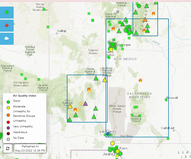
Crews continued to build a fire line Monday. The blaze is expected to be active on the north, east and southern sides this week due to heavy fuels and topography of the area. Increased smoke lingering in the central and southern areas of the state will affect the air quality in surrounding areas.
The forest service said the Black Fire is expected to consistently spread southward into the 2010 Aspen Fire and 2013 Silver Fire burn scars.
Winds are expected to travel southwest Monday around 20 miles per hour, shifting west and northwest Tuesday. Southwest winds will return by Thursday. Relative humidity in the area will be around 10%. Temperatures are expected to increase as the week progresses.
Forest officials said they expect heavy smoke Monday and Tuesday because cloud cover will keep smoke from rising and dispersing. T or C, Winston, Magdalena and Socorro will experience moderate to unhealthy air quality as northeast winds blow smoke their way. Areas south of the fire will likely experience good air quality most of Monday.
Grant, Catron and Sierra counties announced new evacuations Sunday afternoon including:
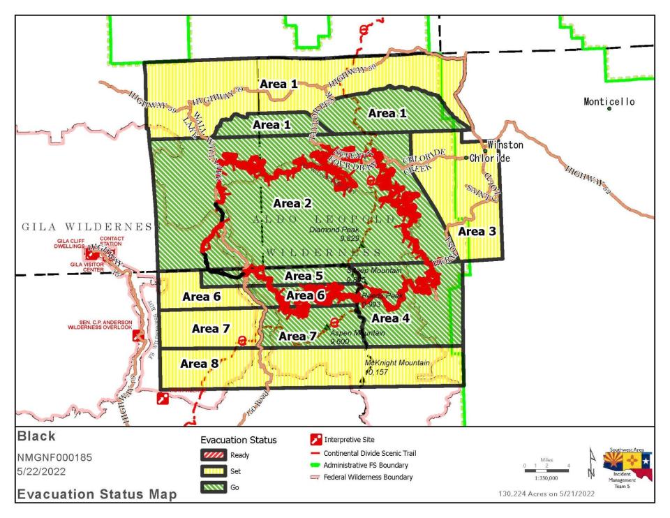
GO – Area 1: New: Starting from Taylor Peak northeast to Kline Mountain, then east to Turkey Creek, following the Bear Creek Road southeast, tying back into the north end of Area 3. The Area 1 portion, including Taylor Ranch and Alexander Peak, remains in GO. The line extends north along the Titanic Road, then east approximately eight miles before heading southeast, tying back into Area 2. The rest of Area 2 remains in Go. The rest of Area 1 remains in Set, and encompasses parts of Catron and Sierra Counties, including Beaverhead and Poverty Creek.
GO – Area 6: No Change: Area 6 east of Forest Road 150 is now in Go. The area west of Forest Road 150 remains in set. This area is in Grant County.
GO – Area 4: No Change: Areas in Sierra County, including Hermosa and Mud Spring Mountain.
GO – Area 5: No Change: Areas in Grant County, including 150 corridor 1.5 miles south of Tom Moore Trailhead.
GO – Area 7: Change: Area 7 east of Forest Road 150, including the Continental Divide Scenic Trail.
SET – Area 7: Change: Area 7 west of Forest Road 150, including the Rocky Canyon Campground.
SET – Area 3: No Change: Areas in Sierra County, including Winston and Chloride.
SET – Area 8: New: Area beginning at the south end of Area 7, four miles south, then east approximately 27 miles. The area now includes Victorio Park Mountain, Flagpole Mountain and Pack Trail.
A community meeting will be held at 7 p.m. Monday in Winston at the Winston Country Church, 2899 Highway 52. Attendees are asked to bring their own chairs.
Road closures include Highway 59 from 59/52 intersections to the 59/150 intersection. Forest Road 150 is closed on the North Star Mesa at the State Highway 35 junction. Interstate 25 and other state highways are open.
The Gila National Forest remains under Stage 2 fire restrictions and a temporary flight restriction continues to be enforces to let air crews assist with suppression.
People can follow the Gila National Forest's Facebook page at www.facebook.com/GilaNForest to remain up to date with evacuations.
More fire coverage:
As feds stay quiet on state’s largest-ever wildfire, theories circulate about its cause
Uninsured homes leave New Mexicans vulnerable in areas hit by wildfires
Leah Romero is the trending reporter at the Las Cruces Sun-News and can be reached at 575-418-3442, LRomero@lcsun-news.com or @rromero_leah on Twitter.
This article originally appeared on Silver City Sun-News: Black Fire grows by 50% since Friday, now 11 percent contained

