Blast of freezing air will have many in the South shivering to end 2023

Following the season's first snowflakes in parts of the South almost to the tail end of 2023, some residents may have to reach for winter jackets as some of the chilliest air of the season moves in through New Year's weekend, say AccuWeather meteorologists.
The blast of colder air will send temperatures at night below freezing as far south as the Gulf Coast and Florida, raising some agricultural concerns. For those from colder climates spending the holidays in the South, it might be an unwelcome return to the weather they are used to at home.
 |
"While this is not expected to be the coldest air the region will see this winter, it will be quite a shock given the recent warmth," said AccuWeather Senior Meteorologist Adam Douty.
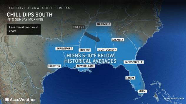
That recent warmth, featuring temperatures 5-10 degrees Fahrenheit above historical averages in the days around Christmas, was accompanied by locally heavy rain tallying several inches. Fortunately, while the temperature will dip into the weekend, it will be largely dry for outdoor activities, including New Year's Eve celebrations.
A few locations over the interior Southeast states had their first snowflakes of the season late Friday and Friday night. These included Tupelo, Mississippi and Huntsville, Alabama.
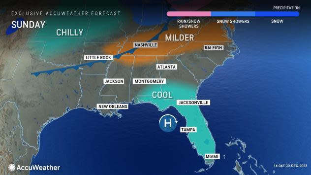
AccuWeather meteorologists say that the same storm that generated the snowflakes will also reinforce the chilly air over the region that will last into Sunday.
"The core of the cold occurred Saturday night," Douty said.
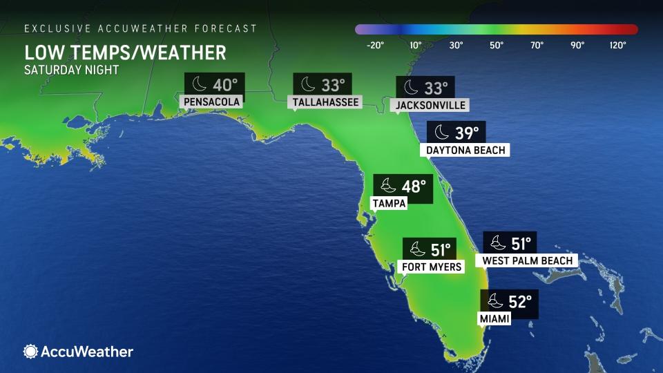
Temperatures come dawn Sunday morning in places like Gainesville and Tallahassee, Florida, will be near freezing, with the 20s even likely across interior Georgia and points to the north and east. For parts of the Sunshine State, it will be the first time temperatures have plunged that low this season, threatening some outdoor plants and vegetation.
"The frost risk will cover nearly all of northern Florida, about as far south as Ocala," added Douty. Fortunately, with the state's citrus crop mainly clustered in the central part of the state, where temperatures should stay above freezing, damage to this important economic staple is not anticipated this time around.
 |
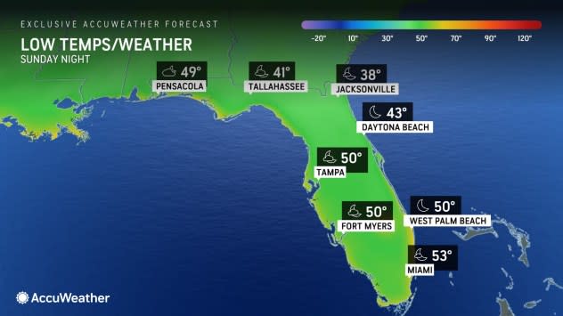
For the central and southern part of the peninsula, low temperatures on both days of the weekend will be in the mid- to upper 40s for places like Orlando, while Fort Myers and Miami will dip into the lower 50s. Such temperatures are about 5-10 degrees below the historical average to close the year.
Daytime highs on Saturday were several degrees below average, with the temperature in Orlando only reaching 60 degrees Fahrenheit, while the temperature rose to 66 degrees in Miami. Afternoon highs on Sunday can be a few degrees higher than on Saturday, but will once again be below average for most.
The cold snap is likely not to be frigid enough to cause iguanas to fall out of trees, a uniquely Florida phenomenon that occurs when the mercury is in the lower 40s or below for several hours in the southern part of the peninsula.
 |
The iguanas-and many humans-will be happy to know that the chill will be short-lived, as temperatures are forecast to rebound closer to historical averages, and even above, as early as Sunday afternoon and especially through the first week of the new year.
Want next-level safety, ad-free? Unlock advanced, hyperlocal severe weather alerts when you subscribe to Premium+ on the AccuWeather app. AccuWeather Alerts™ are prompted by our expert meteorologists who monitor and analyze dangerous weather risks 24/7 to keep you and your family safer.
