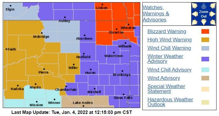
Blizzard warning issued for northeastern South Dakota; winter storm advisory in effect for Sioux Falls
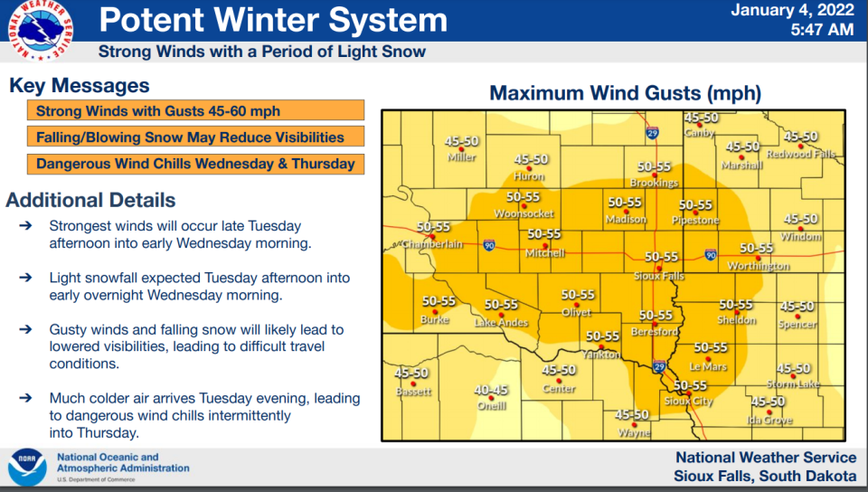
High winds, blowing snow and freezing temperatures will impact the eastern side of South Dakota beginning Tuesday, according to the National Weather Service.
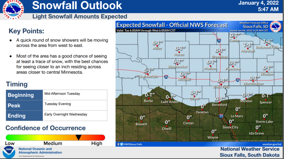
A winter weather advisory and wind chill advisory are in effect for Sioux Falls beginning Tuesday night, according to the NWS. Snow accumulation of up to an inch and high winds with gusts near 55 miles per hour are possible.
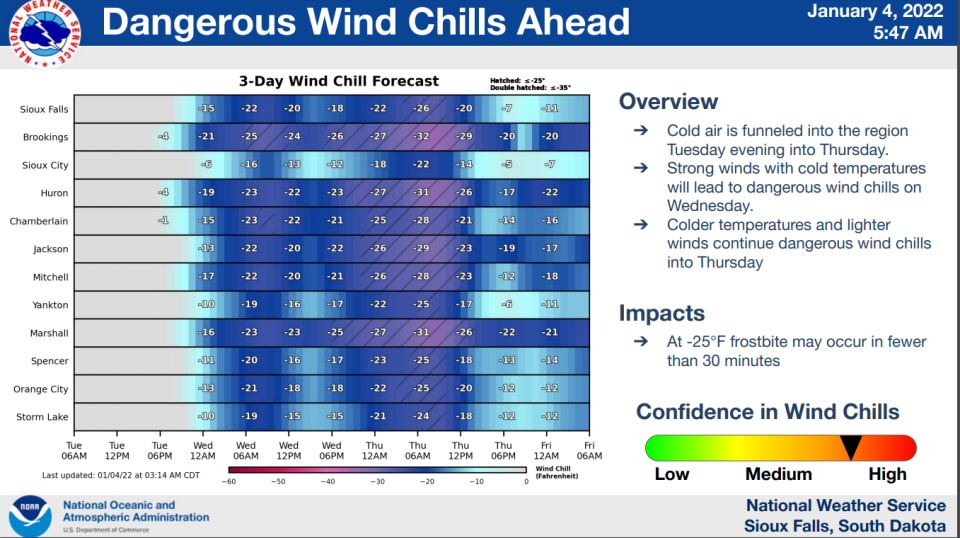
Because of high winds, cold wind chill values are expected and could be around 30 degrees below zero, according to the NWS.
Blizzard warning issued for northern South Dakota
A blizzard warning for Marshall, Roberts and Day Counties as well as parts of Minnesota has also been issued for Tuesday by the NWS.
While only two inches of snow are expected, wind gusts could be as high as 45 mph and there could be reduced visibility between 6 p.m. Tuesday and 3 a.m. Wednesday, according to the NWS.
The potential blizzard-like conditions could impact the evening and morning commutes and make roads slippery, according to the NWS.
The blizzard warning lasts from 3 p.m. Tuesday to 9 a.m. Wednesday, according to the NWS. There's also a wind chill advisory in effect as well from midnight Tuesday to noon Wednesday.
Cold temperatures and high winds lead to wind chill advisory
High wind chills are expected to last from Tuesday to Thursday, according to the NWS.
Throughout the night Tuesday, wind chill values could drop to between 20 to 30 degrees below zero into Wednesday morning.
The average wind chill value between Tuesday and Thursday is expected to be between 15 to 35 degrees below zero, according to the NWS.
Frost bite sets in at negative 25 degrees in less than half an hour, according to the NWS.
SFBJ: Amid the Great Resignation, South Dakota is losing workers, but unemployment remains low
Weekly forecast expected to be chilly
Tuesday: Partly sunny with a high near 42. Windy with gusts in the afternoon reaching up to 45 mph.
Tuesday night: Patchy blowing snow before 10 p.m.. Low near -1 with wind chill values near -22. Windy with gusts near 55 mph. Less than half an inch of snow possible.
Wednesday: Partly sunny with a high near 4. Wind chill values near -25. Windy with gusts near 40 mph.
Wednesday night: Mostly cloudy with a low near -10. Wind chill values near -27. Windy with gusts near 25 mph.
Thursday: Mostly sunny with a high near 1. Breezy.
Thursday night: Mostly cloudy with a low near -6.
Friday: Partly sunny with a high near 19.
Friday night: Mostly cloudy with a low near 14.
Follow Annie Todd on Twitter @AnnieTodd96. Reach out to her with tips, questions and other community news at atodd@argusleader.com or give her a call at 605-215-3757.
This article originally appeared on Sioux Falls Argus Leader: South Dakota weather: High winds, blowing snow to impact eastern S.D.

