Bomb cyclone, tornadoes and possible nor’easter all likely to hit US over the next week
The US faces triple weather threats as severe tornadoes, a nor’easter and a “bomb cyclone” loom large over the country during Halloween week.
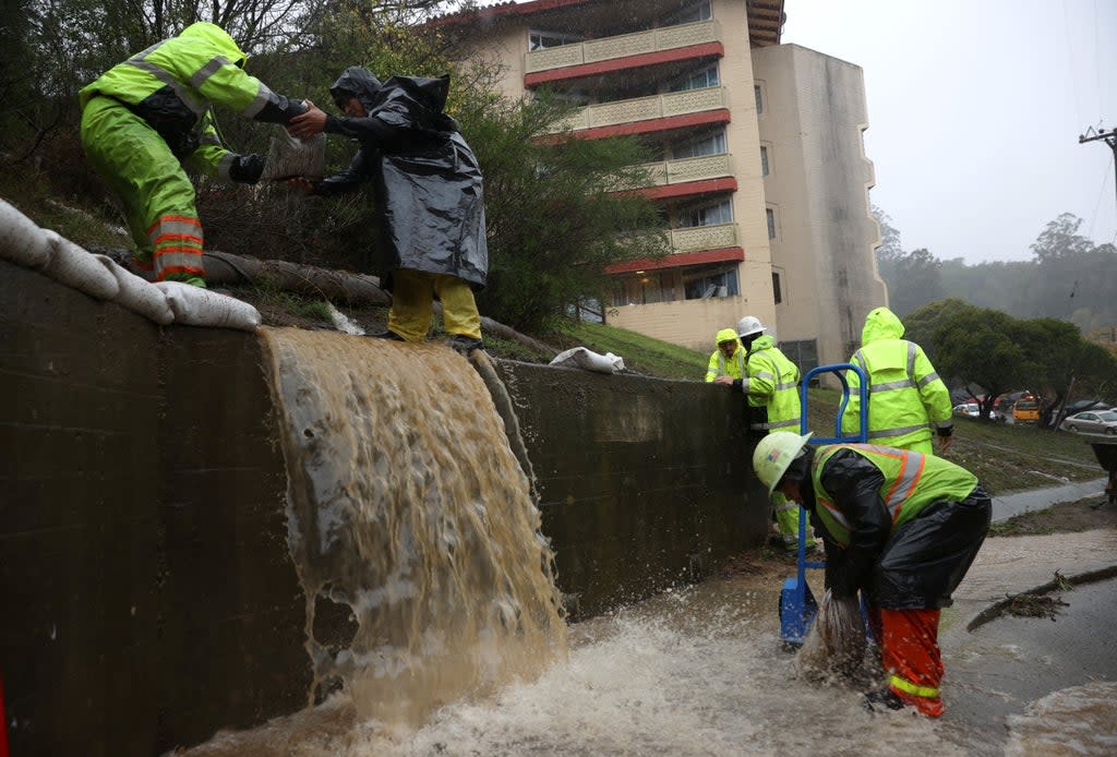
The US’ Pacific Northwestern states, including northern California, Washington and Oregon, have already been hit by the “bomb cyclone” that formed over the Pacific Ocean on Sunday, leading to a storm and heavy showers across the coast.
A bomb cyclone develops when a mid-latitude cyclone intensifies, dropping atmospheric pressure by at least 24 millibars in a span of 24 hours.
While the bomb cyclone has been battering the West Coast, funnel clouds, accompanied by strong winds, appeared in various parts of Kansas, Illinois and Missouri on Sunday.
The Storm Prediction Centre of the country’s National Weather Service (NWS) warned of a “tornado watch” in a tweet. “A tornado watch is in effect for much of Missouri and far western Illinois through 10pm CDT,” the agency said.
A tornado watch is in effect for much of Missouri and far western Illinois through 10pm CDT. Stay tuned to the local NWS offices in @NWSKansasCity, @NWSStLouis & @NWSSpringfield for the latest information including any potential warnings. pic.twitter.com/0LQ37bPexj
— NWS Storm Prediction Center (@NWSSPC) October 24, 2021
A powerful low-pressure system known as a nor’easter has been moving along the US East Coast as well and could likely hit the country by Tuesday. The nor’easter is expected to move up the New England coastline on Monday night through Wednesday.
A flash flood warning has been issued for New York City for Monday night through Tuesday afternoon with up to four inches of rain expected over a 36-hour period.
A powerful storm because of the bomb cyclone, meanwhile, killed two people in Seattle on Sunday, when a tree fell on a vehicle. The storm triggered mudslides and flash floods even as heavy gusts of wind toppled utility poles leading to power outages.
Winds over 80 km/h (50mph) gusted through San Francisco and triggered power outages around Sacramento.
More than 160,000 users in California, over 170,000 in Washington, and over 28,000 in Oregon have been left without power as of Sunday.
The NWS’ meteorologists have predicted up to 10 inches of rain over the west coast in the aftermath of the bomb cyclone.
“It’s an atmospheric river already moving through northern California,” meteorologist Marc Chenard told Reuters. “Atmospheric rivers” are narrow paths of moist air that contain an excess amount of water vapour, causing heavy rains.
It will “be a wild 24 to 36 hours across northern California as we will see an extreme and possible historic atmospheric river push through the region,” according to the NWS.
The storm comes amid a scathing wildfire season in California, which heightens threats of flash flooding.
“Burn scars, that’s the area where the water tends to run off quicker, so that’s where the biggest flash-flood risks are. Warnings are of life-threatening flash flooding in and around the burn scars,” Mr Chenard said.
Read More
$100bn climate crisis fund for poor nations will be three years late
Paying for pollution: The case for climate reparations
Sturgeon warns of ‘entirely justified anger’ from young on climate
Prince Charles warns of ‘dangerously narrow window’ to act on climate change
Greenpeace chief warns of Cop26 ‘greenwashing’ - follow live
Colombia’s Amazon rainforest ‘has lost area size of Wales’ despite £250m UK fund

