Boulders, beaver dams and beauty: It’s all in a day’s paddle at these top Triangle trips
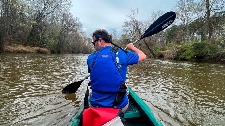
Among the eyesores in my backyard, the pile of dented, battered, mud-stained kayaks and canoes ranks as most unsightly by far — a collection of ramshackle boats I have steered into boulders, rammed into tree trunks, turned upside-down and earnestly adored for the past 18 years.
For a long time, whenever I had a weekday off, I would drive to Sampson County and float down the Black River, surprising wild turkeys, bothering great blue herons and paddling through families of curious beavers — visitor to an unseen world.
But on a lot of those days — more likely on the ornery Haw River — I would strike a rock just below the surface and turn the boat backward, bail out and flail around as my glasses floated away or my wedding ring sunk to the bottom, then scramble out on a bank covered in pudding-thick mud and drag my waterlogged vessel woefully home.
Such are hobbies.
So today I present an invitation into the world of small boats, an offer extended with both sincerity and caution.
I’ll keep it local, in and around the Triangle, because the North Carolina mountains mostly involve heavy rapids and the coast gets complicated by tides and alligators.
I’ll also keep it fairly simple: paddles that a beginner can tackle without spilling a drink and a veteran can enjoy without dozing off. Unless I’ve made a note, there’s always plenty of water in these rivers.
But trust that anything I’m advising here, I’ve done multiple times with my college pal and tireless canoe partner, Mark Lindblad. This doesn’t even begin to include our more disastrous outings. As a truer guide, I recommend Paul Ferguson’s “Paddling Eastern North Carolina,” third edition, and I’ve included a reference to his detailed notes on each of these sections.
Let’s start with Raleigh’s biggest waterway, our sleepy and muddy neighbor to the East.
Neuse River
River Bio: The Neuse begins just above Falls Lake and flows 275 miles southeast, passing through Raleigh, Smithfield and Goldsboro before it hits Pamlico Sound. At one point, at Cliffs of the Neuse State Park, its banks rise nearly 100 feet high. But our journey is much simpler.
Put in: Milburnie Beach canoe access, 1101 Old Milburnie Road, Raleigh.
This sandy spot sits just below what used to be Milburnie Dam, which Raleigh removed in 2017. The Neuse is shallow and slow just below a set of rapids, and boats will quickly pass under U.S. 64, aka New Bern Avenue.
Take out: Poole Road greenway access, 6405 Poole Road, Raleigh.
This is a busy spot for bikers and joggers on the Neuse River trail, but the canoe launch is just a short haul from the parking lot.
Ferguson book: Neuse no. 4.
Total distance: 3.5 miles, about an hour.
Why here? This is as easy as paddling gets, and it only takes about an hour. The route offers a view of some giant boulders, which make a nice lunch stop. Toward the end, some small choppy rapids take your boat past a popular swimming hole, and you’ll want to stay to the left. In all, the highlight here is having a near-wilderness experience in the middle of North Carolina’s capital city. For all the civilization, you can still spook a heron or two.
Downside: Construction mars much of the route’s beginning, as does traffic noise under bridges for U.S. 64 and its bypass a few miles later. Plenty of houses back up to the river, so you’re never actually alone.
For more adventure: Put in at Poole Road and float 6.9 miles down to Mial Plantation Road, which is sparsely developed and offers lusher scenery. Warning: that takeout at the end can be a bit tricky. I’ve seen two paddlers go bottom-first into the water there.
Tar River
River Bio: The Tar starts around Roxboro and Oxford north of Durham and flows 215 miles Southeast, passing through Louisburg and Rocky Mount before it eventually becomes the Pamlico. To my thinking, it is a far wilder river than its neighbor the Neuse, presenting more fallen trees and various other obstacles.
Put in: Bells Bridge Boat Ramp, 3001 E. Andrews St., Tarboro.
This section presents a bit of a drive to Tarboro, which takes an hour and some change. But it’s worth it for this windy and tranquil ride around the city, which bends so much that the put-in and take-out are an easily walkable 2 miles apart.
Take out: Riverfront Park, 100 River Road, Tarboro.
This hard-to-miss city park sits right off N.C. 33. If you want, you can walk back to the put-in through Tarboro, passing the highly interesting Calvary Churchyard and the 18th-century town common.
Ferguson Book: Tar no. 15.
Total distance: 10.4 miles, about 3 hours.
Why here? The endless S-curves make for an effortless paddle, and the majestic cypress trees make for otherworldly viewing. I’ve seen many bald eagles here, and you’re in for uninterrupted wilderness even if they take the day off. You’ll know it’s almost time to stop when you reach a house with the deck sliding down the bank.
Downside: Drive is a tad far.
For more adventure: Try the Tar closer to Raleigh, especially coming into Louisburg’s River Bend Park, but watch out for dams and downed trees.
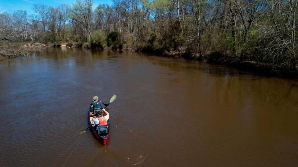
Deep River
River Bio: The Deep starts around Greensboro and flows east until it joins the Haw and forms the Cape Fear. But most of us encounter it in Chatham and Lee counties, where it is slow-moving and friendly. The Endor Iron Furnace, used by the Confederate Army in the Civil War, is one highlight visible only from the river, and only in the winter. But mostly, the Deep is about seeing critters in the woods.
Put In: Carbonton Dam access at NC 42 bridge, a few miles west of Sanford.
Canoeing gets a little trickier here, where the Deep offers a parking lot but no real aid for getting the boat in the water. You’ll have to drag your vessel down a hill and into some pretty thick mud before paddling freely, but this stretch does offer the landmark remains of the Carbonton Dam, which consist of a cool brick tower covered in graffiti and housing dozens of pigeons.
Take out: U.S. 421 where it crosses the Deep a few miles northwest of Sanford.
Normally, I’d advise taking out at Plank Road in Gulf, but when Mark and I paddled past there in February, downed trees had stacked up under the bridge, forming a rapid that had washed away the small dock. So paddle on another 4 miles to 421, where a brand-new boat ramp awaits.
Ferguson book: Deep no. 8 and half of 9.
Total distance: 10.3 miles, about 3-4 hours.
Why here? Much of this slow-moving stretch passes through Triangle Land Conservancy acreage, and it’s a wild kingdom of river life. Mark and I passed a great blue heron rookery, or nesting ground, and found a dozen of the birds in the treetops guarding their young. Later, an otter swam alongside the boat, and for much of the ride, we heard barred owls conversing in the branches. The Deep is also swarming with beavers, whose dam-building habits can unfortunately lead to blockages around bridges.
Downside: See aforementioned beavers. Also, the Deep can be slow as paddling through syrup.
For more adventure: Add a few more miles and take out at Deep River Park, which boasts the historic Camelback Bridge.
Eno River
River bio: The narrow, rocky Eno runs a short 40 miles from Hillsborough to just above Falls Lake, where it joins the Flat River to form the Neuse. The Eno’s heart flows through the north part of Durham, where it makes some lovely class II rapids but often sits too low for paddling. When it is up and running, any paddler here will find company.
Put in: Eno River boat launch, just off Red Mill Road, Durham County.
This handy launch, just east of Interstate 85, lacks the rock-dodging excitement you’ll find upriver. But this lazy backwater of Falls Dam lets you paddle in either direction regardless of the water level. I headed upriver to where the Eno meets the Little River, which makes for an easy paddling option.
Take out: Same place. Just paddle back from wherever you’ve roamed.
Ferguson Book: Eno River “end” past 7.
Total distance: Up to you.
Why here? Normally, you’ve got to catch the Eno on a good day, like right after a rain. But this place never runs dry, so you can take time to explore the slow green water. When I paddled it in March, the Eno backed up to a downed tree stretching all the way across, and though I could have portaged around it, the water got shallow and reedy in a hurry, so I just sat still for a while and listened to the peeper frogs.
For more adventure: Try any of the sections through Eno River State Park, which offer class II rapids and many boulders that are better maneuvered with a kayak. The water gets dangerous when it’s running high, and Mark and I experienced one of our more spectacular wrecks here, nearly losing the canoe and riding the river on our backs for half a mile. Be sure to check the water levels online at the USGS Eno River station at Hillsborough.
Haw River
River Bio: This gorgeous and wildly popular river is perhaps the Triangle’s best, running mostly through Alamance and Chatham counties before hitting Jordan Lake, the Deep River and turning into the Cape Fear. Whitewater fans can find just about the biggest rapids this flat country has to offer, but we will once again choose the mostly easier path.
Put in: Chicken Bridge Road access in Chatham County.
This is a favorite spot for swimmers along with paddlers, but I wouldn’t take this route as a first-timer. Better to have somebody experienced aboard as it does present some class II rapids and a maze of a rock garden toward the end.
Take Out: Dam at U.S. 15/501.
The water slows down at the dam, where you will definitely want to pull out to the parking lot on the left and steer clear of the edge. Do not, repeat, do not go over the dam.
Ferguson Book: Haw no. 10 (no. 8 in the book’s second edition.)
Total distance: 6.7 miles, about two hours.
Why here? On a blue-sky day, the scenery is just unmatched. The Haw splits around islands, bubbles over rocks and occasionally gushes at a rapid ominously named Final Solution, which requires navigating around a tricky bend. The variation in the trip is likely what makes it such a frequent choice for paddlers, starting straightforward and ending up in a rock garden. But at a medium-level height, you can scout most of the rapids and come out just fine. I’ve wrecked twice here in a kayak, once out of stupidity on my birthday and once thanks to treacherous rocks hidden just below the surface.
For more adventure: Try the section that starts in downtown Saxapahaw. If you’re up for 11-plus miles, you can make it all the way to Chicken Bridge.
Have any questions?
I’m still an amateur, and partial to canoes rather than kayaks because it’s easier to bring a cooler along. But I’ve been on most of the rivers and many of the creeks between Chapel Hill and the coast, so I’m happy to offer my reviews. I’ll finish with my top three, none of which are problem-free:
1. Great Coharie Creek around U.S. 421 near Clinton.
2. The Lumber River through Lumber River State Park.
And the big one,
3. The Black River through the Three Sisters section in Bladen County. This one requires a GPS.
