Brewing storm in the Pacific to bring flurry of impacts to California

A sign of changing times is on the horizon out West, with the onset of the 2023-2024 wet season not far away. AccuWeather meteorologists are closely monitoring a brewing storm in the Gulf of Alaska that could usher in a multi-day stretch of rain and mountain snow across California later this week.
"It looks increasingly likely that the powerful storm that dumped heavy snow on Anchorage, Alaska, this past week will come slowly southward into early this week," AccuWeather Senior Meteorologist Heather Zehr stated.
 |
Prior to the arrival of any impactful weather in California, many cities across the Northwest have already experienced the shifting weather pattern as a series of storms have brought much-needed rain and mountain snow to the region. Through the first 13 days of November, Portland, Oregon, has observed 12 days with measurable rainfall totaling nearly 4 and a half inches.
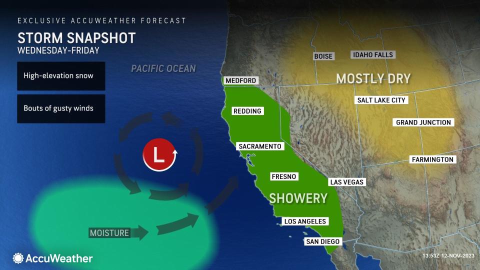
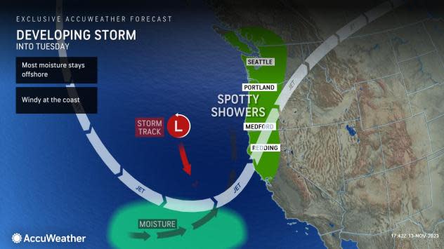
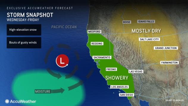
Heading into the new week, the corridor of wet weather will expand south, with impacts expected to spread into California as early as Tuesday. During the early week timeframe, impacts to the West Coast may be relatively low, as the brewing storm off the coast will likely be in no hurry to press inland.
 |
"The storm track is trending farther west and offshore, which delays the arrival of any significant rain over California in particular until late in the week," Zehr stated. "The best chance for rain on Tuesday is over northwestern California with the storm's warm front brushing the coast, then some rain may move in toward the Central California coast later Tuesday night or Wednesday."
San Francisco could end up being one of the first cities to feel the effects of the incoming storm on Tuesday as a plume of subtropical moisture from the Pacific Ocean begins to approach the coast. In addition to the onset of wet weather on Tuesday, an increasingly gusty breeze is expected, especially right along the Pacific coast.
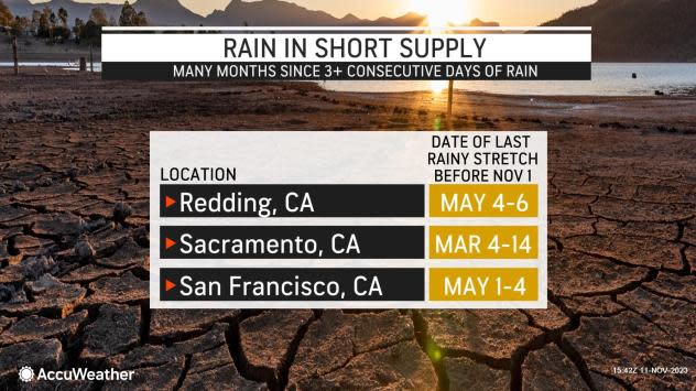
Across the San Francisco Bay Area and the interior northern valleys of California, it has been about six months since it has rained for three or more consecutive days. That appears to be on the table beginning on Tuesday.
 |
Heading into midweek, AccuWeather meteorologists are closely monitoring the likelihood for the storm to slow down and nearly stall just off the West Coast for a time, which could prolong the onshore push of Pacific moisture along the coast, but limit the potential for heavy rain and mountain snow farther inland.
The dip in the storm track could also bring some rain to Southern California during the second half of this week, potentially marking the first major rainmaker for the highly populous region in quite some time. "An area of low pressure aided by a southward diving jet stream will bring downtown Los Angeles its first chance of measurable rainfall since Sept. 30," AccuWeather Meteorologist Alexander Duffus stated.
 |
In Downtown Los Angeles, only 0.05 of an inch of rain has fallen since Aug. 22. While that period represents the heart of the dry season, it is still only around 6% of the historical average of 0.85 of an inch.
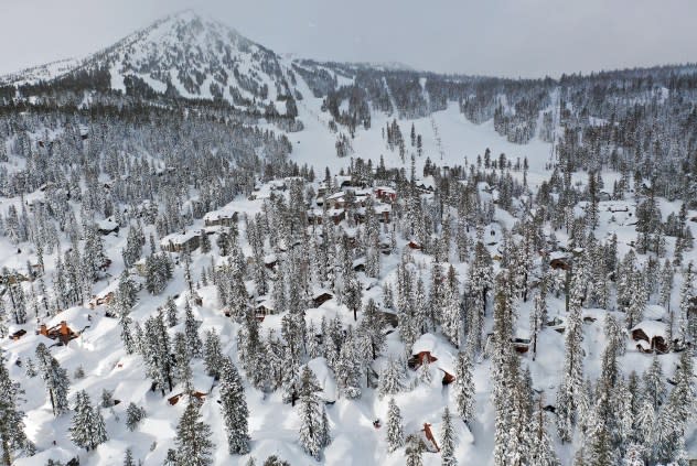
Ski resorts in the Sierra Nevada have also been anxiously awaiting the first major snow of the season, and that too appears to be possible later this week as the storm slowly shifts inland. According to the U.S. Forest Service's snow depth map, only a few inches of snow is on the ground in the highest elevations of the Sierra.
 |
MAMMOTH LAKES, CALIFORNIA - MARCH 12: In an aerial view, snow blankets houses and condominiums near Mammoth Mountain chair lifts in the Sierra Nevada mountains, in the wake of an atmospheric river event, on March 12, 2023 in Mammoth Lakes, California. |
Depending on how much moisture presses inland late this week, there is the potential for this storm to bring some snow across the Sierra, perhaps even into some of the mountain ranges across the interior West.
"With the path of the storm off of the coast for so much of the week, the Sierra could stay mainly dry. If the storm tracks far enough to the south when it finally comes inland, they may not get much snow at all, if any. However, there is some chance that snow may still fall on Thursday or Friday", Zehr added.
Courtesy of the hyperactive wet season last winter and spring across California, wildfire activity has been well below the historical average of what typically burns. According to CalFire, 319,000+ acres have burned across California, which is the lowest acreage to date since the 2019 wildfire season.
Although the storm will likely usher in bouts of gusty winds this week across California, the influx of rain and mountain snow has the potential to effectively put a wrap on the wildfire season across the state as the wet season commences.
The expected slow eastward progression of the storm late in the week may end up dampening weekend plans this weekend across portions of California and the interior West. AccuWeather meteorologists will continue to closely monitor and provide the latest forecast updates to see where this system may be heading next.
Want next-level safety, ad-free? Unlock advanced, hyperlocal severe weather alerts when you subscribe to Premium+ on the AccuWeather app. AccuWeather Alerts™ are prompted by our expert meteorologists who monitor and analyze dangerous weather risks 24/7 to keep you and your family safer.
