Brockton area could see more than 2 feet of snow, blizzard conditions this weekend
BROCKTON — A weekend snowstorm could bring more than two feet of snow, a bomb cyclone and blizzard conditions to the Brockton area.
"This could be a top 10 snowfall on record for the Boston area, as we are forecasting the potential for about 2 feet or more in a lot of areas of easternmost Massachusetts," said StormTeam 5 Meteorologist Cindy Fitzgibbon. "This is going to be an incredible amount of snow."
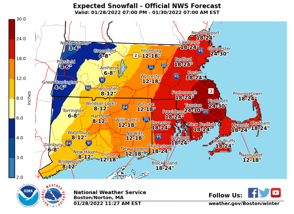
As of Friday afternoon, the National Weather Service's Boston office is predicting 24 to 30 inches of snow for most of southeastern Massachusetts, including the Brockton area.
This story is available to all as a public service and is made possible by our subscribers. Please consider supporting quality local journalism with a subscription to The Enterprise. Here's our latest offer.
The latest on this weekend's nor'easter: National Weather Service's winter key messages
Record snowfalls: Here are the largest single-day snowstorms in Massachusetts history
The National Weather Service has issued a blizzard warning that goes into effect at midnight Friday for parts of Bristol, Essex, Middlesex, Norfolk, Suffolk, Plymouth, Barnstable and Dukes counties and lasts until midnight Saturday.
"Travel could be very difficult to impossible," the weather service's alert states. "Strong winds could cause tree damage."
The storm is expected to begin Friday night, but the heaviest duration will be from 5 a.m. to 5 p.m. Saturday. The storm could drop 2 to 4 inches of snow per hour during the height of it, Fitzgibbon said.
"The greatest impacts are along the coast with 1 to 2 feet or more of snow and wind gusts exceeding hurricane force of more than 70 mph," she said. "It does appear that there will be some bands setting up in Eastern Massachusetts, where we could exceed 24 inches and maybe get closer to 30. This is going to be a lot of snow coming, and this all gets started Friday night.”
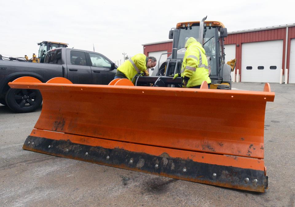
Because of the impending storm, Brockton Mayor Robert Sullivan has issued a snow emergency in the city beginning at 6 p.m. Friday.
“Since early this week, the Brockton Emergency Management Agency (BEMA), Department of Public Works, Police Department, Fire Department, Parks Department, School Department, Parking Authority, Brockton Area Transit (BAT), and the Mayor’s Office have been monitoring the trajectory of the storm and at this time I find it prudent to declare this Snow Emergency to facilitate snow removal efforts in the City,” Sullivan said in a Friday afternoon written statement. “It is paramount that our residents stay off the streets and roads to give our snow removal crews ample support as they work to make them safe for travel.”
The snow emergency makes all street parking prohibited during the storm.
Sullivan's office said 130 snowplows and 12 salt trucks will be assisting in snow removal operations.
Residents can park at the parking lot on the east side of Montello Street between Crescent Street and White Avenue; the Warren Avenue lot on the west side of Warren Avenue between Belmont and Bartlett streets; the South Street lot on South Street near Main Street behind the gas station; at the Howard School on North Main Street; at the Whitman School on Manomet Street; at James Edgar Playground on Dover Street; and in the downtown parking garage on Crescent Street.
The storm, which will develop off the coast of the Carolinas late this week, could rapidly strengthen enough as it moves northward along the East Coast into the weekend to be dubbed a bomb cyclone, AccuWeather reported.
A bomb cyclone, or bombogenesis, occurs when the central pressure of a storm crashes by 0.71 of an inch (24 millibars) or more within 24 hours. The plunging pressure will cause air to rush into the center of the storm — just like a giant vacuum. The high winds will pull in copious amounts of moisture, helping to enhance precipitation.
"This is going to be an intensifying storm that will produce a lot of wind, which raises concerns for blowing and drifting snow, power outages and blizzard conditions in some areas,” AccuWeather chief meteorologist Jonathan Porter said. "There is also a serious coastal flooding and beach erosion threat, especially in eastern Massachusetts."
Material from WCVB-TV and AccuWeather was used in this report.
Enterprise senior reporter Cody Shepard can be reached by email at cshepard@enterprisenews.com. You can follow him on Twitter at @cshepard_ENT. Support local journalism by purchasing a digital or print subscription to The Enterprise today.
This article originally appeared on The Enterprise: Brockton weather: Two feet of snow, blizzard conditions this weekend

