'Brutal' Severe Rain Is Coming to an Already Flood-Damaged California
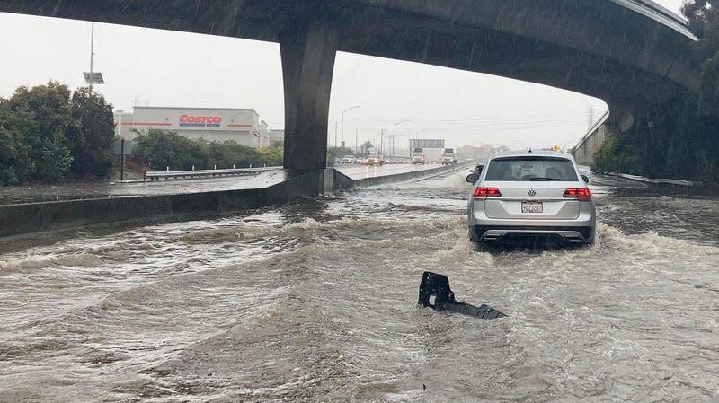
At least one person died, more than 1,000 prison inmates were evacuated from a county jail, and a levee broke amid flooding on New Year’s Eve in Northern California. A so-called “atmospheric river” brought more than five inches of rain to downtown San Francisco on December 31, making it the second wettest day in over 170 years of record keeping in the city. Elsewhere in the Bay Area rainfall totals exceeded four inches.
The New Year’s Eve atmospheric river was the second major precipitation event to sweep through West Coast states last week. An earlier storm led to at least five deaths in Oregon, all related to car crashes, reported The New York Times. Combined, the storms flooded creeks, rivers, roadways, and buildings. All that rain triggered landslides. In their wake, the atmospheric rivers left debris covered highways, sinkholes, power outages, and other damaged infrastructure.
Read more
Highway 1 is closed this morning from Ragged Point to south of Big Sur due to rockslides. Caltrans is working to clear the highway. Debris will be removed tomorrow behind the catchment at Paul’s Slide where it has reached the top of concrete barriers. No estimate for re-opening. pic.twitter.com/6GyiyeUfM6
— Caltrans District 5 (@CaltransD5) December 31, 2022
@NWSBayArea @NWS @danncianca @NBCBayWeather My brother just sent me these photos where he lives. San Mateo Creek overflowing on Arroyo Ct. 😬#SanMateo #AtmosphericRiver pic.twitter.com/dmsXyBzMkU
— 🇺🇸Douglas 🇬🇧🏴 (@rukiddingme3590) December 31, 2022
Common flooding on Green Valley Creek across Green Valley Rd. In Graton, New Years Eve. @NorthBayNews @NWSBayArea #AtmosphericRiver #CAwx pic.twitter.com/iPxJ84DzW9
— Kent Porter (@kentphotos) December 31, 2022
Never seen anything like this in San Francisco. Bernal right now… pic.twitter.com/l0J1ZCslY4
— Zach Klein (@zachklein) December 31, 2022
Now, another major atmospheric river—likely to be the largest of the three—is forecast to bring much more rain to California. The National Weather Service is predicting widespread rainfall of 3 to 6 inches across the state from Wednesday to Thursday. In northern California and the coastal mountain ranges, rainfall could locally exceed those amounts. “Recent rainfall has left soils saturated and susceptible to flooding and rapid runoff concerns. Sensitive terrain will also have the potential for landslides,” NWS wrote.
Along with the rain, heavy winds up to 70 mph are forecast in some coastal areas. And, in the high Sierras Nevada mountains, snow will fall instead of rain—at possible rates of up to three inches per hour, causing white out conditions.
“To put it simply, this will likely be one of the most impactful systems on a widespread scale that this meteorologist has seen in a long while,” a Bay Area NWS meteorologist said in a Monday night forecast discussion. “The impacts will include widespread flooding, roads washing out, hillside collapsing, trees down (potentially full groves), widespread power outages, immediate disruption to commerce, and the worst of all, likely loss of human life,” that forecast continued. “This is truly a brutal system that we are looking at and [it] needs to be taken seriously,” the meteorologist concluded.
Though California and the rest of the West have been in dire need of water, suffering from extensive and significant drought, when so much rain falls all at once, it inevitably causes problems. Parched soils don’t readily absorb water, so most of it quickly becomes run-off. Burn scars from wildfire compound the issue—as scorched soil is even less absorbent. Together drought, recent fires, and heavy rain is a recipe for rock and mudslides—which closed roads around Northern California over the weekend.
Preparation for the oncoming storm has already begun, as clean-up from the previous storm continues. People around the Bay Area were filling sandbags to place around their homes and businesses on Tuesday—during a brief lull between rains.
Though atmospheric rivers are a common phenomenon in the West, and are responsible for most of California’s rain—some research suggests they are becoming more intense and frequent as climate change worsens. Click through to see a glimpse of the damage California is already dealing with.
Highway 50
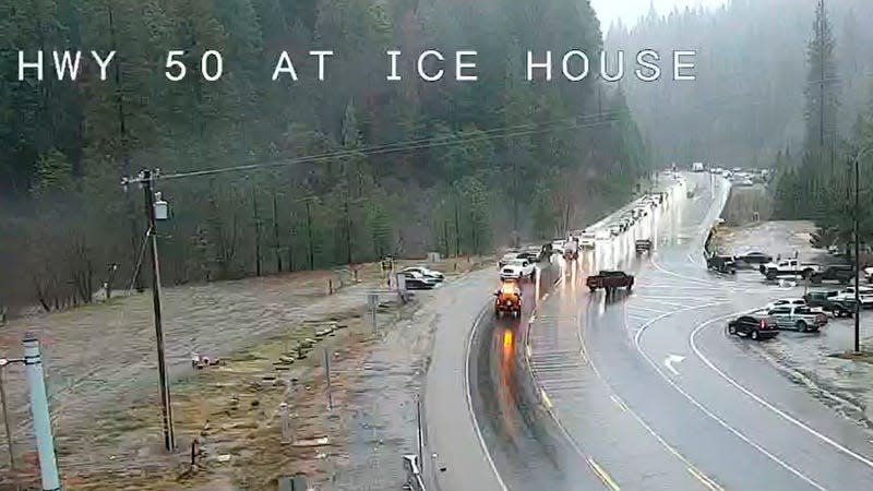
Highway 50 in El Dorado County was shut down by floods on New Year’s Eve.
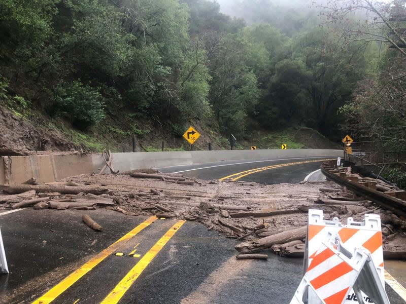
State Route 299
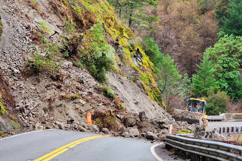
The heavy rain triggered landslides that also blocked roads, like this one on State Route 299 in Trinity County. Areas burned in recent wildfires are particularly susceptible to landslides.
State Route 271
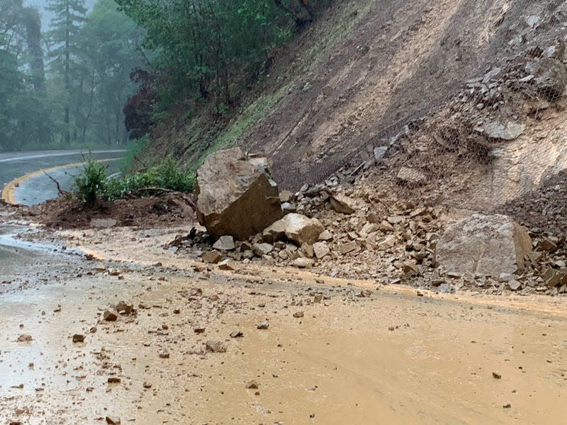
Another landslide was apparent in Mendocino County, where State Route 271 was closed.
Sinkhole
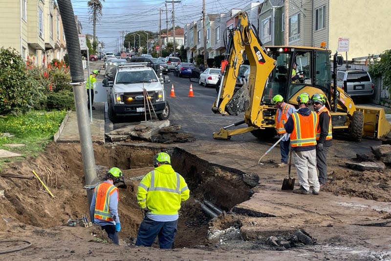
Flooding left behind other infrastructure damage, like this sinkhole in Daly City.
Harrison Road in Salinas
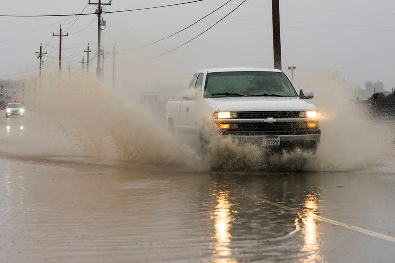
The water made for dangerous driving conditions across Northern California throughout the holiday weekend. On New Year’s Eve, Harrison Road in Salinas was flooded.
Alameda County
Niles Canyon Road in Alameda County was also covered in debris following a landslide.
Sierra Snowfall
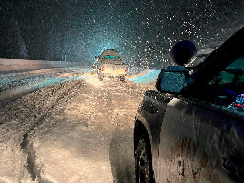
At higher elevations, all that precipitation fell as snow, not rain—stranding drivers on icy Interstate 80 near the Nevada border.
Flooded Buildings

In the Bay Area, residents have begun clean-up efforts and preparation for another possible round of floods. Restaurant owner, Sylvan Mishima Brackett, points to the level flood waters rose to on January 1 in his San Francisco business.
Preparing for What’s Next
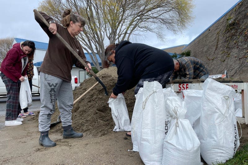
In preparation for the next round of rain, people in South San Francisco fill sandbags on Tuesday.
Flood Watch
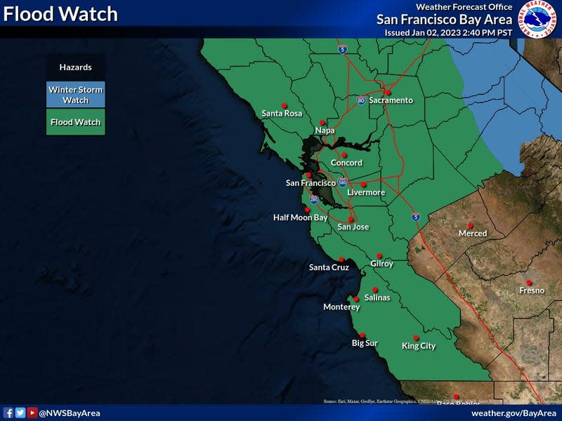
Most of Northern California and the Bay Area are under a flood watch Wednesday and Thursday.
More from Gizmodo
Sign up for Gizmodo's Newsletter. For the latest news, Facebook, Twitter and Instagram.

