Buffalo could get 4 feet of snow. Are Wellsville, Dansville in the storm's path?
While a potentially paralyzing lake effect snowstorm pummels Buffalo this weekend, it will likely be business as usual in some other areas of western New York, including in Allegany and Livingston counties, according to National Weather Service forecasters.
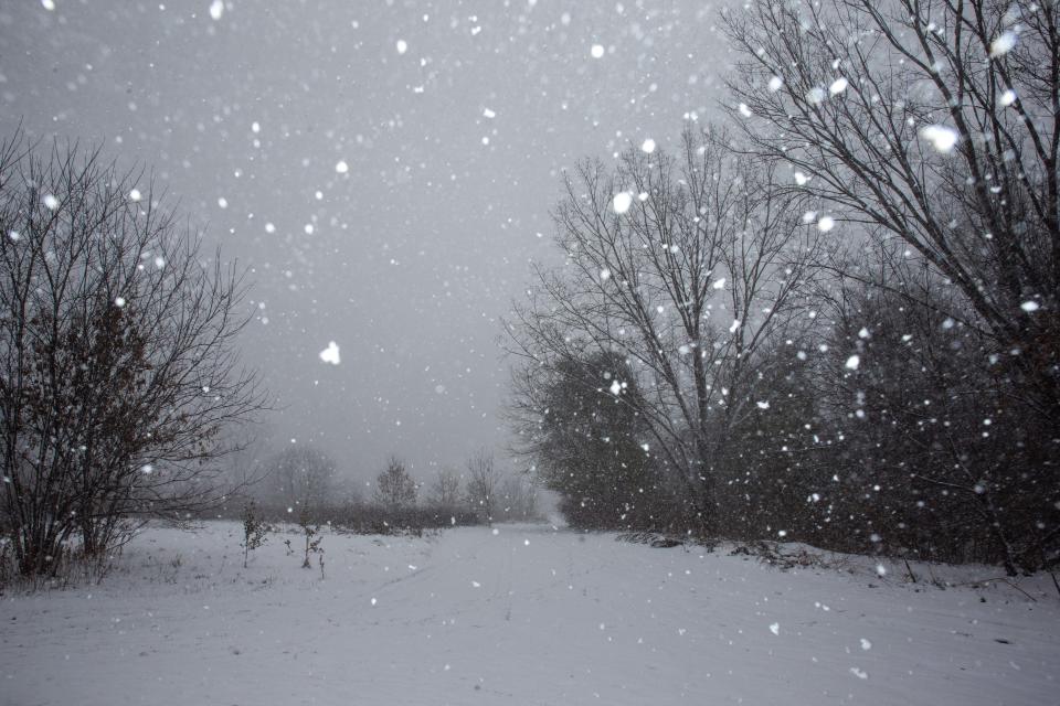
The Buffalo metro area is bracing for up to four feet of snow by Sunday, with the lake effect storm expected to be at its greatest intensity over a 24-hour period beginning Thursday night and continuing until Friday night.
Not everyone in the region is expected to get hit, however.
Only about 50 miles separate northwestern Allegany County and the city of Buffalo, but as far as this weekend's weather is concerned, they might as well be in different regions of the state, according to Liz Jurkowski, a Buffalo-based National Weather Service meteorologist.
Jurkowski said, “People are going to be like, ‘What?’"
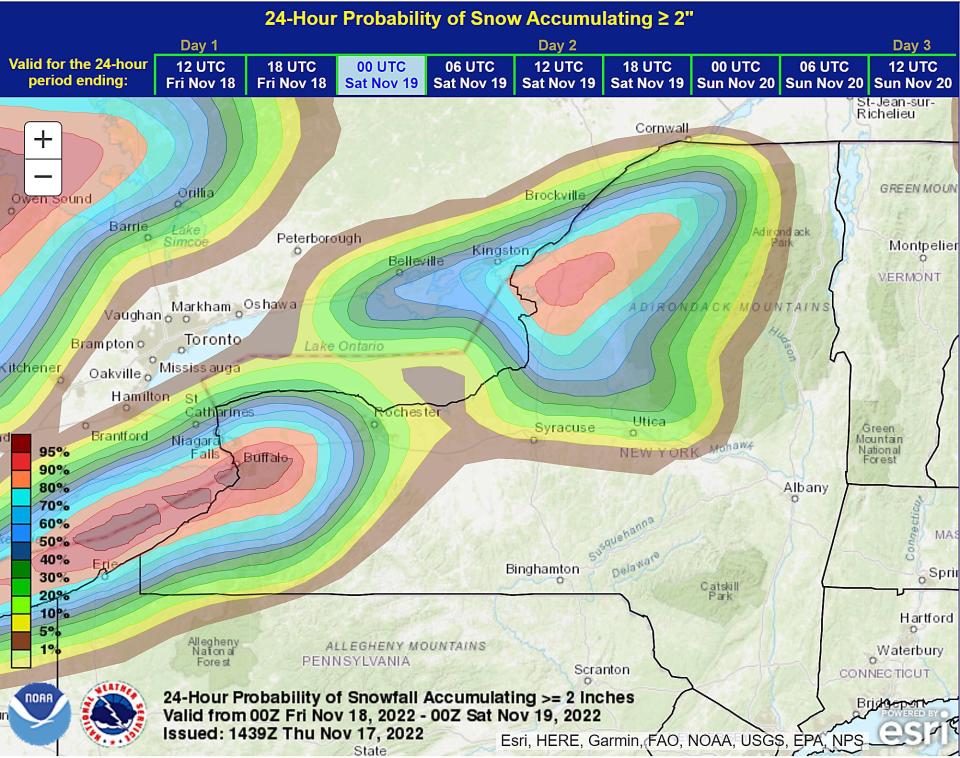
The reason? It's all about "lake effect." Lake effect snow occurs when cold air, often originating from Canada, moves across the open waters of the Great Lakes. As the cold air passes over the unfrozen and relatively warm waters of the Great Lakes, warmth and moisture are transferred into the lowest portion of the atmosphere. The air rises, clouds form and grow into a narrow band that produces 2 to 3 inches of snow per hour or more.
Jurkowski said lake effect snow is "highly localized" and Allegany County is insulated from the lake shores and the winds.
“The winds are not going to be strong enough to push (the snow) that far in," Jurkowski said. "They’re going to be way south of the (snow) band and have some pretty nice weather."
Jurkowski said Wellsville in Allegany County and Dansville in Livingston County may might see a “few snowflakes” Saturday night and Sunday morning as a snow band shifts south, but she added, "They should be on the quiet side of the forecast for the weekend," with no significant accumulation.
Sports:Bills' newcomers are getting ready for their first Buffalo snowstorm
For subscribers:Hornell's new Hush Cocktail Lounge makes a roaring debut on Main Street
State:Toy guns under new restrictions as NY law goes into effect. What to know
Elsewhere, many western New York communities are expected to hear the sounds of snowplows and shovels. Lake effect snow warnings and winter storm watches were in effect through Sunday night in several other counties in Western New York, as well as in the Finger Lakes, Central New York and North Country regions.
New York Gov. Kathy Hochul declared a state of emergency in 11 counties, including Erie, Genesee, Niagara, Wyoming, Cattaraugus and Chautauqua, and the governor deployed 106 workers from other regions, including 92 plow truck operators/supervisors, to the impacted area.
Hazardous travel conditions and local power outages as a result of the storm are likely due to the combination of snow, ice and wind in the forecast.
Hochul urged New Yorkers to stay alert and avoid unnecessary travel in the Buffalo area Thursday evening through Friday.
“I want Western New Yorkers to take this seriously,” Hochul said.
Follow Neal Simon on Twitter @HornellTribNeal. To get unlimited access to the latest news, please subscribe or activate your digital account today.
This article originally appeared on The Evening Tribune: New York snow storm: Will Wellsville, Dansville be hit?

