Buresh Blog: ‘24 Nat. Weatherperson... Severe weather storms... Eclipse in 2 months!...Cat. 6 hurr??
Become a part of the First Alert Neighborhood Weather Network powered by tempest:
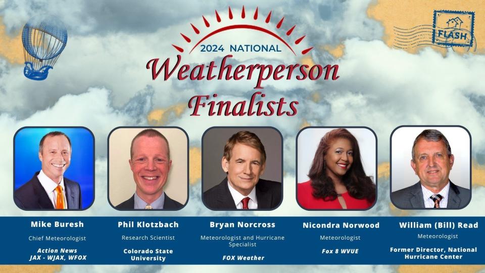
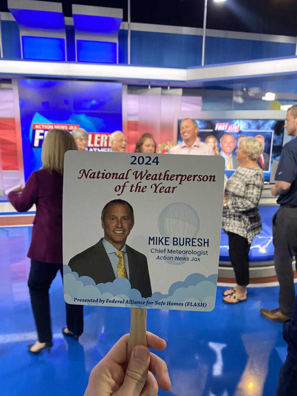
Well - it was an interesting day for me Fri., Feb. 2 as the Federal Alliance for Safe Homes (FLASH) announced who garnered the most votes for their annual “National Weatherperson of the Year”. And it turned out to me! I still do not know who exactly nominated me, but it’s clear I have some very devoted fans, followers, friends & family members that took advantage of voting every day for several weeks :). First of all - the nominees this year & in year’s past is astounding. For ‘24: Dr. Phil Klotzbach, Bill Read, Bryan Norcross & Nicondra Norwood.
Past winners include:
2014 - Jim Cantore, On-Camera Meteorologist, and Co-Host, “AMHQ” - The Weather Channel
2015 - Max Mayfield, former National Hurricane Center Director
2016 - Alex Garcia, Chief Meteorologist - KABB Fox 29 - San Antonio, TX
2017 - Dr. Richard Knabb, Hurricane Expert and National Tropical Program Manager - The Weather Channel
2018 - Ada Monzon, Chief Meteorologist - WIPR-TV, Noticias 24/7, Univision Radio (WKAQ 580 AM)
2019 - James Spann, Chief Meteorologist - ABC 33/40, Birmingham, AL
2020 - Joe Snedeker, Morning Meteorologist - WNEP - Newswatch 16, Scranton, PA
2021 - Ginger Zee, Chief Meteorologist - ABC News
2022 - Ken Graham, Director - National Weather Service
2023 - Matthew Cappucci, Meteorologist – MyRadar, Capital Weather Gang, and FOX5 DC
I can say I know & have worked directly with Max Mayfield, Richard Knabb, & Ken Graham - all former directors of the National Hurricane Center. I’m certainly familiar with the rest - all have made major contributions to their craft in the field of meteorology.
As for the Federal Alliance for Safe Homes, I’ve worked with their “fearless leader”/President & CEO Leslie Chapman-Henderson for years essentially since arriving in Jacksonville including live television appearances from the National Hurricane Conference as well as from our Action News Jax studios. One of the most memorable initiatives a number of years ago was a “Go Tapeless” campaign (taping windows before a hurricane is a no-no)... & then - later - “Hurricane Strong”. FLASH:
Our mission - We promote life safety, property protection and resiliency by empowering the community with knowledge and resources for strengthening homes and safeguarding families from natural and manmade disasters.
Our vision - A world where people value, demand, and build strong homes and resilient communities.
FLASH has evolved & developed into a leading non-profit that champions natural disaster resilience & mitigation using innovation, integrity & collaboration. The “Preparing for a Storm” has very useful info. * here *.
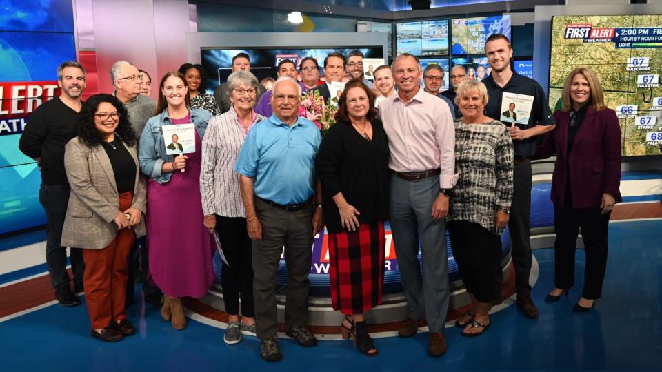
As for the award itself, well... I was caught completely off-guard if no other reason, I thought the winner was to be announced Mon., Feb. 5. Action News Jax did a spectacular job of being in the know but keeping it quiet. So the announcement at 3pm Fri., Feb. 2 in the news studio was a big surprise! Adding to the surprise was my wife - with our kids on FaceTime - along with my dad, stepmother, sister & nephew who were all there! As was Leslie from FLASH! So it suddenly became a very emotional moment when I saw my dad & just how happy he was. Mom (deceased in 2008) & Dad paid for virtually all my college (I wasn’t gifted in sports or scholastically) - what a priceless gift that just keeps on giving. So the hug with dad & seeing his eyes tear up caused me to pretty much - well - lose it(!) [as you can see in the video below]. Understand Mom & Dad took me all over the place to satisfy my curiosity in the weather that began in the 2nd grade. They would take me to see my favorite local t.v. meteorologists in Cedar Rapids & Waterloo, Iowa (Craig Johnson who replaced Conrad Johnson - no relation but Conrad was the first AMS “Seal of Approval” t.v. meteorologist). They took me to Kansas City to see & tour the then National Severe Storm Forecast Center which is now the Storm Prediction Center in Norman, Ok. Then there was touring colleges & filling out long applications. That gift of a college degree is something I can never repay & was my ticket to being independent & at least reasonably successful :). The nomination also brought me back into contact with High School classmates, long-time friends from afar & even a college professor emailed me. I appreciate everyone’s vote(s) :).
#firstalertwx well-this weathercast borders on embarrassing as I don't recall being so openly emotional in all my years on live t.v. A very special thanks to all who voted...to my fam...to the First Alert Weather Team...to @ActionNewsJax @WOKVNews & certainly to @FederalAlliance pic.twitter.com/BnHQ74km0Z
— Mike Buresh (@MikeFirstAlert) February 3, 2024
The week of Feb. 5th is ‘Severe Weather Awareness Week’.
Topics include:
* Marine Hazards & Rip Currents
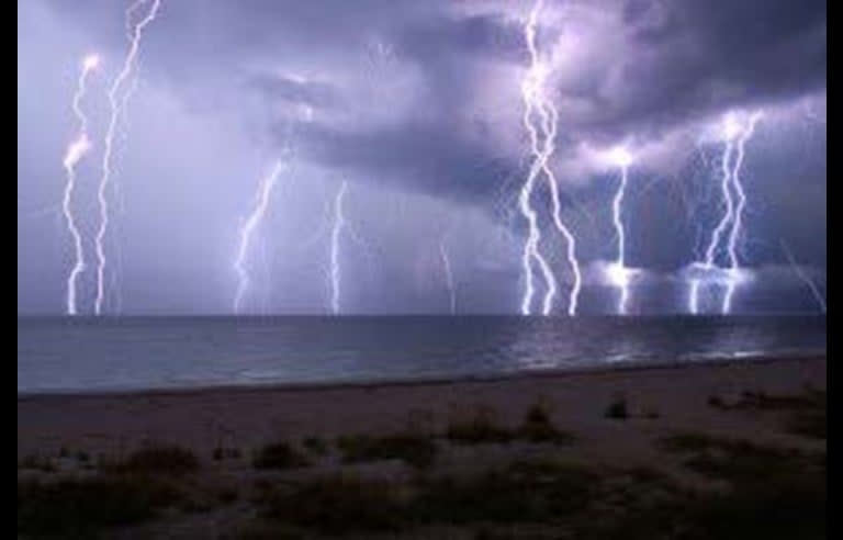
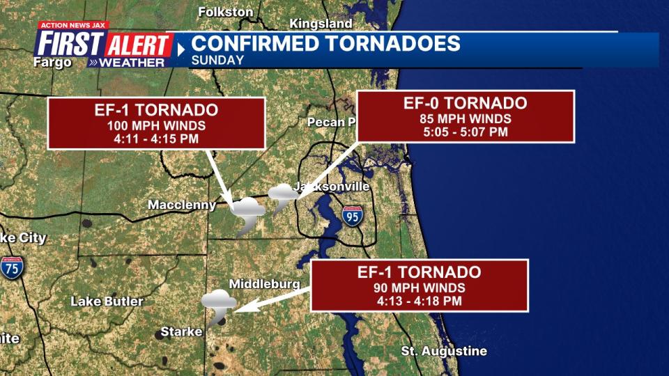
We had some severe weather Sunday afternoon (Feb. 4th) across NE Florida & Southeast Georgia including at least 3 confirmed tornadoes. An EF-1 tornado touched down east of Maxville in Southwest Duval Co... an EF-0 occurred near Cecil Field before lifting just before crossing I-10 near Whitehouse... an EF-1 touched down over Western Clay Co. west & northwest of Kingsley.
So the string of potent winter storms going back to mid Nov. continues. The storminess has been at least partially fueled by El Nino - a warming of the equatorial Pacific - which often times results in wetter & stormier winters from California to Florida thanks to an active subtropical jet stream. Such a pattern looks to continue essentially uninterrupted through the rest of Feb. & likely into March.
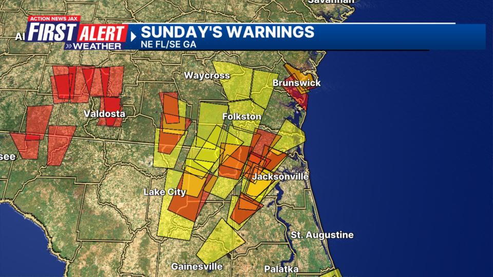
The set-up Sunday was what meteorologists refer to as ‘conditional’. IF conditions could quickly come together then severe storms & tornadoes would be possible. Indeed... that’s what happened once skies cleared behind a large area of moderate to heavy rain & as a strong upper level disturbance approached moving eastward along the Gulf Coast. The combination of warmer temps. at ground level but very cold temps. aloft (steep lapse rates) & powerful upper level winds combined for a short term but pretty significant outbreak of severe weather that included tornadoes & large hail.
From Nate Wilson - funnel cloud near Normandy Blvd.:
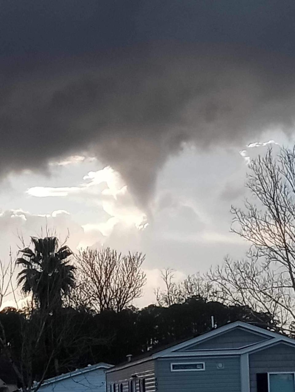
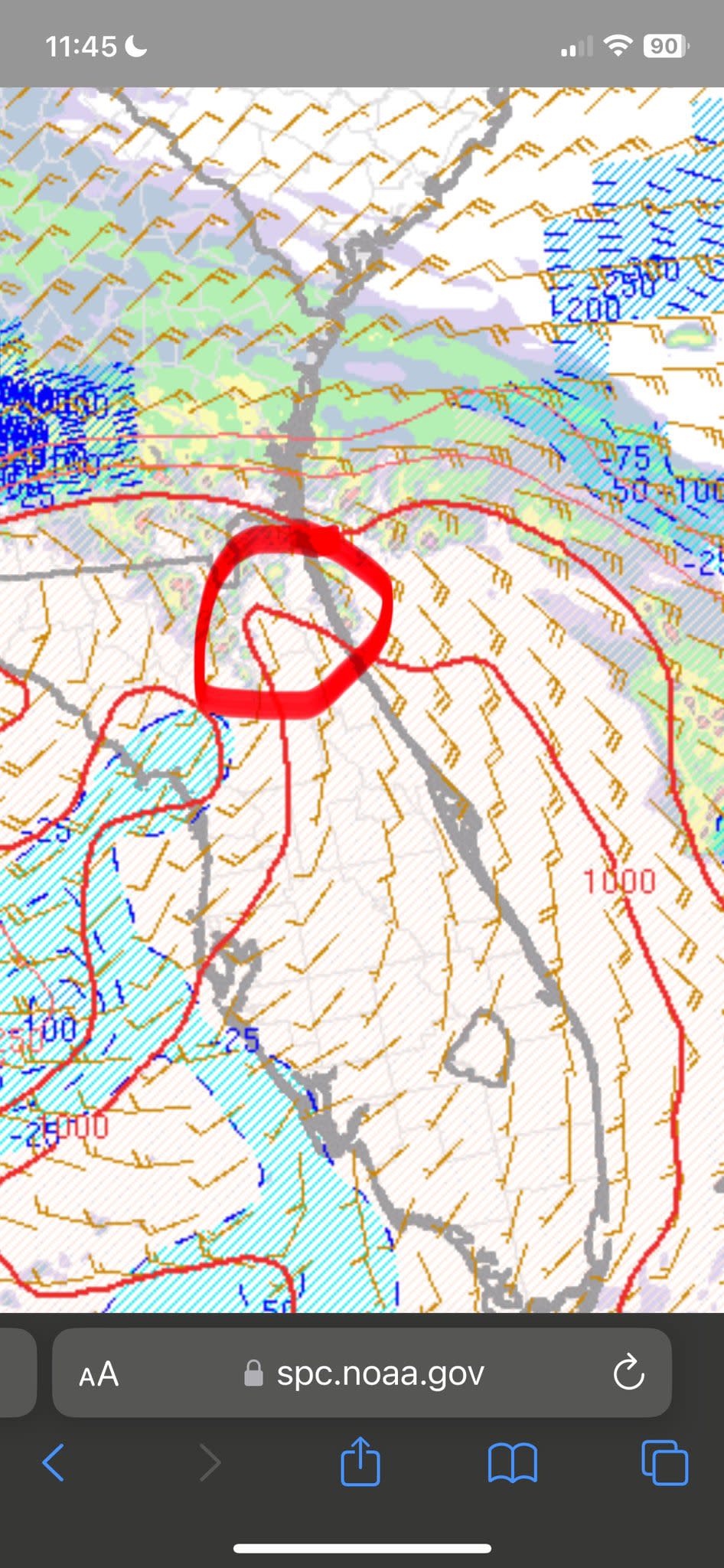
Good chase by ‘Chris Fl Tornado’ who made the decision before noon that he would focus in the vicinity of Jacksonville where forecast models were predicting the strongest instability. He had some great pics & videos which was very useful for Corey & me while covering the tornado warnings live on the air. The image below shows the instability axis that was forecast for late Sunday afternoon + the approaching cold air aloft. Chris’s video is below the image:
TORNADO in Jacksonville Florida today! @ReedTimmerAccu @MikeFirstAlert @NWSJacksonville @JimCantore @StephanieAbrams #FLwx pic.twitter.com/WwcIPm5Di8
— Chris FL Tornado (@ChrisFLTornado) February 5, 2024
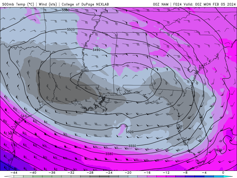
The upper level (500 mb) forecast map (NAM) for 7pm Sunday shows the very strong upper level winds including strong directional & speed shear (referred to upper level diffluence):
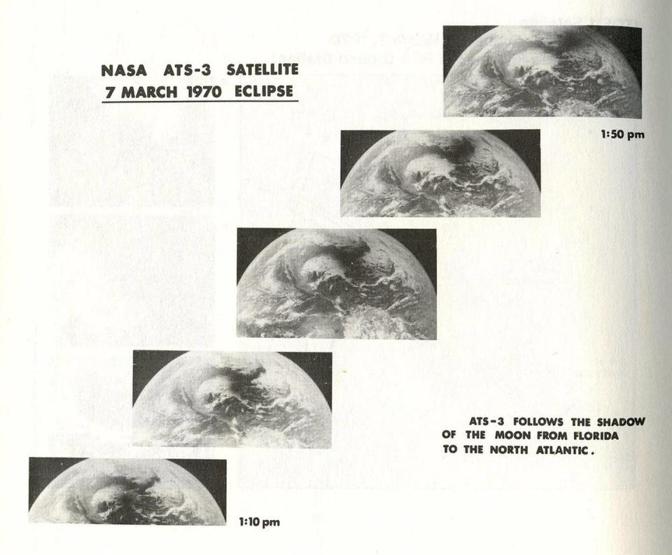
The countdown continues to the 2024 “Great American Eclipse”! Now 2 short months away. Get all the info. at ActionNewsJax.com * here *. I wrote a historical web story about past eclipses that offers a glimpse into the past going all the way back to the early 20th century. The March 7th U.S. east coast total eclipse was the first to occur in the satellite era as shown below (Michael Zeiler, GreatAmericanEclipse.com):
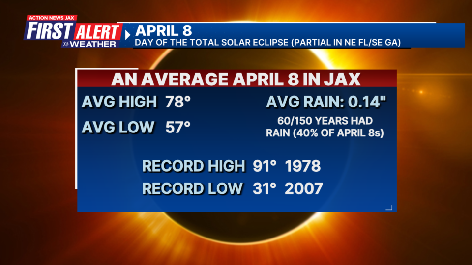
The average weather for Jacksonville on April 8th - day of the solar eclipse - which be a partial eclipse for Jax/NE Fl./SE Ga.:
The Washington Post has gotten a lot of traction with a story about a Saffir-Simpson scale that would include a Category 6. The article quotes 2 research meteorologists who claim climate change should be the reason for an ‘extreme’ category proposing a threshold of 192 mph for sustained winds. So far, only 1 hurricane in the E. Pacific & 4 typhoons in the West Pacific would have qualified for such a designation. Chris Landsea from the NHC wrote in a 2011 research paper that the warming oceans were resulting in about a 1% increase in intensity which would be insignificant. But water temps. have increased more significantly during the last 5-8 years, so that percentage is likely higher now. Current NHC Director Michael Brennan: “It’s not clear that there would be a need for another category even if storms were to get stronger,” he said. Ultimately there are concerns about messaging and especially the public possibly taking a Cat. 5 hurricane less seriously if there were to be a higher (6) category. The NHC definition of a Cat. 5: Catastrophic: A high percentage of framed homes will be destroyed, with total roof failure and wall collapse. Fallen trees and power poles will isolate residential areas. Power outages will last for weeks to possibly months. Most of the area will be uninhabitable for weeks or months.
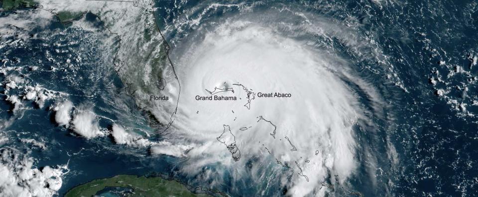
Cat. 5 Dorian, 2019 from the GOES East satellite: