What are burn scars? What to know about this dangerous Idaho phenomena after heavy rain
The worst of Hurricane Hilary’s remnants have come and left Idaho. Some parts of the state, such as Boise, escaped the worst of Hilary’s wrath, while other regions felt the brunt of the tropical storm’s force.
While Boise and the surrounding Treasure Valley only saw about 0.4 inches of rain, areas west of the City of Trees and in the mountains saw heavier totals. Ontario, Oregon, received 1.5 inches of rain between Sunday and Tuesday morning, while mountainous communities such as McCall received about 2.3 inches.
While the threat of Hilary’s rain has passed, flooding and landslides via a lesser-known threat still persist: wildfire burn scars.
What are wildfire burn scars?
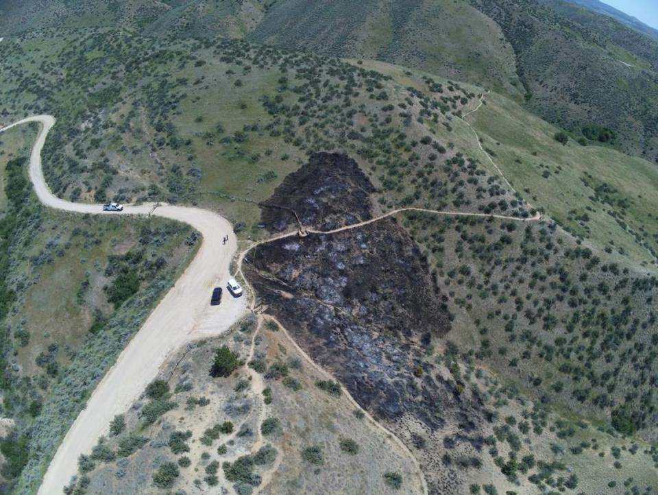
If you’ve ever driven past the aftermath of a wildfire, it’s relatively easy to see the damage caused - scorched land, stripped trees and little observable life.
But what you can’t see is the damage that’s been done underneath the ground.
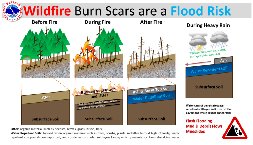
When organic materials, such as trees, shrubbery, and even litter, burn at a high intensity, water-repellent compounds are broken down and seep into the soil below.
“There’s such a thing as what we call hydrophobic soil that naturally repels water, and that can cause water runoff,” National Weather Service meteorologist Joel Tannenholz told the Idaho Statesman.
As the hydrophobic repellents seep into the soil, a layer of ash from the wildfire sits on top of it. When heavy rains enter the area — such as with Hilary — the top layer of ash becomes saturated with water as the water-repellent soil below cannot retain any water.
As a result, the layer of ash slides downhill, resulting in a landslide and potential flooding from continued rain on top of the hydrophobic soil.
Burn scars in Idaho
As of Monday afternoon, no landslides had been reported in Idaho, according to Tannenholz.
But much of the mountainous areas of the Gem State remain under a flood watch, including Idaho City and McCall. Heavy rain and storms are forecast for Idaho’s mountains through Tuesday afternoon, with the Weather Service warning that, in addition to the rain that’s already fallen, flooding is possible.
️A Flood Watch is in effect for portions of southeast Oregon and southwest Idaho today. Excessive rainfall from thunderstorms this afternoon and evening coupled with the rain that fell on Monday could cause additional flooding. #IDwx #ORwx pic.twitter.com/ysu7ZzX2EV
— NWS Boise (@NWSBoise) August 22, 2023
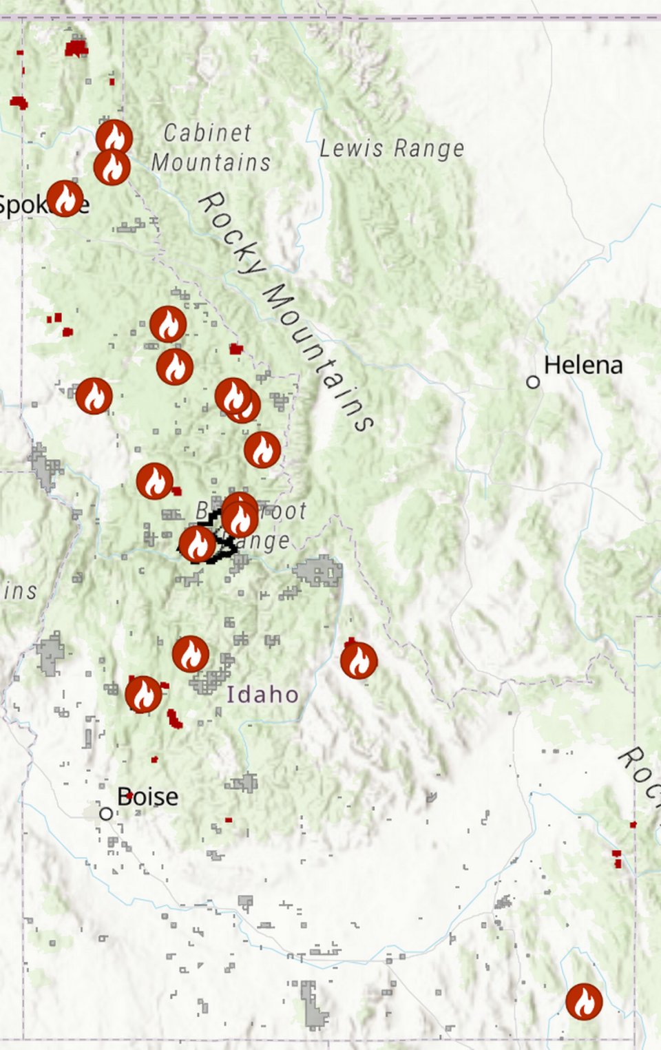
Drivers can check a wildfire map on Idaho Fish and Game’s website. There are no significant active wildfires up close to primary highways in the state, but the East Fire near Highway 55 is only 6% contained and growing in size, and the Hayden Fire in east Idaho is near Highway 28 and U.S. Route 93.
But it doesn’t take an active wildfire to present a flooding danger. Extinguished fires, which feature a layer of ash and hydrophobic soil underneath, have left burn scars throughout the state from past wildfires.
Many of these burn scars are in more remote parts of the Idaho wilderness, so if you plan on hiking or camping once the rains pass, you should remain aware of potential landslides. The IDFG interactive map shows the locations of previous wildfire perimeters, which will let hikers plan accordingly to where they go.