Messy burst of sea-effect snow squalls to hit Atlantic Canada this weekend
After a sopping week for Atlantic Canada, with drenching rains over Halifax, freezing rain coating Newfoundland, and heavy snow in New Brunswick that prompted school closures, the Atlantic provinces are back in the snowy spotlight as the winds shift and temperatures drop.
SATURDAY AND SUNDAY
Cold northwesterly winds blowing across the mouth of the St. Lawrence will fire up sea-effect snow squalls, impacting drivers as they collide with the Atlantic provinces. Sections of Prince Edward Island, Cape Breton, and western Newfoundland will be the target for a wide 10-20 cm of snow for the higher elevations, and 5-10cm for communities such as Deer Lake and Stephenville.
Snow squalls are characterized with locally heavy snowfall, and within these bursts, periods of difficult travel with poor visibility is expected. Be sure to reduce speed and put on your hazard lights if you get caught in an area of low visibility while driving.
DON'T MISS: Coldest air of the season envelopes all of Eastern Canada next week
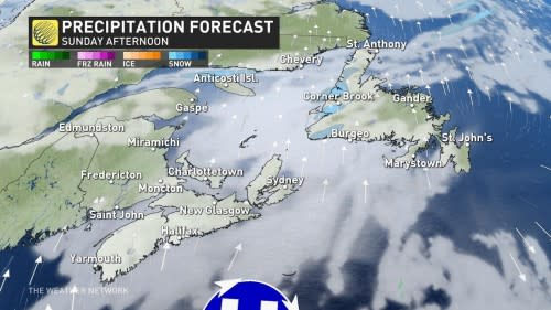
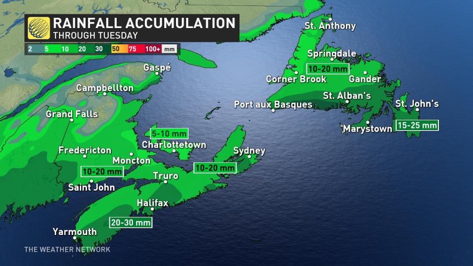
The squalls will ease through Sunday as the wind direction will shift to the south as the next storm approaches. The vast majority of the moisture will be of Atlantic origin, meaning this will be another milder storm bringing primarily rain and strong wind. Monday afternoon will see the arrival of another round of heavy rain for the major Maritime cities with snow confined to northern New Brunswick.
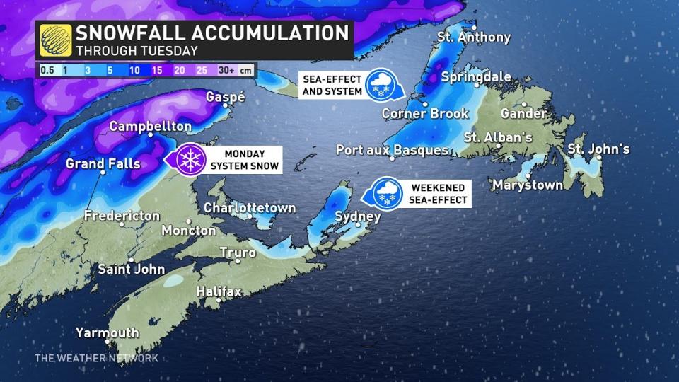
Tuesday will be Newfoundland’s turn for the active weather. Initial snowfall will occur across the western half of the island before transitioning to rain while the Avalon will see rain for the duration of the event.
Make sure to keep checking back to The Weather Network for more forecast information and updates on your weather in Atlantic Canada.

