Some busy Boise streets will change. What it means for drivers, bikers, walkers
Changes are coming to Boise’s streets.
The interlocking network of roads, streets and sidewalks has had to shift over the years to accommodate the growing city, and these changes aren’t going to lessen anytime soon.
The Ada County Highway District, which controls most streets and roads within Boise, has extensive plans to edit the urban streetscapes residents depend on.
Some of these changes are focused on walker and biker safety after a deadly year. Some are aimed at lessening bloated intersections. Others still attempt to fix aging infrastructure and easing drivers’ commute times.
This is especially pronounced in the city’s downtown area, where a whack-a-mole game of construction and closed roads have shifted traffic patterns.
ACHD’s Road Work in the Area map shows dozens of downtown streets lined in maroon and red, showing closures and pending closures. Green and blue line many of the other streets, showing lane restrictions and pending lane restrictions.
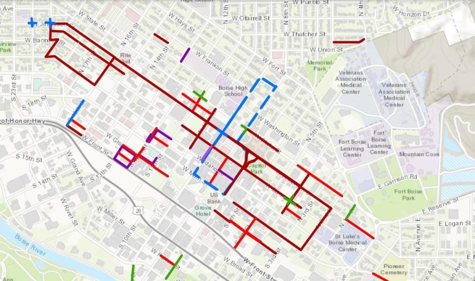
The Idaho Statesman looked into four projects that may have some of the biggest impact in the central Boise area in the coming years. Some have been approved, while others are still waiting their turn.
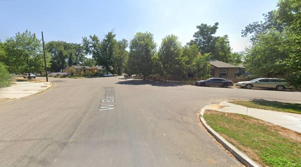
1. Bannock Street
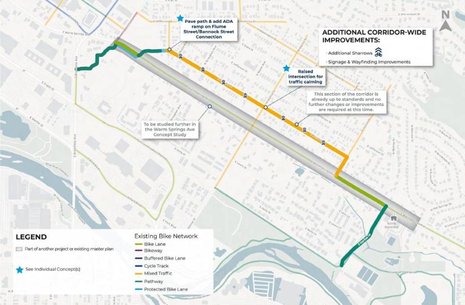
One of the largest projects for downtown is coming to Bannock Street, where ACHD is planning an estimated $4.1 million in upgrades along the entire length of the street.
According to a project concept report, the work would be split into a western and an eastern phase. It would extend from Whittier Elementary School on 29th Street in the West End neighborhood, east past Cecil D. Andrus Park by the Capitol, through the downtown campus of St. Luke’s Health System, to the terminus on Coston Street in the East End neighborhood.
Rachel Bjornestad, public information officer for ACHD, said in an email that Bannock street serves a variety of roles through Downtown Boise, the West End and East End neighborhoods, including residential and business access and connections to schools and parks.
“Bannock Street is a vital part of the community,” Bjornestad wrote. “(The project) is being developed to help ensure that the street meets the community’s needs.”
ACHD’s proposed plans for the western phase include bulbouts, which extend the curb into the parking lane to improve pedestrian crossings and slow traffic; raised intersections; and a traffic circle. ACHD is also looking to make the 27th and Bannock intersection safer for both cyclists and pedestrians.
Raised intersections are level with the sidewalk. They reinforce slow speeds and encourage drivers to yield to pedestrians, according to the National Association of City Transportation Officials.
The traffic circle at 19th and Bannock would similarly slow neighborhood speeds and increase visibility for a messy intersection that looks like a deformed X.
In the eastern phase, ACHD plans to install paved paths and ramps at the Flume Street crossing and a raised intersection where Bannock meets Walnut Street.
The agency is also planning to add additional shared lane markings, signs, and wayfinding improvements that would help people orient themselves along the street.
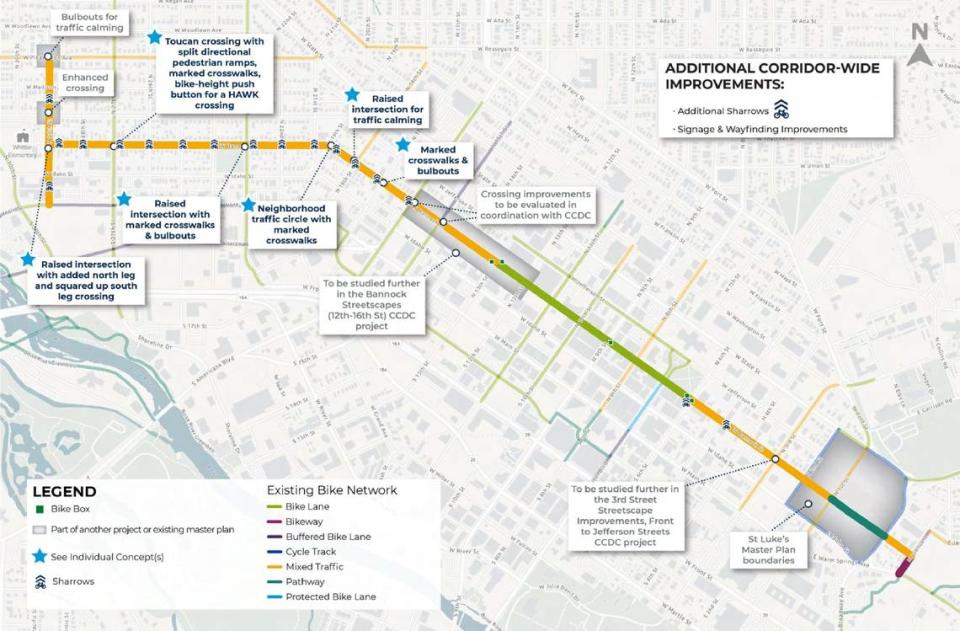
2. Franklin Street
Just north of downtown, ACHD is working to spruce up Franklin Street through “enhanced bicycle facilities that improve safety and access to schools, parks and businesses proximate to the corridor,” according to a November report. Bicycle facilities include bike lanes and barriers separating vehicles and cyclists.
The improvements would start at 18th Street and Ellis Avenue and extend behind the Albertsons supermarket on State Street, past Boise High School, and through Fort Boise to the end at Boise Fire Station No. 1 by the Boise Bike Park. More upgrades could be added from Reserve Street to Coston Avenue.
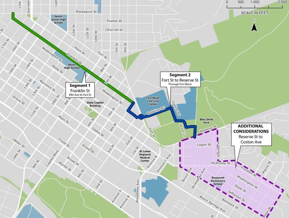
“Safety strategies such as bulbouts, raised intersections and mini traffic circles were considered for traffic calming, and [so were] bicycle/pedestrian safety improvements,” according to the report.
Also included in the proposal were Americans with Disabilities Act improvements, bulbouts and beacons at 13th and Franklin and enhancements along the new Boise High School field. ACHD would also convert speed bumps in Fort Boise to “bike-friendly speed tables,” which are similar to speed bumps but generally have a flat surface and are car-length.
“The project is intended to implement the goals and policies of ACHD’s North Boise Neighborhood Plan, ACHD’s Boise East End Neighborhood Plan and the 2018 Roadways to Bikeways Master Plan Addendum through the implementation of bicycle and pedestrian facilities that improve safety and access to schools, parks and businesses,” Bjornestad said.
ACHD estimates the project to cost just over $1 million.
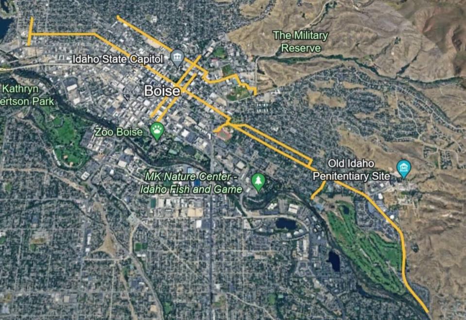
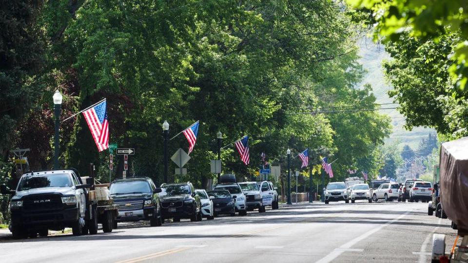
3. Warm Springs Avenue
While still in the early stages, ACHD may also consider upgrades to the Warm Springs Avenue stretch from Avenue C, by Dona Larsen Park, to Windsong Drive, just past Warm Springs Golf Course.
ACHD received 620 responses to an online survey and had 97 participants attend a June public workshop to identify improvements along the corridor, said Edinson Bautista, senior transportation planner for ACHD, during a September hearing on a study of the project.
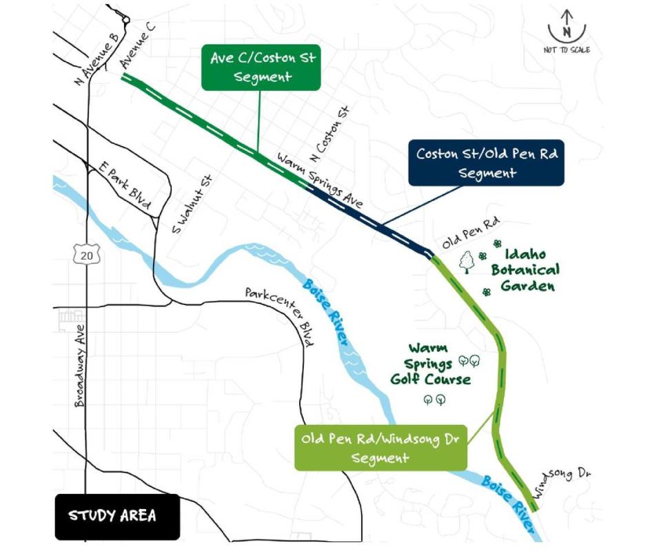
Bautista said there were a significant number of comments showing interest in a roundabout at the intersection of Warm Springs Avenue and Old Penitentiary Road.
“It was pointed out that there was difficulty with the current traffic flow at this intersection, especially when there’s events,” Bautista said, “as well as conflict between vehicle, cyclist and pedestrian users at that intersection.”
ACHD also found a desire to improve the intersection between Warm Springs Avenue and Walnut Street, which leads into Kristin Armstrong Municipal Park, the Idaho Department of Fish and Game Headquarters and the Boise River Greenbelt.
“There was a general consensus from the public that it needs to be improved for all users,” Bautista said.
The study also found an interest in increasing pedestrian crossings across the corridor and more protection for cyclists.
The district still has two more public outreach efforts and refinements before the proposed upgrades go before the ACHD commissioners for approval in summer 2024.
4. 5th and 6th streets
In the heart of downtown, ACHD and the city’s urban renewal agency, Capital City Development Corp. or CCDC, are looking to bring upgrades to 5th and 6th streets and convert them from one-way to two-way streets.
The changes include upgrading aging stormwater infrastructure, improving accessibility for those with disabilities, adding bulbouts and upgrading sidewalks.
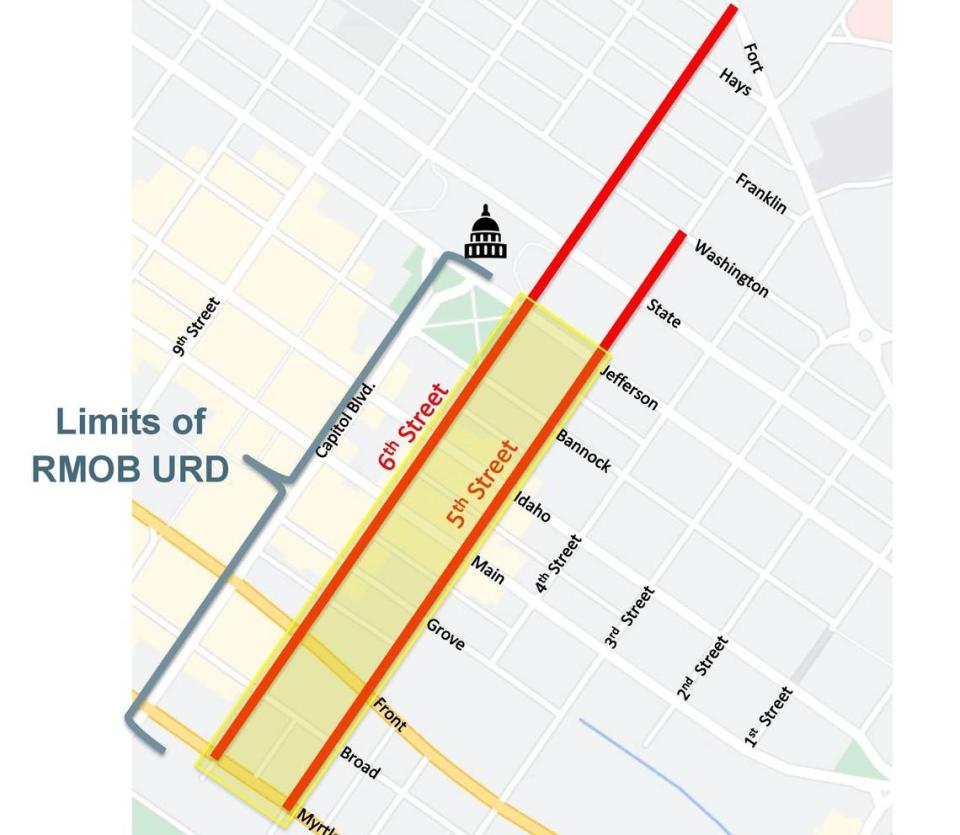
The conversion would include signal changes, pavement markings and new signs. ACHD approved the partial two-way conversion in 2017 but it still needs the Idaho Transportation Department to sign off before moving forward.
“Regardless of whether ITD and the state ultimately allow the two-way conversion component to take place, there will still be a project with other meaningful improvements,” said Zach Piepmeyer, parking and mobility director for CCDC, during a Nov. 13 board meeting.
Early cost estimates forecast the full project to cost $12.1 million. CCDC would put in $2.9 million while ACHD would contribute $9.2 million.
Big downtown Boise apartment & YMCA development is threatened. What just happened
Idaho sells old highway department HQ, ‘prime’ Boise real estate. This is who bought it
New park, improved bike and walking path are coming to downtown Boise’s Grove Street
Stretches of an iconic Boise street will be changed. Pedestrians, bicyclists take note

