Calgary is preparing for an even bigger flood than 2013
There’s a lot motivating hydrologist Frank Frigo to help prepare Calgary for a 1,000-year flood.
If floodwaters were again to rise to dangerous levels on the Bow and Elbow rivers, perhaps 10 feet or more higher than they rose a decade ago, damage would likely exceed the estimated $6 billion cost of the 2013 floods.
More critical infrastructure, like water and communications lines, would be compromised, with river flows surging to rates never before recorded in modern times. In 2013, when floods reached "100-year" levels on the Bow and "200-year" levels on the Elbow, those rivers flowed as high as 12 times their regular rates. During a "1000-year event," (these terms are used both to describe the likelihood and intensity of a flood), the flow would be even greater.
More private and public property would certainly be lost, with the unimaginable power of water rushing as fast as six metres a second, reshaping the land and environment in more dramatic ways.
And, most significantly for Frigo and everyone who plans for emergencies in the city of Calgary, the danger to human safety would be even greater than the historic floods that took five lives in 2013.
"Average flows in the Bow and Elbow rivers are about two metres deep in the summer," Frigo says.
"When we have events of about one-in-20-year likelihood, that level goes up by about four metres. One-in-100 is about a metre, metre-and-a-half higher than that, so six could become 7.5 metres. A one-in-200 is another metre higher than that, then one-in-1000 gets up to another 2 metres higher above even that."
WATCH BELOW: Why Alberta's 2013 flooding was so intense
RELATED: Before Fort McMurray's wildfire, Alberta's costliest disaster was 2013 flooding
While a "1000-year" flood, with levels more than three metres higher than in 2013, may sound unlikely, there is a (very) small chance that it could happen every year.
As mentioned, the hydrological term describes the likelihood of a flood of a certain level occurring in a certain place in any given year. A "100-year" flood, for example, has a one per cent chance of occurring in a given year.
So, while a "100-year," 500-year," or "1,000-year" event has an increasingly smaller likelihood of occurring, there is still a chance it could happen next year, the year after, or in any year during the coming decades.
That’s why Frigo and the city of Calgary are preparing for the worst now.
"2013 is not the most severe flood on record. In both 1879 and 1897, there were large events on the Bow that we know from anecdotal evidence exceeded what we saw in 2013," says Frigo.
"They were greater than that 100 to 200-year level. They clock in at between 350- and 500-year levels. Then, through paleohydrology work, we’ve been able to project all the way back to the 1500s, and we can see periods that were dryer and much wetter than anything we’ve seen recently."
In 2013, extreme rainfall totaled above 200 mm in areas around Calgary and as high as 325 mm in the hardest-hit areas in a matter of days. While a higher-than-average alpine snowpack and the region’s steeply descending, saturated watershed played a role, Frigo says the weather was the biggest culprit behind the devastating disaster.
That year, he says, a low-pressure system and a significant feed of moisture from the Pacific Ocean and Gulf of Mexico became trapped over the Rockies thanks to a high pressure ridge to the north. The skies opened, and torrential rains hammered the large river basins west of Calgary for days.
Theoretically, a similar but more intense meteorological setup pouring rain over a larger part of the basins of the Bow and Elbow rivers, which are thousands of square kilometres in size, could result in an even bigger flood.
To help predict how such severe events might play out, the city of Calgary has developed a complex modelling system harnessing not only sophisticated weather forecasting but also urban geographic information and historic flood data. It can be used to estimate the impacts of everything from a relatively common, or "one-in-two-year" flood, all the way up to a one-in-1000-year event.
Those models are being used to guide the city’s flood management strategy.
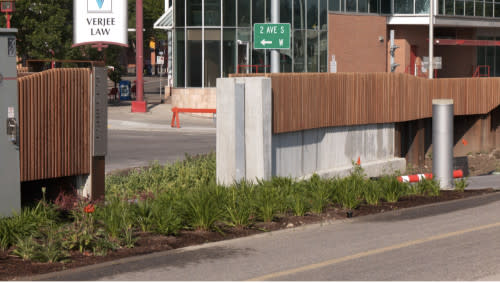
The downtown flood Barrier in Calgary. (Connor O'Donovan/The Weather Network)
For example, new flood barriers stretch along the rivers in many Calgary communities, including in areas hit hard in 2013, like downtown Calgary and the west Eau Claire neighbourhood.
Those barriers, Frigo says, were not only designed to ensure protection from a one-in-200-year flood event, but also included an extra half-metre of height. Further, he says, their foundations were built strong enough that they can be even further expanded if needed down the road.
To mitigate risk from the Elbow River, new gates have been installed at the Glenmore Dam in Calgary, which roughly doubles the Glenmore Resevoir’s storage capacity. Meanwhile, the Springbank Off-stream Reservoir is under construction and due to become operational in 2025 with a 70.2 million cubic metres capacity.
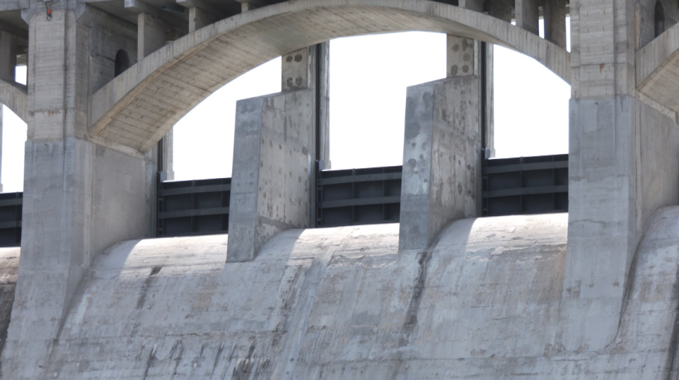
The new gates installed on the Glenmore Dam. (Connor O'Donovan/The Weather Network)
Working together, Frigo explains, those reservoirs should be able to manage an event as large as what was seen on the Elbow in 2013.
But more capacity is needed, he says, especially along the Bow. That’s why Calgary and other communities are exploring creating new upstream reservoirs, or expanding existing ones to further mitigate risk.
"It’s quite clear that the amount of storage that exists upstream of Calgary on the Bow River isn’t adequate to address a very large flood," he says.
"Both for drought resilience and flood protection, the city of Calgary and many others are interested in working with the province to look at the construction of incremental storage, a new reservoir upstream on the Bow River."
Better river monitoring technology is in place as well, along with improved emergency response strategies. Riverbanks have been rehabilitated and protected against erosion. Stormwater and sanitary system improvements have been made.
According to city estimates, the overall damage potential that existed in 2013 has been reduced by 55 per cent. When the Springbank Off-stream Reservoir is completed west of the city in 2025, that protection level will increase to 70 per cent.
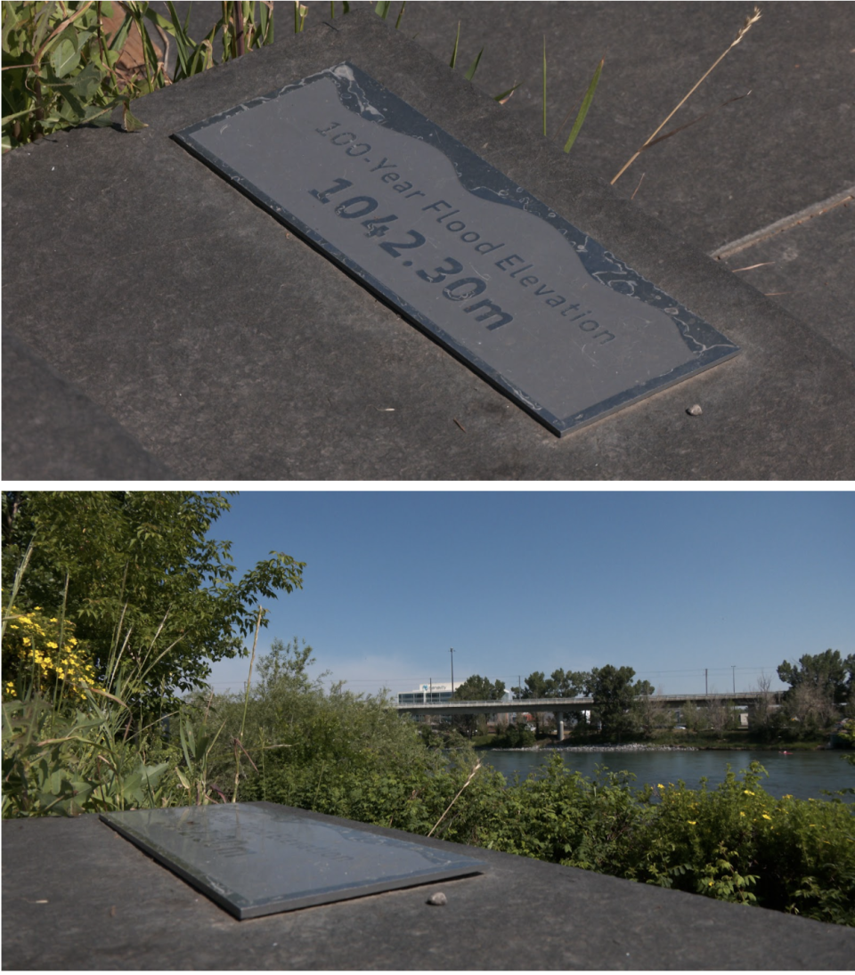
This marker along the Bow River shows flood levels reached in 2013. (Connor O'Donovan/The Weather Network)
So, as Frigo has pointed out, there is more work to be done.
Theoretically, he says, the "probable maximum flood" for the region would result in river flows twice as high as they reached in 2013.
"That would be in excess of a 100,000-year flood in terms of the actual likelihood. And, while theoretical, there’s nothing stopping nature from creating those types of events. An event close to the probable maximum flood actually occurred in Vanguard, Saskatchewan, in 2003." (There, nearly 350 mm of rain fell in just over eight hours.)
And, while it is decreasing mountain snowpack levels, Frigo adds that climate change is still increasing flood risk, as well, with the potential for more severe floods in addition to droughts.
That, he says, is providing even more motivation for the city’s "Swiss cheese" model of flood defences.
"All of the climate change research suggests that both on the drought side and on the flood side, we will see more extreme events," he says. "What we are expecting is that over about the next 70 or 80 years, all of the flood likelihood estimates to increase by about 20 per cent."
(Learn more about the 2013 floods in This Day in Weather History, a podcast by The Weather Network)
Header image: View of Elbow River meander belt from Forgetmenot Ridge in Kananaskis Country showing the devastation caused by the June 2013 flooding in Southern Alberta. Credit: Joe Price/Submitted.

