
California Braces for More Flooding as New Storms Strikes
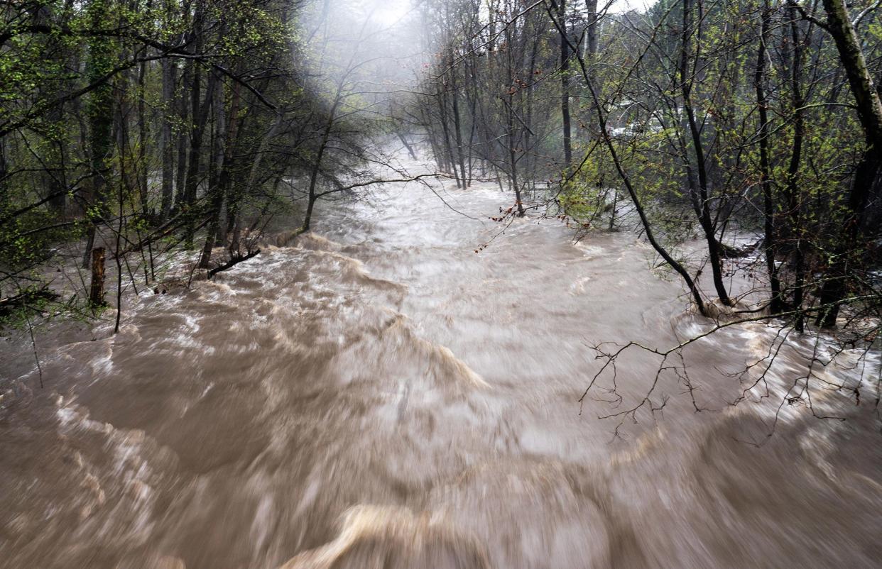
(Bloomberg) -- California’s next round of heavy weather will arrive overnight with high winds that could spark renewed flooding and power outages just a day after an earlier storm sparked evacuations, closed roads and left entire communities awash.
Most Read from Bloomberg
‘Old-School’ Signature Bank Collapsed After Its Big Crypto Leap
US Core CPI Tops Estimates, Pressuring Fed as It Weighs Hike
Credit Suisse Finds ‘Material’ Control Lapses After SEC Prompt
Billionaire Charles Schwab’s Fortune Is Slammed by SVB Fallout
Sacramento will get it most severe weather through the night into Tuesday morning, said Idamis Del Valle-Shoemaker, a National Weather Service meteorologists. There are flood watches up a large swath of California through early Wednesday.
The storm will deliver “significant impacts,” she said.
A weekend downpour caused widespread flooding that prompted the evacuation of residents along the Salinas River in Monterey County on Sunday. Deluges forced the closure of the iconic coastal Highway 1 and roads in the San Francisco Bay area.
While some rivers have begun to recede, the next round of rain will swell them beyond flood stage in coming days, according to the California Nevada River Forecast Center.
California Governor Gavin Newsom extended the state of emergency to six more counties on Sunday, taking the total to 40.
By late Sunday, portions of Interstate 880 in Fremont had reopened. Earlier, the Capitol Corridor rail service was rerouting trains around Fremont and Hayward due to a washout. In San Mateo County, damage from a landslide blocked a stretch of Highway 84, which connects Silicon Valley to the coast. Roads in South Lake Tahoe were impassable because of high water.
Photos and video posted to social media showed widespread flooding in Pajaro, in a region known for its strawberry crop. Strawberries were Monterey County’s most valuable crop in 2021, bringing in $968 million of $4.1 billion in total agricultural revenues, according to the county agricultural commissioner.
The storms hitting California are known as atmospheric rivers that send vast amount of moisture from the ocean crashing onto land. After this week’s system unfurls across the most-populous US state, there should be a lull for a few days.
A further 2 to 6 inches (15 centimeters) of rain will fall across large portions of California, said Marc Chenard, a senior branch forecaster at the US Weather Prediction Center. At its highest peaks, California will also get another round of heavy snow.
“It looks like another multiple-hazard event,” Chenard said. “The main system comes ashore later today and tomorrow. We should start seeing the impacts later today in Northern California.”
Chenard said there aren’t any other atmospheric rivers forecast to arrive in the next week, but rain could continue for several days in many areas.
--With assistance from Brian Wingfield.
(Updates with meteorologist’s comments starting in second paragraph.)
Most Read from Bloomberg Businessweek
Naples, Florida, Sees a Rush of New Money—But City Workers Are Getting Priced Out
The Digital Age Ushers in a Speedier, More Viral Breed of Bank Run
Next Big Job Cuts Will Be in Finance and Health Care, Data Show
©2023 Bloomberg L.P.

