More than 3.2 million acres have burned across California this year; death toll reaches at least 24
As the death toll in California’s wildfires swelled to 24, authorities continued to search for a number of people still missing and firefighters toiled to keep multiple blazes from reaching populated communities ahead of an expected uptick in winds.
More than 3.2 million acres have burned across the state this year, the largest amount on record. Together, the fires have destroyed at least 4,100 structures and forced more than 60,000 people from their homes.
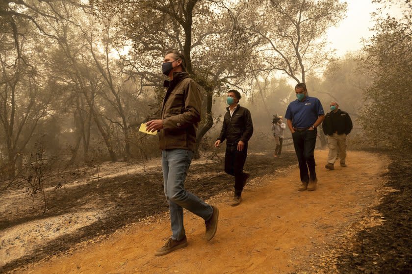
The devastation prompted a visit from President Trump, who arrived in Northern California on Monday for a briefing on the wildfires. The event was held mostly in private and was overshadowed by Trump’s antagonism toward the state and the administration of Gov. Gavin Newsom.
The governor did not meet Trump on the airfield when Air Force One landed shortly before 11 a.m. at McClellan Park, just outside Sacramento. Newsom has credited the president with being “proactive” in his efforts to provide assistance to the state, but he also took the Trump administration to task for its policies that reduced environmental protections.
Experts have said that climate change is causing California’s fires to spread more rapidly because of hotter temperatures and more extreme dry and wet spells.
The fires and wind spurred the U.S. Postal Service to temporarily close some post offices in California, as well as Washington and Oregon.
Trump on Monday deflected questions about whether climate change was a driving force behind the state's historic wildfires, saying instead that major fires could be attributed to what he described as a failure to properly manage the state’s forests, including the need to cut more fire breaks.
“They explode,” Trump said. “Also leaves. You have years of leaves, dried leaves on the ground. It just sets it up. It’s really a fuel of a fire, so they have to do something about it.”
As he did in 2018 after the deadly Camp fire devastated the Northern California mountain community of Paradise, Trump said the state had to do a better job of clearing dead trees from the forest floor.
The state’s deadliest fire so far this year, the North Complex fire, had been crawling for weeks through the Plumas National Forest, and was more than half-contained last week, when an unusually strong offshore wind event whipped up the flames. On Tuesday, the fire jumped the Middle Fork of the Feather River and barreled into mountain communities in Butte County before residents could flee.
Two more bodies were recovered from the burn area Sunday, bringing the death toll to 14. Butte County Sheriff Kory Honea said seven people were still missing and officials were working to locate them.
Buoyed by several days of favorable weather conditions, firefighters were able to construct hand and bulldozer lines around portions of the fire to keep the flames from burning farther.
They continued to report progress overnight into Monday, saying they were able to boost containment of the fire from 26% to 38% even as it grew by 2,900 acres, to 261,488 acres.
Acreage growth sometimes reflects better mapping, as well as intentional fires set by crews to burn fuel between containment lines and the fire front, which help ensure the flames don’t come roaring over the containment lines, said Rick Carhart, public information officer for the California Department of Forestry and Fire Protection in Butte County.
“So we’re essentially growing the fire ourselves on purpose in order to tie in some of those fire lines we have cut and then burning back toward the fire itself,” he said, “just to put black ground in there to make sure that the fire doesn't have any fuel to continue burning.”
Firefighters were nervously monitoring the weather for an anticipated pattern shift that could cause an uptick in fire activity. The National Weather Service issued a red-flag warning for the region that was in effect until 8 p.m. Monday, warning that breezy southwest winds of 10 to 20 mph, with gusts up to 30 mph, plus daytime humidity in the 15% to 25% range, could increase the chance of rapid fire growth.
“That’s going to be one of our big challenges for the day is what is the fire going to do,” Carhart said.
But, he said, the winds weren’t expected to be nearly as strong as Tuesday, when the fire “blew up” and barreled into Butte County.
“This is actually a completely different setup,” said Cory Mueller, a meteorologist with the National Weather Service in Sacramento. “Last week was what we call a north wind event. We get them typically in the fall.”
Those winds are comparable to the Santa Anas in Los Angeles, he said. They blow downslope, gaining speed, heating up and drying out as they move from higher to lower elevations and squeeze through narrow canyons and passes.
“This event is just kind of gusty winds,” Mueller said of Monday’s weather. “They are not nearly as dry and they won’t be nearly as strong.”
Fire officials were working to finish putting in contingency lines in the Cherokee area, just across the lake from the fire front, as protection in the event the winds were to blow embers across the water.
But they said they were confident they could keep the fire from spreading significantly Monday.
“We’ve done a lot of good work on the fire, and we feel really good about the way we’ve gotten it to the point we’ve gotten it right now,” Carhart said. “And we're hopeful that despite the weather conditions that we’re not going to have big damaging fire growth today.”
Elevated fire weather conditions were also forecast for portions of Central and Southern California because of higher temperatures and lower humidity, the Weather Service said.
The Creek fire, which has burned 212,744 acres in the the Sierra National Forest in Fresno and Madera counties, was 10% contained as of Monday morning.
Firefighters were working to protect structures in the Jose Basin area after winds pushed flames across the fire line toward communities.
They were concerned that a shift in the wind could clear smoke that had been providing a cover of shade over the area, which could cause the fire to make a run to the east, officials said.
A fire burning in the Sequoia and Inyo national forests about 25 miles north of Kernville sparked new evacuation orders Monday afternoon after high winds pushed the fire west toward multiple small mountain communities over the weekend.
The SQF Complex fire was 90,845 acres and 12% contained as of Monday. It spread six to eight miles in the past several days, said Mark Vosburgh, public information officer with the Northern Rockies Type 1 Incident Management Team, which was coordinating the response to the fire.
Residents in a portion of the community of Three Rivers in Tulare County were told to get out immediately. The mandatory evacuation order covered the area south and east of Highway 198 and east to south of the Fork Campground, the county said.
The remainder of Three Rivers was placed under an evacuation warning at 1:15 p.m. The Exeter Memorial Building in Exeter was opened as a temporary evacuation point.
The fire behavior has been "very, very" active, sending up a large column of smoke that can be seen from the incident command post 15 to 20 miles away, Vosburgh said. In some cases, that's persisted through the evening, he said.
"In more typical fire conditions there will be a shortened burn window where you have this active burning for a few hours in the middle of the day, but we're experiencing longer periods of active fire behavior going into the night occasionally," he said.
"The other main challenge firefighters face right now is the difficulty of getting resources, getting enough firefighters and resources to respond and give the firefighters a chance for containing it," he said, noting that with all the fires across the state, officials have been forced to prioritize where to allocate personnel and equipment.
In Southern California, the Bobcat fire in the San Gabriel Mountains prompted evacuation orders for portions of Arcadia and Sierra Madre on Sunday. Crews were toiling to keep the fire out of the foothill communities to the south. The fire had grown to 38,299 acres with 3% containment by Monday evening, jumping a contingency line and burning the east side of Little Santa Anita Canyon above Sierra Madre, officials said. Fire crews are fighting the blaze's advance on Mt. Wilson.
The El Dorado fire in San Bernardino County, a blaze sparked by a pyrotechnic device used during a gender reveal party in Yucaipa, was at 14,478 acres and 44% contained as of Monday morning.
Firefighters saw an uptick in fire activity that started overnight and continued throughout the day, said Cathey Mattingly, public information officer for Cal Fire San Bernardino.
"There's a lot of heavy fuel out here," she said. "And then we get a little bit of wind activity at night, there’s diurnal winds that come in, and overnight that set off kind of an increase. Then when the sun started warming up this morning, it really picked up activity."
Fire officials were expecting the warming and drying trend to continue, she said.
Multiple communities in the San Bernardino Mountains, including Angelus Oaks, Mountain Home and Forest Falls, remained under mandatory evacuation orders, while other residents were advised to be ready to evacuate if necessary.
"We don’t want anybody in harm’s way," Mattingly said.

