As California preps for more ‘horizontal hurricanes,’ Air Force gathers intel over Pacific
Massive storms sweeping over California from the Pacific have played havoc on the state for much of its recorded history, including a relentless 1862 downpour that forced Gov. Leland Stanford to take a rowboat to his own inauguration in Sacramento.
In the decades since, similar storms dubbed “atmospheric rivers” have killed dozens of Californians, inflicted billions of dollars in damage, and three winters ago, blasted apart the spillways at Oroville Dam, the nation’s tallest. Nearly 200,000 people were evacuated.
Yet forecasters don’t know nearly as much as they’d like about these “horizontal hurricanes,” despite the dangers and the important role they play in replenishing drought-prone California’s water supply amid a changing climate.
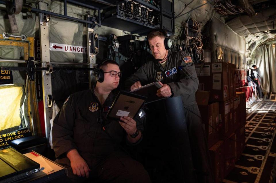
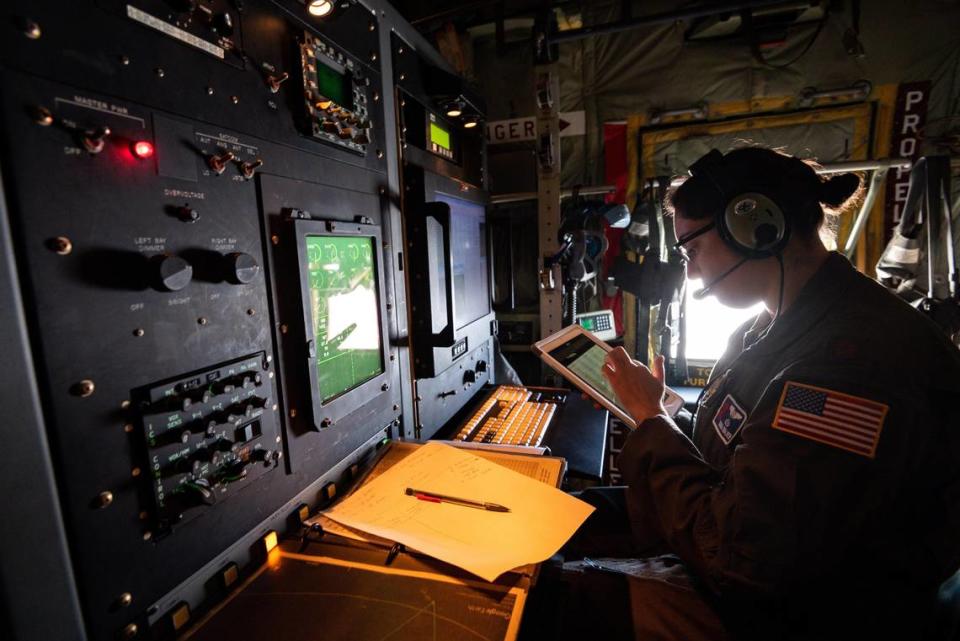
On Tuesday, high above the Pacific Ocean, two U.S. Air Force Reserve “Hurricane Hunter” crews in a pair of WC-130J Super Hercules aircraft were trying to change that, as part of a years-long research project to improve atmospheric river forecasting.
The 53rd Weather Reconnaissance Squadron’s mission over the coming months: C-130s — departing from the U.S. Coast Guard Air Station Barbers Point in Hawaii; or from Travis Air Force Base in Fairfield — will each release 25 sensors called dropsondes into a forming atmospheric river system.
As the dropsondes fall from 25,000 feet along two V-shaped paths covering hundreds of miles, they send back readings on the gathering storm’s water vapor content, temperature, wind speed and direction.
The Air Force relays the data to scientists at the National Oceanic Atmospheric Administration. They share the data with colleagues at research institutions such as the Scripps Institution of Oceanography UC San Diego, which is coordinating the project that will send flights over the next seven weeks.
State taxpayers have paid about $1 million through the Department of Water Resources to fund the ongoing “AR Recon” research, which is in its fourth year of gathering data over the Pacific Ocean.
Predicting deadly floods
Atmospheric rivers form when high-powered winds drag a fire hose of tropical moisture across the ocean surface. The 500-mile wide conveyor belts of water can last for days and can hit California in wave after wave. They provide up to half the state’s rain and snowfall each year. The largest storms can produce as much rain as a major hurricane.
It was only last year that officials agreed on an atmospheric river ranking scale similar to the “Cat” system used to describe a hurricane. An “AR 1” is the weakest system. An “AR 5” is the most destructive. One notorious example of an AR 5 was the New Year’s Day floods of 1997, which killed at least nine people and flooded 300 square miles of California.
Atmospheric rivers — no matter the size — are notoriously difficult to predict.
Forecasts of where exactly they might hit land can be widely off. At three days lead time, predictions tend to be off by as much as 200 miles on average, said Marty Ralph, principal investigator for the AR Recon program and director of the Center for Western Weather and Water Extremes at Scripps Oceanography.
“That basically says we know an AR is likely to hit the coast somewhere, but we don’t know exactly where. It could be ... Santa Barbara versus San Francisco or San Francisco versus the Oregon border,” Ralph said.
That has real-world consequences, he said.
A couple of years ago, evacuations were ordered following the Montecito mudslides that killed 23 people in Santa Barbara County after another atmospheric river was expected to hit the area. When the storm ended up making landfall, it hit near Big Sur, missing Santa Barbara by about 150 miles.
‘The importance of a good forecast’
The Hurricane Hunter squadron will be on standby through mid-March to drop sensors into as many as 12 storms. So far, not every AR Recon flight has gone as planned.
On Tuesday, a minor fuel leak forced the Travis crew to turn back a couple of hours into the 10-hour mission before the dropsondes could deploy. The good news was the flight from Hawaii was able to release its 25 dropsondes into the storm.
And there will be plenty of other opportunities to get the data researchers need in the weeks ahead.
For the airmen on the C-130s, the flights tend to be a little more boring than the ones they normally go on. After all, they fly into hurricanes from their home base in Biloxi, Miss. to give forecasters real-time data from inside the massive tropical storms.
Lt. Col. Jeff Ragusa, the chief pilot of Tuesday’s shorter-than-hoped flight out of Travis, said it’s nonetheless rewarding to be on the forefront of West Coast research that may help save lives from floods and mudslides.
As someone who lives along the hurricane-prone Gulf Coast, Ragusa said he knows a storm’s risks all too well.
“To me, it’s hugely important, and it really strikes home what we’re doing,” he said standing outside his C-130 after landing at Travis. “We understand the importance of a good forecast for bad weather. ”
Data for dams
Researchers say the data the AR Recon flights are gathering will be valuable for the managers of California’s major dams like Oroville, Folsom and the others that ring the Central Valley.
Experts say it could save lives if dam operators know exactly when to open spillways to ensure there’s enough room in a reservoir to catch floodwaters. Conversely, knowing a storm is going to be weak or miss the area entirely could allow dam managers to keep spillway gates closed to store more water for future droughts.
As it stands, many of California’s dams rely on decades-old rules set by the U.S. Army Corps of Engineers that spell out exactly when and how much water to release based on formulas that experts say rely too heavily on out-of-date climatological data and runoff projections, instead of the latest modeling.
The hope is the data gathered in the AR Recon flights could someday be used to make California’s dam management more nimble. There’s still plenty of work to do on that front.
In the lead-up to the Oroville Dam crisis, the storm that filled the lake to capacity was predicted to hit more than 100 miles north of where it actually did, Ralph said.
“This is everything for us because it means both water supply and flood control at the same time,” said Jeffrey Mount, a watershed expert at the Public Policy Institute of California. “If we have to make emergency releases in order to prevent something like Oroville... or if can we cheat a little and hang on to the water to improve our likelihood of having a full reservoir in the spring, it really, really makes a difference.”

