California wildfires: Satellite images reveal devastating scale of disaster across US state
The sheer scale of destruction caused by wildfires in California has been revealed in satellite images released by Nasa.
More than 200 people were still missing on Monday in California’s deadliest and most destructive blaze on record, which is one of two fires raging in the state.
At least 31 people have been killed and more than a quarter of a million have been forced to evacuate.
:: Follow the latest updates on the wildfires raging in California
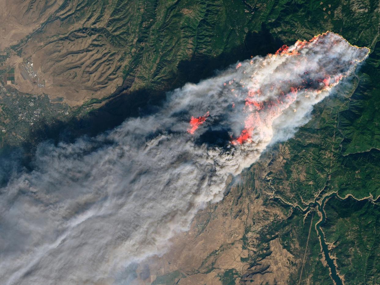
A photo of the blaze, named Camp Fire by officials, was captured by the space agency’s Landsat 8 on Thursday 8 November, showing a huge plume of smoke rising from the fire hours after it first broke out.
The fire is highlighted in the image, and smoke from the blaze can be seen spreading over the town of Paradise. Around 24 hours after the image was taken, the fire had torn through 70,000 acres of land.

Another image from Nasa’s Terra satellite shows wildfires raging on both sides of the state.
In northern California, smoke from the Camp Fire covers the town of Paradise and reaches as far south as San Francisco before drifting over the Pacific Ocean.
Smoke from the Hill Fire and Woolsey Fire can also be seen billowing into the sky in southern California before heading out to sea.
The death toll from the wildfires rose to 31 on Sunday, after six more people were found dead.
The Camp Fire has claimed at least 29 lives since it broke out on Thursday, while at least two people have died in the Woolsey Fire threatening the wealthy beach community of Malibu, near Los Angeles.
More than 6,700 homes and businesses in Paradise have been burned down by the Camp Fire, more structures than any other California wildfire on record.
The Woolsey Fire has scorched at least 83,275 acres and was only 10 per cent contained.
Around 228 people are still unaccounted for, Butte County Sheriff Kory Honea told reporters on Sunday evening.

