California's record-setting, wild weather set to impact Canada
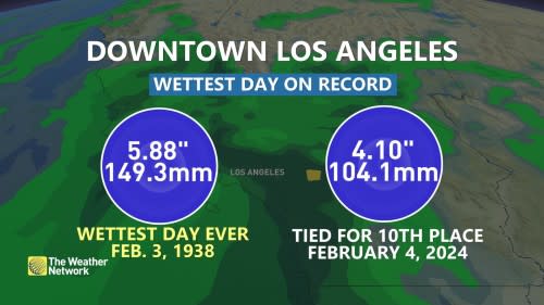
The University of California (UCLA) recorded a record-breaking rainfall total of more than 300 millimetres of torrential rainfall in just 24 hours this week.
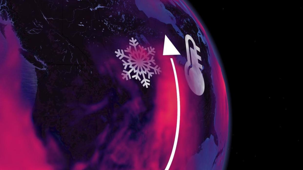
Where is all this rain and energy going next? Well, Canada. And, it’s going to drastically alter our weather patterns this week.
RELATED: Lingering atmospheric river soaks California, threatens more flooding, mudslides
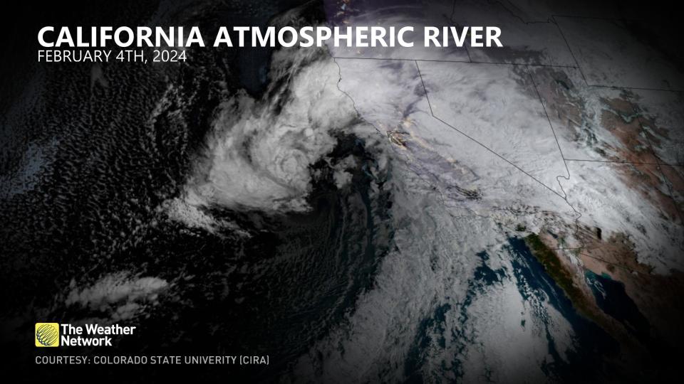
On Feb. 4, a powerful low-pressure system swept toward coastal California while its associated atmospheric river stalled across the state. Moisture was drawn up from the tropics south of the Hawaiian Islands.
All that moisture and energy crossed the Rocky Mountains on Tuesday, and by Wednesday, a Colorado low develops on the leeside of the Rocky Mountains.
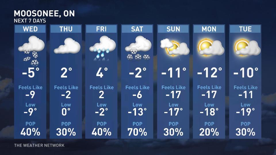
This Colorado low will spill snowfall across the Prairie provinces, potentially exceeding seasonal totals from this winter. It’s a slow-moving Colorado low that will struggle to make headway across Ontario until later Thursday and Friday.
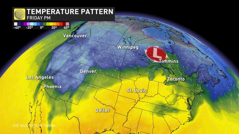
The system is sweeping the once-tropical moisture associated with the atmospheric river up to the shores of Hudson Bay, keeping things exceptionally mild. Temperatures above 15 degrees above normal are stretching from Ontario to Labrador.
Meanwhile, this amplifies the high-pressure ridge across Ontario and Quebec, allowing the warmer air mass to spread all across Eastern Canada.
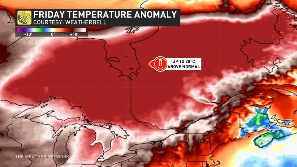
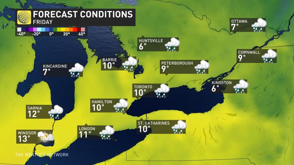
Friday afternoon could feature temperatures in the low teens across extreme southwestern Ontario, as models warm up to the idea of pushing the warmth in from Michigan.
Even the Greater Toronto Area (GTA) is forecast to push into the double-digits on Friday, nearly 12 degrees above the normal mark. A couple of projections show the low teens pushing close to the GTA.
A temperature of 14°C this month at Pearson International Airport would be a top 10-warmest February day on record, with the mildest occurring on Feb. 23, 2017 (17.7°C).
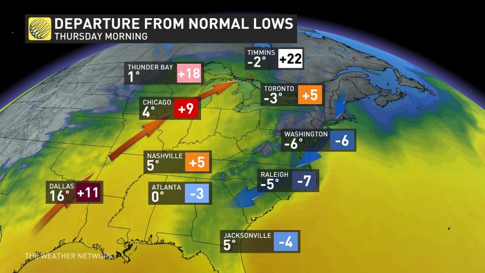
In an unusual turn of events, it’s cooler down towards Raleigh, N.C., than in Timmins, Ont., on Thursday morning.
Eventually, the same Colorado low brings a round of milder conditions across Atlantic Canada and snowfall across Labrador, with New Brunswick and Labrador recording the mildest temperatures –– relative to average.

