Canada is colder than a cloud, and looks like one on satellite
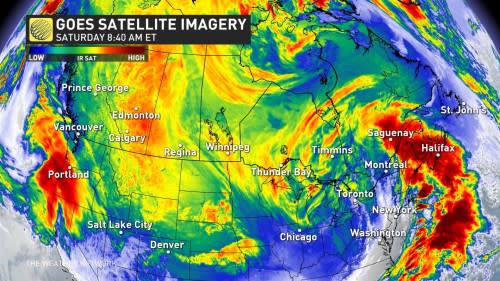
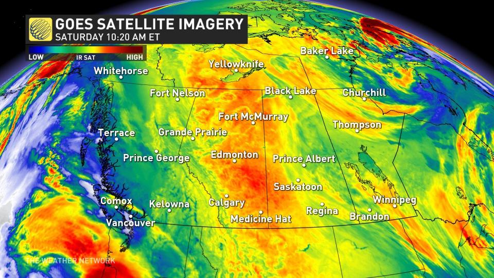
Appearances can be deceiving, and the proof of those was found in Saturday's satellite imagery.
Canada was, in fact, disguised as a cloud since it's so cold, especially across the West where temperatures and wind chills are unfathomable and dangerous in many areas.
SEE ALSO: The Prairies are so cold, you can see the frigid air from space
Conditions are so cold that weather satellites can see the frigid air from space. Air temperatures in the -30s and -40s have showed up on infrared satellite imagery on Saturday, mistaking the frigid air for chilly cloud tops like towering cumulonimbi.
A similar scenario occurred in Western Canada in December 2021, with identical daytime highs.
Take a look at today's satellite imagery below.
So, just how cold was it?
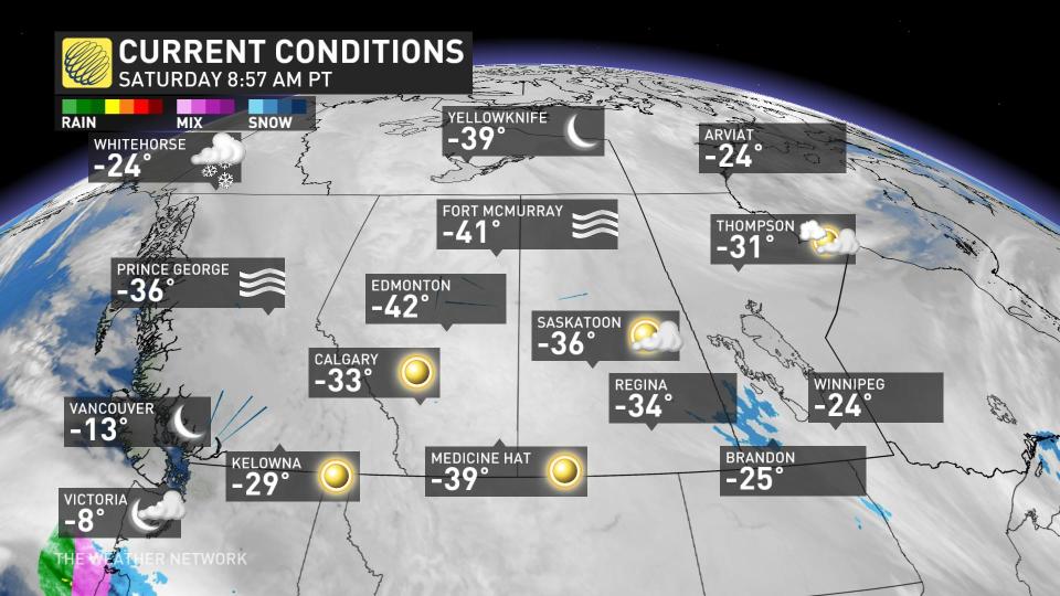
At 9 a.m. local time on Saturday, Edmonton, Alta., was -42°C, Fort McMurray, Alta., was -41°C, Medicine Hat, Alta., was -39°C, Calgary, Alta., was -33°C, Prince George, B.C., and Saskatoon, Sask., were -36°C, Regina, Sask., was -34°C, Kelownam B.C., was -29°C, and Winnipeg, Man., was -24°C.
On Friday, temperatures bottomed out at -50.1°C in Keg River, Alta. It was the first -50°C reading in Canada this season and the first for Alberta in 20 years. It was colder there than it was in the Arctic Circle, if you can believe that.
The hazardous cold set records on Friday on parts of the Prairies.
Edmonton International Airport reached a temperature of -45.9°C Friday morning, making it the third-coldest temperature at the locale since records began in 1960. During the day, the airport only got as warm as -34.4°C, making it the lowest-maximum high recorded at the terminal.
Saturday night could see a new, rare record that Edmonton falls to the its lowest temperature on record, for either the city or the airport station. The previous record occurred on Jan. 19, 1886 at -49.4°C.
To the south, in the city of Calgary, it recorded a high of -30.4°C on Friday –– its coldest day since Feb. 1, 1989 (-31.9°C). With temperatures dipping below -35°C as lows, it was the coldest night since Jan. 11, 1998.
Prior to Friday, Calgary had experienced a daytime high of -30°C just once since the year 2000, on Jan. 27, 2004.
And, when we look to B.C., the province is forecast to see a once-in-a-generation cold. Vancouver International Airport recorded a temperature of -12.9°C at 7 am on Friday –– its coldest January value since 1993 (-14.1°C).
It also recorded a wind chill of -24 at the same time on Friday, a value that is exceptional for the airport, according to Tyler Hamilton, a meteorologist at The Weather Network.
That wind chill of -23 is exceptional for @yvrairport - have to look when it's been colder. https://t.co/KnMquwmKNP
That wind chill of -23 is exceptional for Tyler Hamilton on Twitter: "That wind chill of -23 is exceptional for @yvrairport - have to look when it's been colder. https://t.co/KnMquwmKNP / Twitter" - have to look when it’s been colder. Tyler Hamilton on Twitter: "That wind chill of -23 is exceptional for @yvrairport - have to look when it's been colder. https://t.co/KnMquwmKNP / Twitter"
— Tyler Hamilton (@50ShadesofVan) Tyler Hamilton on Twitter: "That wind chill of -23 is exceptional for @yvrairport - have to look when it's been colder. https://t.co/KnMquwmKNP / Twitter"
It was the coldest wind chill value for the airport since Dec. 29, 1968.
Greater Victoria, B.C., also saw impressive and dangerous cold, recording a highly unusual daytime high of -6.6°C on Friday, making it the chilliest day in more than 50 years. You have to go back to Jan. 25, 1972 to find a colder value.
The bitter cold has also brought out spectacular light displays, with both sun dogs and light pillars reported across Western Canada.
Good news ahead for some, not so much for others
Finally, the frigid pattern in the West will slowly relax next week, but colder-than-seasonal temperatures will dominate across southern Prairie areas through the end of the week. While below normal, they will be comparatively warmer in comparison to the current state of daytime highs.
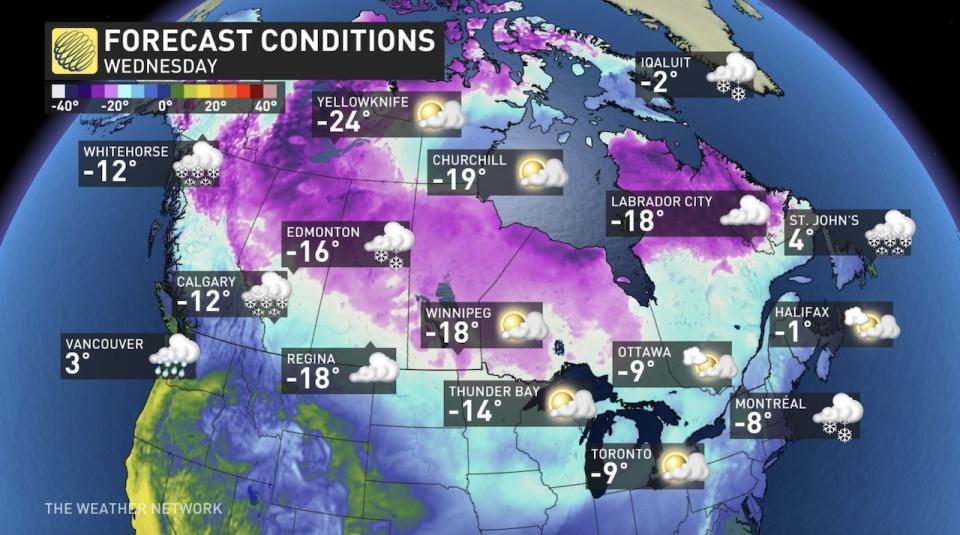
For the East, colder-than-seasonal temperatures will spread into the region for Sunday and continue through next week. However, temperatures won't be exceptionally cold as seen in Western Canada, but will be a sharp contrast to the winter thus far.
With files from Tyler Hamilton, a meteorologist at The Weather Network, and Cheryl Santa Maria, a digital journalist at The Weather Network.
Follow Nathan Howes on the X platform, formerly known as Twitter.

