Caprock Chronicles: Lubbock’s Canyon Lake
Editor’s Note: Jack Becker is the editor of Caprock Chronicles and can be reached at jack.becker@ttu.edu. Todays article is by Jim Bertram, FAICP, a retired city engineer. While working for the city it fell upon Mr Bertram to organize and led the Canyon Lake project.
The Yellow House Canyon, which extends 6.5 miles from northwest to southeast in Lubbock, is the only major break in the local flat topography that is so characteristic of West Texas. The Canyon, though small in size, was formed by the North Fork Double Mountain Fork of the Brazos River. Historically, the canyon was fed by spring water and was a gathering place for buffalo and other range wildlife.
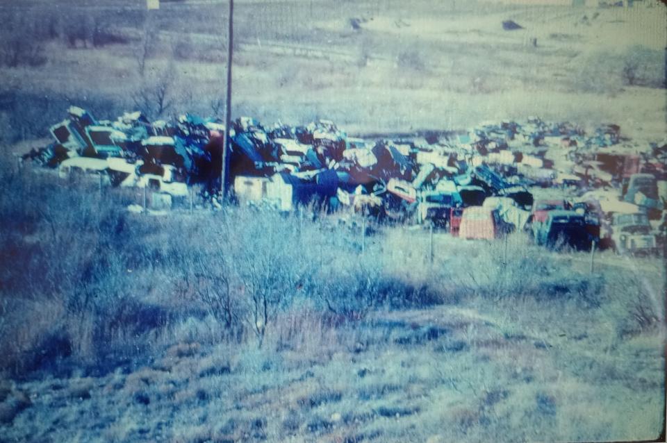
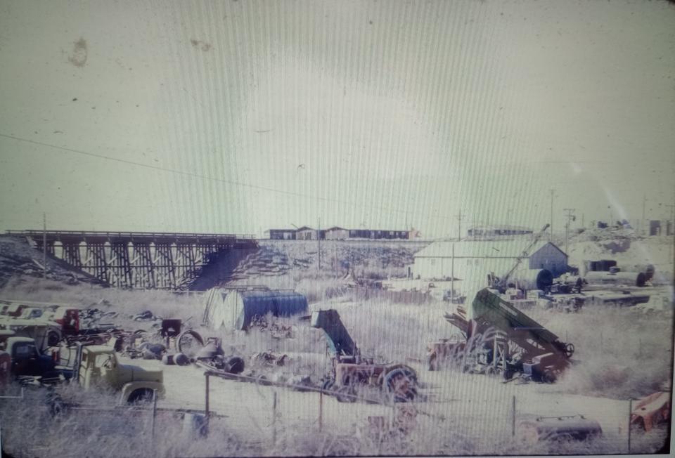
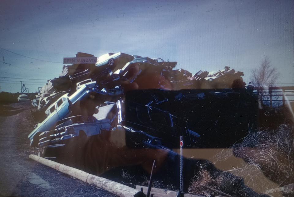
Lubbock was not incorporated until 1909, and with the exception of Mackenzie State Park, the natural beauty of the canyon was not widely appreciated. In fact, the City, for many years, used the southern end of the Canyon as its dumping ground. By the 1960’s, the Canyon contained over 3,000 wrecked automobiles, numerous caliche mines, asphalt batch plants, concrete batch plants, and all kinds of business and residential debris.
In 1967 the City of Lubbock Planning Department updated the City’s Comprehensive Land Use Plan, designating the entire Canyon as open-space and recommended using reclaimed water to create a series of six recreational lakes inside city limits, and two large lakes outside the City. This concept was presented to numerous civic clubs in a 35mm slide show and generated so much interest that the project was included in “Lubbock’s Goals for the 70’s”.
The Lubbock City Council subsequently contracted with Freese, Nichols and Endress, an engineering firm from Ft. Worth, to complete a feasibility study. In 1968 They published their findings and said…. “….there is enough water available to support the proposed lakes, and that, with proper monitoring and control, they can be kept safe and attractive for public use.” The estimated cost of the first six lakes was $6.5 million and would be filled from rain water. The additional water would come from wells drilled on the City’s wastewater irrigation farms southeast of Lubbock. Dams for each lake would be located to avoid flooding upstream roads crossing the canyon.
On May 11, 1970, a devastating tornado hit Lubbock, killing 26 citizens and causing millions of dollars in damage. A subsequent tornado recovery bond issue, which included $2.8 million for the Canyon Lakes project easily passed in a city wide election. Since the bond funds covered only about half of the estimated project costs, grant funds were secured from the Bureau of Outdoor Recreation (B.O.R.) ($3.4 M) and H.U.D. ($835,000).
At that time, no city had ever acquired and relocated automobile wrecking yards with open-space recreation grant funds, so special permission had to be granted from B.O.R. to acquire and remove over 3,000 wrecked cars. Another major roadblock was caused by enormous amounts of debris that had been dumped in the canyon by the Corps of Engineers during cleanup after the tornado.
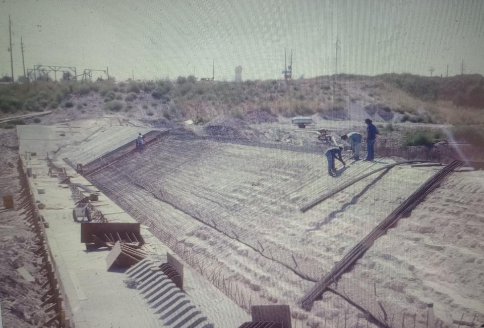
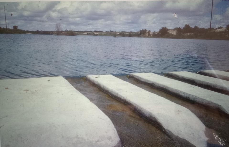
The debris was compacted and covered under 3-4 feet of fill dirt taken from the lake to shape and deepen them. Clark Equipment Company donated the services of two 16-yard earth scrapers and the value of that work, combined with the City’s bond funds and matching Federal Grants, added over $7 million to the project funds.
Project boundaries extended from rim to rim of the canyon, so appraisals were made and land acquisition began about 1972. As parcels were acquired, cleanup and debris removal was begun by the Parks Department, with heavy equipment obtained through the City.
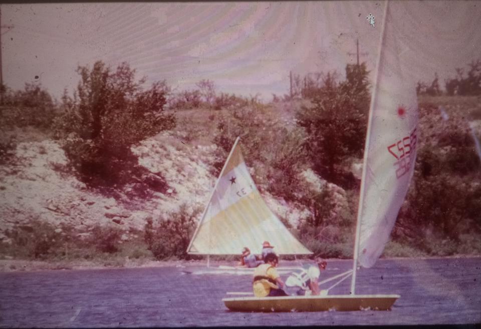
Initially, only dams for Lakes 1,2,3, and 6 were constructed, since a lake already existed in Mackenzie Park. This allowed funds to be used for the development of a road system, which joined all the lakes, for boat launches, jogging trails, picnic units and a water system of 26 wells and a pipeline to bring water from the city's waste water irrigation system to Lake 1.
By 1975, all property had been acquired, all debris had been removed, four dams had been built, a road system and parking lots constructed, and park amenities added. Within five years, after the May 11 tornado, a dream had been realized to reclaim, clean and develop 6.5 miles of the Yellow House Canyon and use reclaimed water for a series of recreational lakes. Since then, a national Wind Power Center, the National Agricultural Museum, an outdoor amphitheater and bicycle trails have been added.
This innovative project, that uses the same water three times (domestic, agricultural, & recreational), still remains the largest urban water reclamation open space project in the United States.
This article originally appeared on Lubbock Avalanche-Journal: Caprock Chronicles: Lubbock’s Canyon Lake

