UPDATE: Cedar Creek Fire reaches 73,922 acres, expect active growth again Saturday
Updated at 2:30 p.m. on Saturday, Sept. 10
The Cedar Creek Fire grew to 73,922 acres with 12% containment by Saturday afternoon after a period of extreme growth Friday and overnight. The main body of the fire remains roughly 7 miles from the community of Oakridge, according to updated maps from fire officials.
As of noon on Saturday, fire officials confirmed the flames had not crossed Highway 58. The burn remains on the north side of Highway 58, as well as south of Forest Road 19 and east of Bunch Grass Ridge.
Oakridge and the surrounding areas remain on level 3 evacuations and Oregon Highway 58 remains closed. A map of evacuation areas is available here. Multiple teams are working to protect homes and structures in Oakridge, Westfir and High Prairie, with more resources arriving later on Saturday from Washington state and Yamhill County.
Fire behavior should ease up somewhat as winds slow Saturday afternoon, but extremely dry conditions will keep the fire active into Sunday before conditions become better Monday and next week.
More:Oregon fire danger to mellow Saturday evening, air quality improves Sunday night
Fire crews advised residents to follow the Oregon State Fire Marshal for the most up to date information on the specific location of the fire as they work to update both evacuation and burn maps throughout the day.
Power restoration throughout Lane County will begin Saturday afternoon and likely continue into Sunday, according to Lane Electric Cooperative. Restoration is based on weather conditions and feedback from emergency responders. Another update is expected around 3 p.m. Saturday.
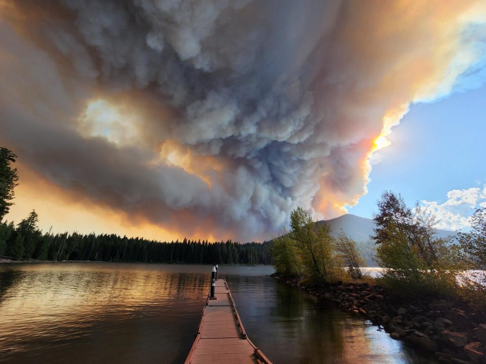
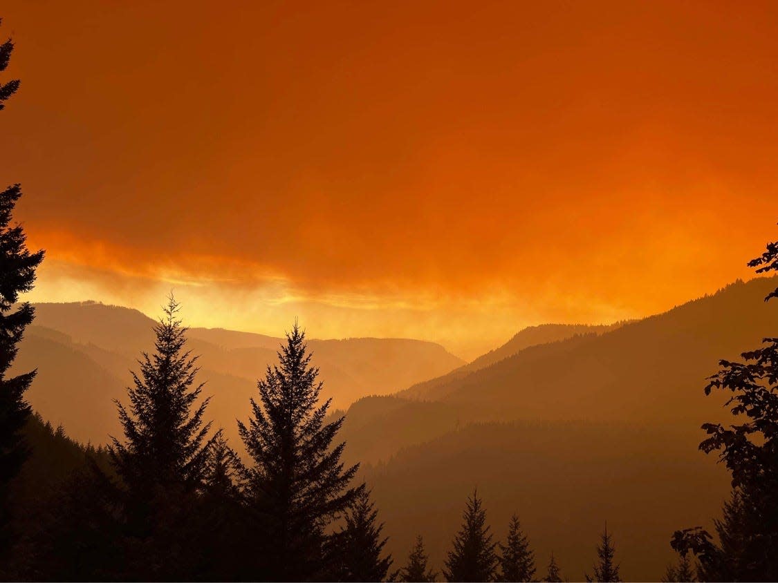
"Today’s fire activity is expected to be extreme with long-range spotting and crown runs. Expect a large smoke column to develop by mid-morning," a morning report from the Cedar Creek Fire crew said. "East winds, low humidity, and high temperatures will continue today and start to ease tomorrow."
While the east winds are expected to moderate by Saturday afternoon, Cedar Creek Fire spokesman Bud Sexton said that humidity levels would still stay extremely low — as low as 8% today. That will promote plenty of burning even after the winds die down, he said.
"I've never seen humidity levels that low on any fire I've been on," he said.
More:Wildfire smoke from Cedar Creek Fire to 'significantly worsen air quality' in Lane County
The fire has not crossed west of Highway 19; firefighters are working to hold and improve the east side. Firefighters are working to keep the fire north of Forest Road 1928.
On the east side of the fire: East of Waldo Lake, the Alaska Incident Management Team has established two branches and six divisions to work in the Deschutes National Forest side of the Cedar Creek Fire. Where possible, direct attack water drops with helicopters is occurring on the southeast edge. Crews are preparing Road 4290 from Charlton Lakes to the Cascade Lakes Highway to control the spread of the fire to the southeast.
On Friday, a level 3 evacuation order, meaning "go now," was issued for the Oakridge, Westfir and High Prairie areas.
Residents were encouraged to evacuate to the temporary evacuation Point at Lane Community College at 4000 E. 30th Ave. in Eugene. The temporary evacuation point is located in Building 16.
Lane Transit District is providing buses to help people who do not have transportation to evacuate. The buses will be staged at:
Oakridge High School (47997 W 1st St.)
First Baptist Church (47606 School St.)
In a statement, the Lane County Sheriff's Office said: "There is immediate and imminent danger and you should evacuate immediately. DO NOT delay leaving your property to gather any belongings or make efforts to protect your home. Drive carefully, turn on your headlights, and follow any directions from public safety personnel."
East winds arrived on the Cedar Creek Fire that was at 33,100 acres Thursday but grew fast on Friday, bringing new evacuation levels outside Oakridge and closing Oregon Highway 58 over Willamette Pass. The fire grew all day Friday and grew through the night and into Saturday.
————
ORIGINAL STORY
Gov. Kate Brown invoked the Emergency Conflagration Act Friday afternoon, which allows the Office of State Fire Marshal to mobilize resources to support local fire agencies and protect lives, homes, and critical infrastructure, a news release said.
"The fire's growth potential in the coming days is troubling, requiring additional resources to battle the fire and support the state's response," Brown said. "With forecasted weather conditions this week, it is important for all Oregonians to be prepared."
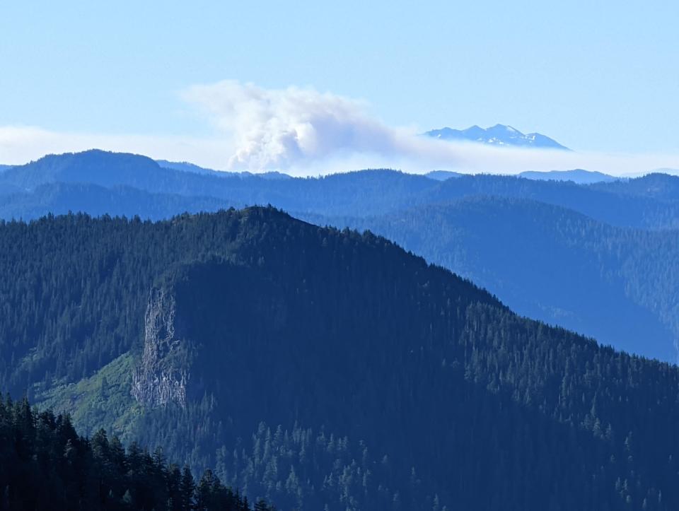
The fire is throwing off a massive amount of smoke, with winds expected to peak overnight before slowly tapering off Saturday afternoon and evening. Cooler weather should eventually slow the fire by Sunday and especially Monday into early next week.
Live Oregon wildfire updates: Power outage updates, wildfire activity
“The east winds are pushing the fire west and we’re definitely going to have very, very difficult fire conditions until the end of the day Saturday,” Cedar Creek Fire spokesman Bud Sexton said.
"Suppression actions may be limited," a Friday morning report said.
By late Friday afternoon, the fire had grown north and west, moving about 2 miles closer to Oakridge. It also crossed Black Creek Road — one of the key containment lines — on the southern end of the fire toward Highway 58, likely accounting for the closure of the highway, which is the main transportation corridor between Eugene and Central Oregon.
Sexton said Thursday that crews didn’t think the topography lined up for extreme runs down river drainages toward populated areas, but he scaled back that language Friday.
“There’s no crystal ball, and with the extreme dryness, it could get into drainages that are aligned,” he said.
There are multiple contingency lines between the fire and Oakridge — where firefighters have sought to remove fuel and stop the fire in its path. But with extreme winds the concern is that the fire sends out embers that bypass the lines, Sexton said.
“With humidity levels so extremely low (dry), the fuels are behaving differently than they would normally,” he said. “The fire can send out embers and spot well ahead of the body of the fire, and that makes it challenging.”
He said a big part of operations Friday was hoping for the best but preparing for the worst and making sure there was frequent communication so that if needed, the Lane County Sheriff’s Office could make calls on evacuating Oakridge.
More:Oregon to see extreme wildfire danger similar to 2020 Labor Day blowup
Other notes from Friday are that the fire has curled around Waldo Lake and the fire perimeter has surrounded North Waldo Campground and is very close to Islet Campground on the east side of Waldo Lake.
Sexton said crews had been busy wrapping structures at the campground and as of Friday morning they were intact.
On the east side, the blaze is moving increasingly close to Cascade Lakes Scenic Highway, Crane Prairie Reservoir and Little Cultus Lake. Those areas are on a level 3 evacuation and are closed. There is a very large closure area around the fire at this point that strictly limits recreation.
Firefighting plans
On Forest Service Road 2421 firefighters will be watching for any spot fires and holding the fire at the road. Crews will be engaging the spot fires north of the Winchester Trail trying to extinguish them if safe to do so. Firefighters are also coordinating with the Middle Fork Ranger District and Lane County Oregon State Fire Marshal representative in order to provide initial attack support to any new fire starts that could occur.
Closures
There are expanded closures on both sides of Waldo Lake for miles in each direction. On the east side of the lake, in Deschutes National Forest, toward the Cascade Lakes Highway, a closure map can be found here. On the west side of the fire, toward Oakridge, in Willamette National Forest, a closure map can be found here.
Extended power shut offs:EWEB, Lane Electric to shut off power for thousands in Lane Co. ahead of high winds
This story will be updated as more information becomes available.
Salem Statesman Journal reporter Skyla Patton contributed to this report.
Zach Urness has been an outdoors reporter in Oregon for 15 years and is host of the Explore Oregon Podcast. He can be reached at zurness@StatesmanJournal.com or (503) 399-6801. Find him on Twitter at @ZachsORoutdoors.
This article originally appeared on Salem Statesman Journal: UPDATE: Cedar Creek Fire reaches 73,922 acres, expect active growth

