Up for a challenge? Tippecansett South Trail is a rigorous, rewarding workout | Walking RI
HOPKINTON — The hiking trails on the western edge of Rhode Island follow some of the same footpaths walked by the Narragansetts and other tribes to reach hunting and fishing grounds, trade routes, ceremonial sites and villages.
I recently hiked one of those trails, called Tippecansett South, and enjoyed the natural setting that included dark tunnels of mountain laurel, granite ledges and outcroppings, log bridges over wetlands and a canopy of oak, maple, pine and beech trees.
I found few visible signs of the Native Americans who lived and traveled here for thousands of years. However, I did spot — almost hidden in the overgrown brush along the path — the remains of the settlers and farmers who pushed out the Native Americans. There are stone walls and cellar holes, mill foundations and a cemetery — if you search hard enough.
The Tippecansett South Trail is a lengthy and at times strenuous hike, but it’s also invigorating.
More:These 10 Rhode Island trails should be on your bucket list
Three trails, one path on the Rhode Island-Connecticut border
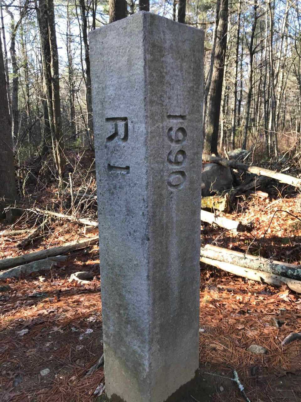
A hiking buddy and I set out from the trailhead on Camp Yawgoog Road, across from a 5-foot-tall stone pillar that marks the state border and is carved with “RI” on one side, “Conn.” on another, and “1990” on a third.
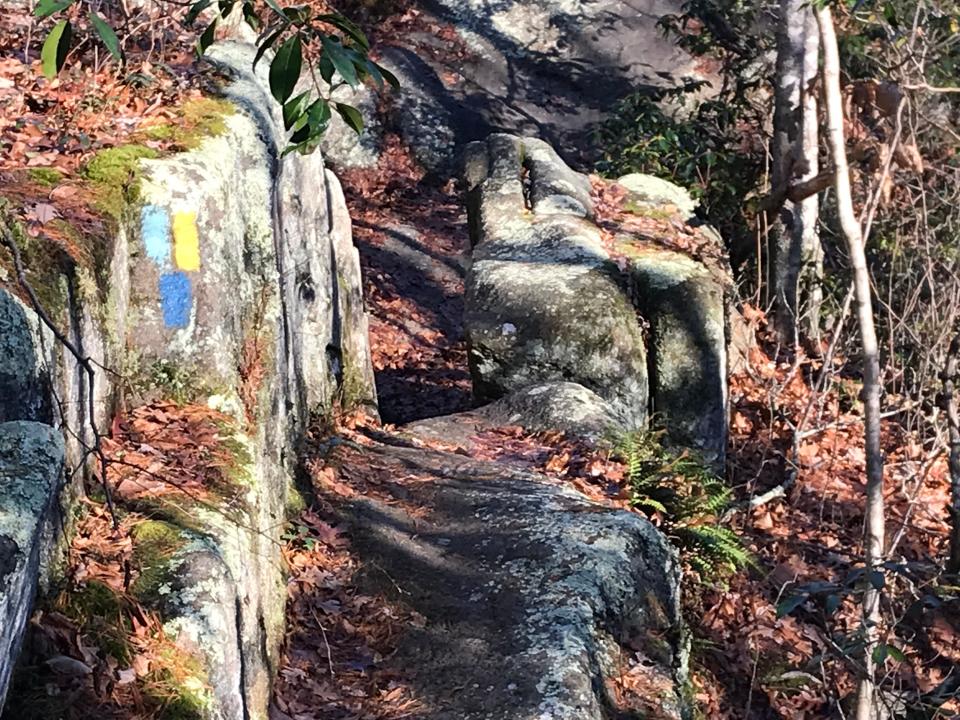
At the start, three trails follow the same path and are marked with different colored rectangles: yellow for the Tippecansett Trail; pastel blue (the color used by the Connecticut Forest and Park Association) for the Narragansett Trail; and dark blue for the Freeman Trail. More on those later.
The flat first segment of the path passes a green sign that says the property is owned by the Rhode Island Boy Scouts, which allows hikers to cross the land at their own risk.
Just ahead, the trail turned wet and muddy in places, and we crossed several streams and wetlands on bog bridges and two moss-covered, square logs.
Walking RI:Stroll through industrial history in Slatersville, America's first planned mill village
Walking RI:See rugged coastline and 100-year-old ruins at Narragansett's Black Point
In the mood to explore some caves?
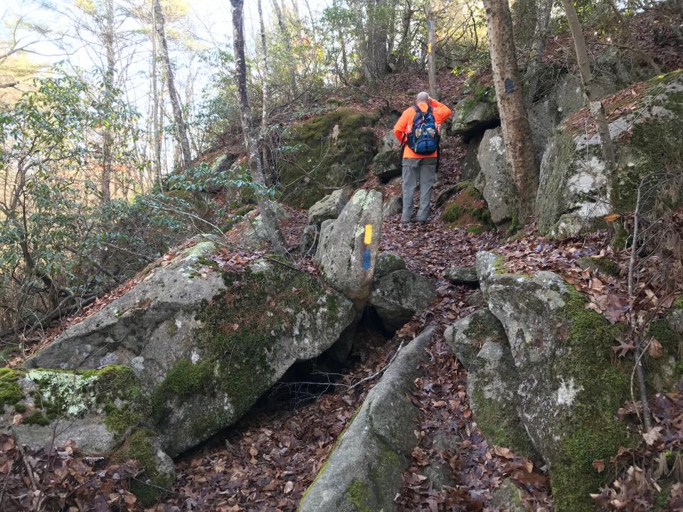
After that, the trail turns rockier and climbs to exposed granite outcroppings and ledges, named Dinosaur Caves and Cliffs, that are split by deep crevices. One high point overlooks a 30-foot drop. When I hiked this area a few years ago, a colleague did some spelunking and went down about 8 feet into one of the small caves. But that’s not for me these days.
Along the ridge, we spotted and tasted some sprigs of wintergreen, which reminded me of the Teaberry gum I chewed as a kid.
After crossing the ledges, the trail splits. One leg, on the right, runs steeply down through a ravine to the bottom of a cliff. We decided to stay left on the ridge, though, and soon came to a junction.
The pastel blue blazes break off to the west into Connecticut and mark the Narragansett Trail. Another segment of the Narragansett Trail runs southeast through Rhode Island. In Connecticut, the path covers about 15 miles and travels all the way to Lantern Hill. The first section of the trail skirts Green Pond to an impressive 40-foot dam, where water tumbles down to a stream that flows through a deep, mossy ravine.
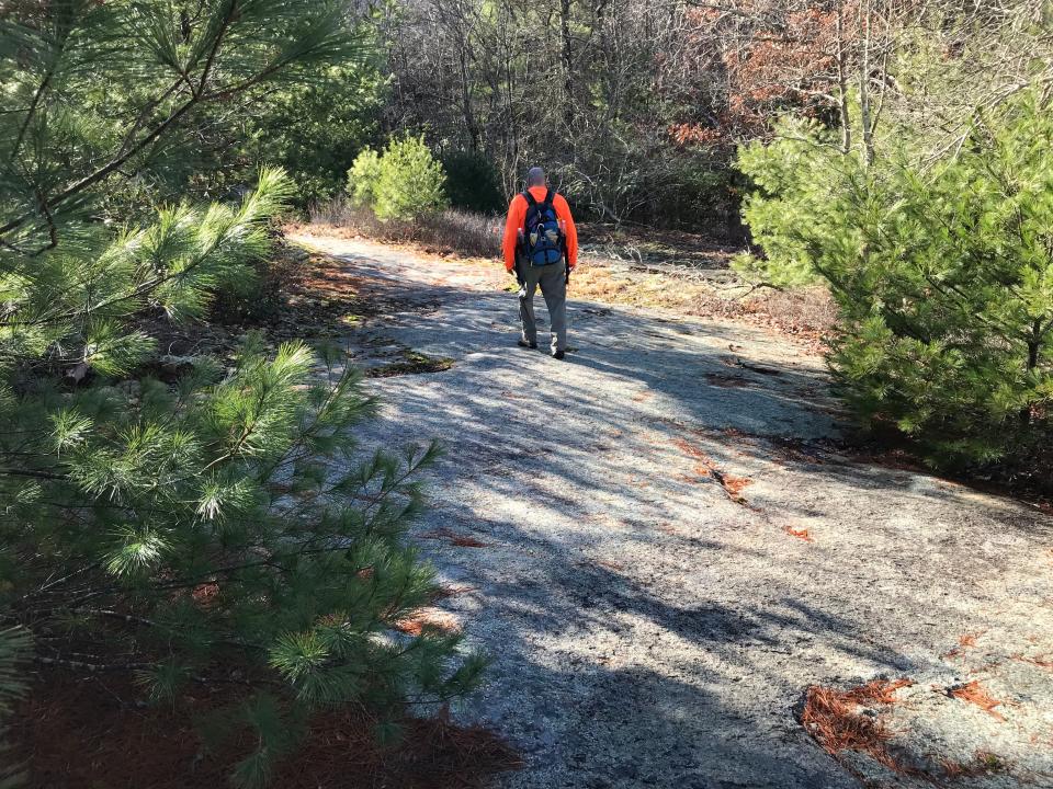
The yellow and dark blue-blazed trail continues north across a massive, smooth, exposed ridge, lined with small pine trees, that some call Dinosaur Rock and may remind hikers of the bald, rocky summits of small mountains in New Hampshire.
At the north end of the ledge, the dark blue-blazed Freeman Trail breaks to the right and east. It runs through the back of Camp Yawgoog and intersects with the white trail on its way to Hidden Lake.
Walking RI:Roughing it on the Pachaug Trail
In June, the trail will lead through brilliant blooms of mountain laurel
We stayed left on the yellow-blazed Tippecansett, which derives its name from a Narragansett word meaning “at the great clearing.”
The trail flattened and passed through dense underbrush and more thickets of mountain laurel that will bloom with brilliant white flowers in June. The trail then turns east for a short section before eventually shifting north and again running close to the Connecticut border. I learned later that the trail, marked in the 1940s, had been rerouted at least a couple of times to curb an erosion problem and avoid the western section of the Boy Scouts’ camping area called Curtis Tract.
The trail stayed flat for about another mile before leaving the Boy Scout property and following an old grassy road that widened and passed some stone walls, clearings and second-growth forests on the right.
Walking RI:Take a refreshing winter hike by a peaceful stream at Tucker Woods Preserve in Charlestown
Hidden in the brush: A historical cemetery
There’s an old graveyard in the underbrush to the east of the trail. The Rhode Island Historical Cemetery Commission lists the graveyard as Hopkinton 79 and has documented 13 unmarked fieldstones in a plot that measures 25 by 30 feet. But many hikers report that the heavily overgrown cemetery is difficult to find.
The old farm lane turned into a gravel road, and I heard cars and trucks on Route 138. To the right I saw some stone walls, cellar holes and foundations.
This area was first settled by Colonists in the 1740s and became the sparsely populated rural part of the village of Rockville. Early inhabitants included Benjamin Maxson and his family and later the Burdick family.
Walking RI:Want a great place for an educational family hike? Try Browning Woods Farm in S. Kingstown
Some people still live there.
On the gravel road, workers were building a new house on the right. Several older houses stood on the left.
When the short road ended at Route 138, we turned left on the paved road and walked about 100 yards. At a sign for Exeter, the yellow-blazed Tippecansett Trail continues north for a short distance on a wooded dirt road lined with laurel and rhododendrons before reaching a fork. The Tippecansett Trail goes left through the Arcadia Management Area to Beach Pond, across Route 165, and then farther north to Escoheag Road.
We decided to save that for another day and turned east at the fork to follow the blue-blazed Dye Hill Trail that ran along a raised dirt road above a swampy area before a slow, gentle incline to the crest of a small hill.
On the left, we found a large, rectangular stone foundation next to a pile of rubble that may have been a chimney or fireplace. On the right, a dirt driveway led by cleared fields, an old electrified fence and a cabin.
Walking RI:Spectacular bay views and Colonial and tribal history at Mount Hope Farm
Flooding on the path? A sign of beavers at work
We took a right on Grassy Pond Road and walked downhill until reaching a flooded section of the road. We walked on the berm to keep our feet dry.
Continuing down the road, which recently had been regraded, we passed a farm with a horse out front, the start of a side trail to Brushy Brook and a high wooden tower in the front yard of another house.
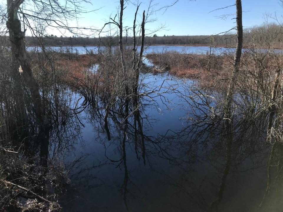
The road intersects with Route 138, just south of Grassy Pond. We met some local residents along the route who said the flooding results from beaver activity that blocks a stream that feeds Grassy Pond. State workers and other volunteers regularly pull down the beaver dam to unclog the waterway.
One local also pointed out the foundation of an old mill on flat, cleared land adjacent to the stream that runs to Grassy Pond.
After studying the pond, we headed right on Route 138 and then turned south into the woods on a wide, stone wall-lined path that was once Spring Street, the original route through the area.
Walking RI:Discover why hikers and anglers love the 'wild and scenic' Beaver River
Walking RI:Follow in the footsteps of Trappist monks in Cumberland
About a hundred yards later, we passed another stone foundation before reaching the Tippecansett Trail that we had walked in on. We retraced our steps to the trailhead.
In all, we hiked 6.5 miles over 3.5 hours.
To me, the best part of the hike was the untouched, natural terrain, which probably hasn’t changed much since the Indigenous peoples walked through these forests and crossed the outcroppings, ledges and cliffs.
As we completed our walk and passed the Boy Scouts’ sign, I recalled that part of the Scouts’ Code is to “leave no trace.” That certainly fits much of the Tippecansett South Trail.
If you go ...
Access: Off Route 138, turn onto Camp Yawgoog Road to the gates of the Scout camp. Turn right and drive 1.2 miles to the trailhead.
Parking: Available for a few cars at a turnout.
Dogs: Allowed but must be leashed.
Difficulty: Moderate to difficult over ledges, outcroppings and cliffs.
Trail Tip: RI Cemetery Weeks
Dozens of free tours, cleanups, gravestone conservation demonstrations, talks and other programs about historic cemeteries will be held in April and May, organized by the Rhode Island Advisory Commission on Historical Cemeteries and the Rhode Island Historical Preservation & Heritage Commission.
For a calendar of events, visit preservation.ri.gov/ricw-calendar.
John Kostrzewa, a former assistant managing editor/business at The Providence Journal, welcomes email at johnekostrzewa@gmail.com.
This article originally appeared on The Providence Journal: Up for a challenge? Hike the Tippecansett South Trail | Walking RI

