A challenging task: Towpath Trail route draws opposition in New Philadelphia
NEW PHILADELPHIA ‒ Residents on the west side of New Philadelphia are making known their concerns about the proposed route for the Ohio & Erie Canal Towpath Trail through the city.
A large number of them attended last week's New Philadelphia City Council meeting, objecting to plans to run the hiking and biking trail past West Elementary School and through the Five Points intersection, out of fears for the safety of trail users.
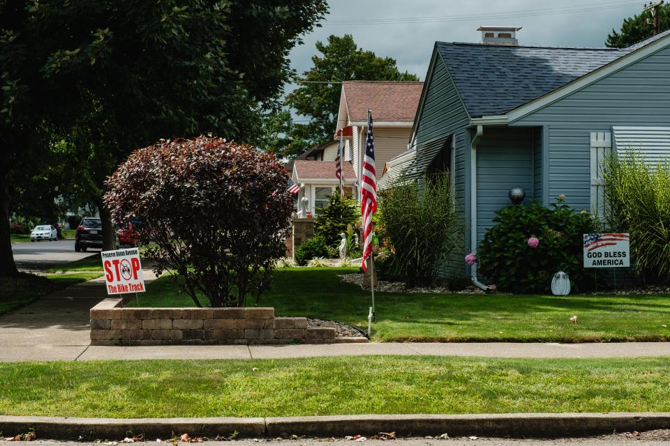
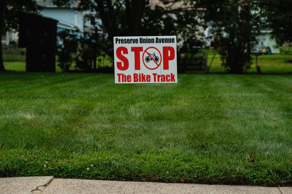
Those who spoke did express relief that an earlier proposal has been scrapped. It had called for a designated bike lane along Union Avenue with a concrete buffer to separate motorists and cyclists using the street. It would have meant the end of on-street parking on one side of Union Avenue. As a result, "Stop the Bike Track" signs have popped up along the street.
The current proposal would retain on-street parking, and a bike lane, marked by painted lines, would be next to the parking area.
Where the trail would go
The latest proposed route through New Philadelphia would go down Union Avenue and Seventh Street, turn right on Fair Avenue and cross Tuscarawas Avenue at West Elementary. It would then go down Tuscarawas to Five Points, where it would cross W. High Avenue, and continue on Seventh Street to Front Avenue. From there it would turn right on Front and go to county-owned land. It would circle behind the Gradall plant along the Tuscarawas Avenue and end at Waterworks Park.
More on the route: Proposed Towpath Trail route in New Philadelphia uses Union, Seventh and Front streets
Ken Estep, who lives on Union Avenue, said running the trail through Five Points is a bad idea.
"I think to run a bike path through Five Points, we're just asking for somebody to get hurt. That's a complex intersection. I say that as a cyclist. I've ridden my whole life," he told council. "I would not ride my bike through that intersection."
Teresa Prince, who lives at the intersection of Seventh Street and Fair Avenue, said she didn't think running the trail through her neighborhood would be safe.
"That intersection right there and the intersection of Seventh and Fair are two of the most dangerous intersections in the whole city. When I'm working at home, I see at least two or three cars race right through the stop sign," she said.
Sherrie Kibler, who lives on Union Avenue, opposed the idea of running the trail past the school. Trail users would cross Tuscarawas Avenue at a crosswalk. Trail consultants have proposed putting some kind of signalization there.
"There's a lot of traffic at that school since we've gone away from the neighborhood schools ‒ people from all over the city, buses, etc. Anything that adds anything in terms of congestion or traffic is not a good plan. I think to stay away from that school would be a better choice," she said.
A challenging task
Dan Rice, president and CEO of the Ohio & Erie Canalway Coalition, which is working with New Philadelphia to develop the trail, said he appreciates the feedback from residents.
"We really appreciate the input from all the neighborhood residents because it has really made the design that much better. We are looking forward to incorporating their feedback," he said, noting that the proposed route has already been changed at least six or eight times.
"We fully recognize that this is a very challenging task," he said of planning a route. "In most cases, it is on former canal lands. But in the urban areas, such as Bolivar, Massillon, Akron or Cleveland, if the public right away is gone, we have to get creative."
There are still remnants of the Ohio & Erie Canal along the Tuscarawas River in the Dover-New Philadelphia area, but most of them are privately owned.
"The challenge would be to try to go back and obtain that right of way, either through an outright purchase or an easement. It could take a really long time. It could be very expensive, and all it would take would be one of those private property owners to say no to prohibit us from utilizing that route," he said.
"We've looked at at least 12 different options about how to get from Dover down to Waterworks Park. The proposed routes that we've narrowed it down to are based upon safety and most cost-efficient way to get it done. Is it the most scenic route? The answer would obviously be no. But riding on city streets is not unappealing, but it's different than when you're riding along a river or riding a trail."
Rice acknowledged that crossing W. High Avenue is one of the biggest challenges trail designers face, since it is a major artery into the city.
Crossing W. High Avenue
"If you are going to cross W. High Avenue, you should do it where there is a signalized crossing, where traffic is stopped to allow pedestrians and bicyclists to get across the street," he said.
He also agreed that the area around West Elementary is congested, but he noted that no more than 25 or 50 hikers or bikers would be crossing the street there on any given day.
Another public meeting is planned once details of the trail route are finalized.
Dover's plan: More details emerge on proposed Towpath Trail route through Dover, New Philadelphia
When it is completed, the trail will run from New Philadelphia to Cleveland. It is currently completed from Cleveland to Zoarville.
Reach Jon at 330-364-8415 or at jon.baker@timesreporter.com.
This article originally appeared on The Times-Reporter: Some New Philadelphia residents say they oppose Towpath Trail route

