The chance of a damaging earthquake on the Wasatch Front in your lifetime is pretty high, new data shows
SALT LAKE CITY (ABC4) — An updated report from the U.S. Geological Survey show that areas around the Wasatch Front have a greater than 50% chance to see earthquakes powerful enough to damage buildings over the next century.
Earlier this month, the USGS updated its National Seismic Hazard Model, applying the latest science on the country’s geologic and seismic activity to create maps of earthquake risk across all 50 states. The last time these maps were updated was 2018.
Mark Petersen, a USGS research geophysicist and the lead author of the report, said these maps are used to help engineers, scientists and lawmakers update building codes and plan for potential earthquakes and strong shaking.
“Seismologists are not good at predicting earthquakes in advance, instead we forecast the location of future earthquakes, the magnitude of those earthquakes,” Peterson said.
Utah Shaking
One of the updated USGS maps shows the chances of slight damaging shaking over the next 100 years across all 50 states.
In this visualization of the country, the American West is awash with color, much of it deep red along the California coast, meaning that damaging shaking is almost guaranteed.
Zooming in on Utah, there isn’t any red. However, the Wasatch Front, which sits along the Wasatch Fault, is orange, meaning that there’s a 50% to 75% chance of damaging shaking in the coming decades.
“What this means is that in the area near the Wasatch Fault, people will most likely experience some types of earthquakes that could affect shaking damage in their houses, places of work, their schools, and other places,” Peterson said.
National Seismic Hazard Model (2023)
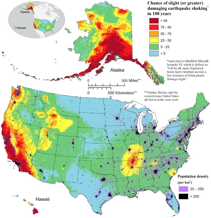
Outside the Wasatch Front and Utah’s mountain high country, much of central and western Utah is colored yellow on this map, meaning that there’s a 25% to 50% chance of shaking damage. In eastern Utah and along the Arizona border, the color is mostly green, corresponding to a 5% to 25% chance of damage.
This damage chance, Peterson explained, does not mean collapsed buildings and ruined neighborhoods. Rather, the shaking would leave cracks in structures. While not devastating, it could lead to expensive repairs.
According to the U.S. Geological Survey and the Federal Emergency Management Agency, $15 billion in forecasted losses are expected from shaking damage across the country each year.
The Magna Earthquake
About four years ago, a 5.7 magnitude earthquake shook the Salt Lake Valley. The quake caused parts of buildings to crumble and left cracks in roadways. Its aftershocks were felt as far away as Wyoming and Colorado, and it gave researchers a trove of data.
“This important earthquake has taught us a lot about seismic hazard in Salt Lake City,” Petersen said.
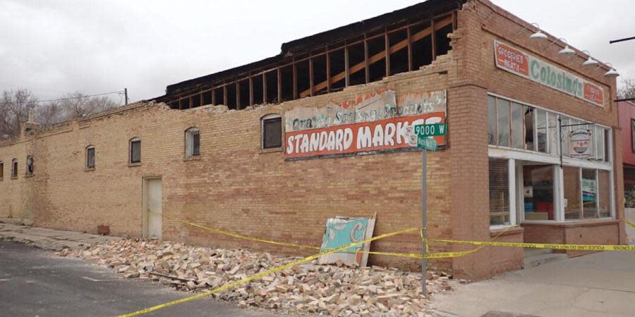
Using information gleaned from the Magna quake, the new USGS hazard models now better reflect the complexity of the faults near and along the Wasatch Front, Utah’s most heavily populated area.
This data from the 2020 earthquake has allowed Petersen and his team of colleagues to better assess the shaking levels that can occur during an earthquake on the Wasatch Front.
Bigger Quakes
Over the last 100 years, there have been several moderate earthquakes in Utah. Moderate earthquakes register between magnitude 5 to 5.9 on the Richter scale. They generally cause only slight damage to buildings and other structures.
Yet, the prehistoric record shows very large earthquakes have rumbled under Utah, so powerful they caused the Wasatch Mountains to rise. Some of these more recent prehistoric quakes were estimated to be magnitude 7, roughly as strong as the devastating Haiti earthquake of 2010.
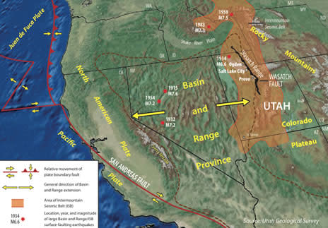
According to Peterson, the recurrence of strong earthquakes along the Wasatch Fault typically happen every 1,200 years.
“In many places along the Wasatch, the fault hasn’t ruptured for close to that average recurrence time,” he said. “So, we recognize that the likelihood of these earthquakes may be increased.”
Jim Pechmann, a University of Utah seismologist and co-author on the latest USGS report, said a working group he was part of estimated in 2016 that there was a 57% chance of a magnitude 6 or larger earthquake in the Wasatch Front region in the next 50 years.
“That could cause considerable damage locally,” he said.
Shaped by the Wasatch
Petersen grew up in Utah, and spent much of his youth in the mountains. While skiing and hiking, he could see the Wasatch Fault, and the structures being built upon it.
The power of the earthquakes that shaped places like the Cottonwoods was evident, as was the damage such events could cause to Wasatch Front in the future.
“It gave me an appreciation of these large energy events that can cause so much damage and destruction,” he said.
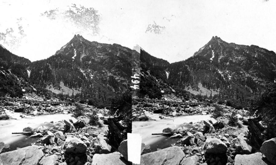
“If we learn more about these,” he added, “we can do more to improve the safety of people living in those areas.”
For more information on how to respond during and after an earthquake, FEMA has preparedness tips here.
For the latest news, weather, sports, and streaming video, head to ABC4 Utah.

