Severe thunderstorms cut power to thousands Wednesday in Akron-Canton region
A storm front moving across the state Wednesday evening brought severe thunderstorms, downed trees and powerlines, and cut power to thousands.
A severe thunderstorm warning was briefly issued for parts of Summit, Stark, Wayne and Portage counties Wednesday evening.
According to FirstEnergy Corp., about 30,000 customers were without power throughout the region around 6:45 p.m. The hardest hit counties include Cuyahoga (4,913), Portage (12,629), Summit (2,284), and Lorain (5,103). About 160 customers were without power in Stark County.
In Cuyahoga Falls, the city electric department reports power was out along Howe Avenue and along Bailey Road from Howe to Munroe Falls Avenue.
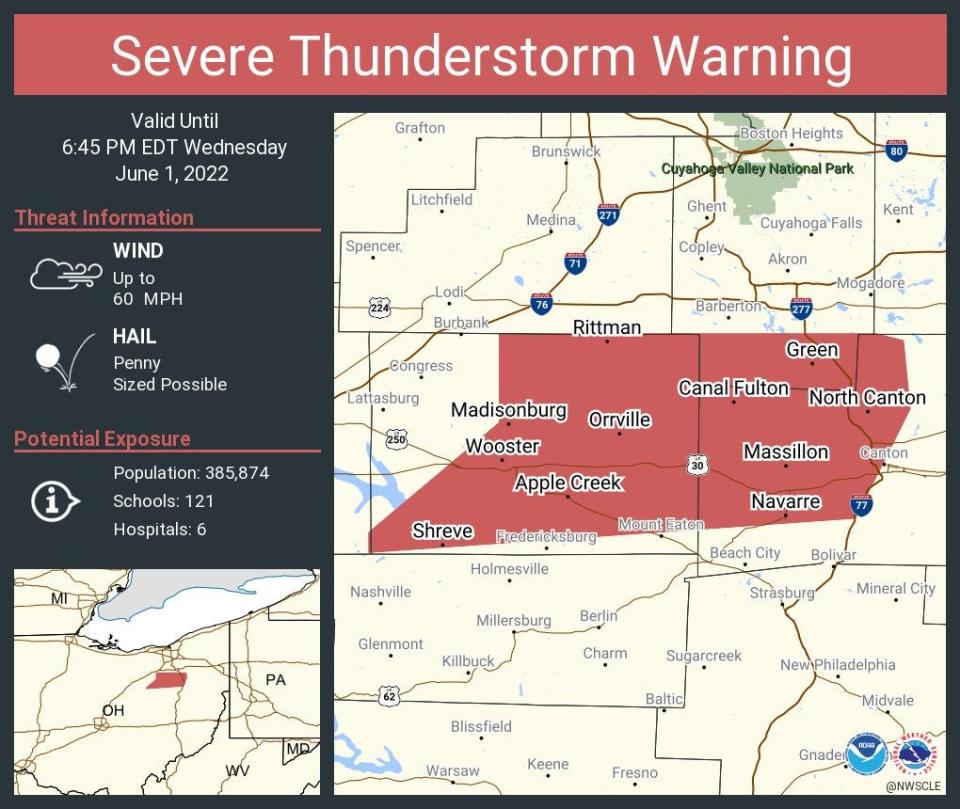
At 5:39 p.m., a severe thunderstorm was located over Hudson, or 12 miles north of Akron, moving east at 45 mph. Gusts of up to 70 mph were said to be possible.
Temperatures near 90 were reported during the day as a cold front moved through the region, according to the National Weather Service.
Forecasters predicted the storms might be strong to severe.
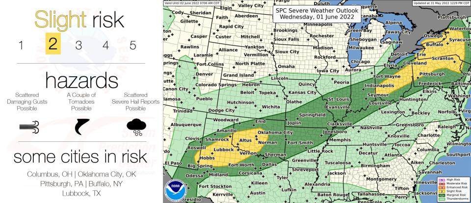
"Strong to severe thunderstorms may develop along and ahead of a cold front that approaches the region this afternoon," the National Weather Service said at 1 p.m. Wednesday. "... The main threat is strong damaging winds but some larger hail is possible with the first storms that develop."
Counties forecast with a slight risk of storms included Medina, Stark, Summit, Portage and Wayne, all located along a broad band extending from southwest to northeast across the middle of the state from Meadville to Marion, Pennsylvania.
The initial line of storms that develops Wednesday afternoon was predicted to be the most likely to reach the severe level.
Get it on your phone: The BeaconJournal.com app is packed with great features. Here are 5 you need to know about
Wednesday's high was expected to be about 84 degrees with a low of around 58 overnight.
Showers are likely Thursday, forecasters said, with a chance of thunderstorms after 2 p.m. under mostly cloudy skies with a high of around 68.
Clouds are expected to diminish overnight Thursday, with sunny skies and a high of about 73 on Friday, forecasters predict.
This article originally appeared on Akron Beacon Journal: Severe thunderstorm watch issued Wednesday for Akron-Canton region

