Tornado warnings expire for the Charlotte area after storms roar through region
The Charlotte region experienced severe thunderstorms, tornado warnings, a ground stop at the airport and over 30,000 power outages Monday afternoon and evening
A tornado warning for Mecklenburg and Cabarrus counties expired around 6 p.m. Monday, the National Weather Service said. A similar warning for Stanly County expired at 6:30 p.m.
Severe threat of storms were still underway into the evening for parts of Charlotte, particularly uptown running south toward Pineville. Officials were still expecting 50 mph wind and very heavy rain, which threatened localized flooding.
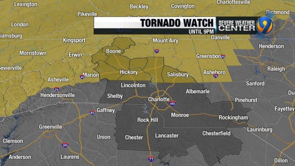
The NWS issued a tornado watch through the evening for Alexander, Ashe, Burke, Caldwell, Catawba, Iredell, Rowan and Watauga counties. That covered areas north of Interstate 40 to Virginia and west to Tennessee. A tornado warning was issued for Iredell and Rowan County until 5:30 p.m.
Weather knocks out power for 50,000+ in Charlotte region
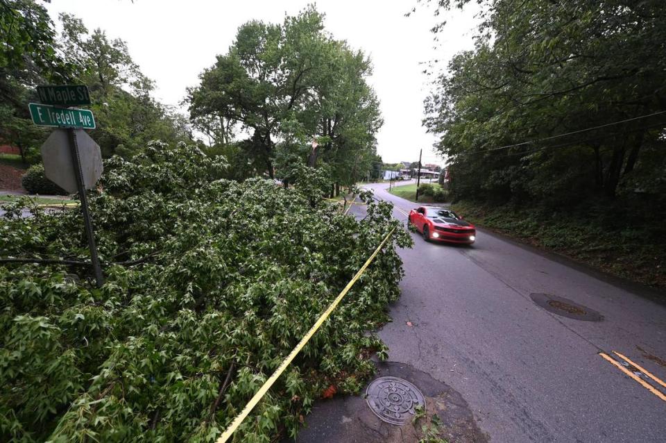
WSOC, the Observer’s news partner, reported that there were trees down in Catawba and Alexander counties because of the storms. Radar indicated damaging winds in the metro area upwards of 50 mph or more, WSOC reported.
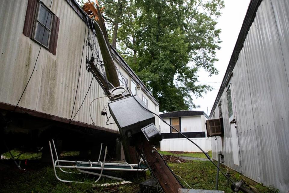
By 6:30 p.m., at least 30,000 Duke Energy customers had lost power near Charlotte. By 5:40 p.m., a large tree had fallen on a mobile home off of North Tryon Street on the 2100 block of Aberdale Farm Lane, according to the Charlotte Fire Department. Officials didn’t immediately say if anyone was hurt.
Statewide, more than 130,000 customers were without power.

The National Weather Service issued a severe thunderstorm watch until 9 p.m. throughout Cabarrus, Cleveland, Gaston, Lincoln, Mecklenburg and Union counties in North Carolina; and Chester and York counties in South Carolina.
Mayor Vi Lyles interrupted a Monday afternoon city council committee discussion at the Government Center in uptown to announce the tornado warning. City leaders as well as members of the public and the press in attendance were directed to shelter in the building’s basement until the storm passed.

At about 4:30 p.m., the Federal Aviation Administration said it was rerouting planes around the system, which was approaching much of the East Coast.
The FAA is re-routing aircraft around the storms heading to the East Coast as much as possible. Soon we will likely have to pause departures in and out of East Coast airports including NYC, Philly, DC, Charlotte and Atlanta. Monitor https://t.co/ltA3DmcHcd. #FAAWeatherSquad pic.twitter.com/yk8f1tqBty
— The FAA ️ (@FAANews) August 7, 2023
Flights were grounded at CLT airport at 5:15 p.m., and that was expected to remain in effect until 6:45 p.m., the FAA said.
Ground stop lifted at Charlotte airport after strong storms
Officials at the Charlotte airport urged people to check with their airlines for flight status.
Stormy weather around Charlotte
The system will bring threats of flash flooding, hail and isolated tornadoes through rush hour and into the evening before a tailing cold front settles over the area for the rest of the week.
Damaging winds remain the main threat, according to the advisory, and no hazardous weather is expected for the rest of the week.
The heat index was expected to reach 107 in Mecklenburg, Cabarrus and Union counties from 11 a.m. to 7 p.m., according to the National Weather Service heat advisory.

Staff writers Mary Ramsey and Adam Bell contributed

