Chicago could see biggest snow of the season as winter storm targets Midwest, Northeast
A winter storm will bring snow to portions of the Plains, Midwest and Northeast this week, likely disrupting travel and closing schools.
A swath of heavy snowfall is likely across the Midwest into the lower to central Great Lakes on Tuesday and Wednesday, the National Weather Service said. Snowfall accumulations in these areas may range from 6 to 12 inches; some locally higher totals are possible.
Several inches of snow is forecast to coat Chicago and Milwaukee, where significant travel impacts are possible starting Tuesday, the Weather Channel said.
News and weather happen, even at night: The Evening Briefing newsletter brings the news straight to you and your inbox
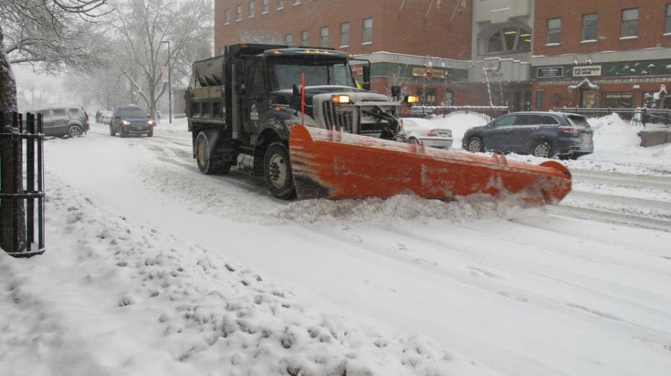
Chicago has the potential to receive its biggest single snowstorm of the season with this storm, AccuWeather warned, where at least 6 inches is possible, likely more. The Windy City's biggest snowstorm this winter was Feb. 12-13, when 3.5 inches was reported.
Winter storm watches have been issued for portions of the Midwest ahead of the winter storm, including the Chicago metro area. In all, over 17 million people live where a winter storm watch is in effect.
Millions will be receiving snow beginning this evening, with areas like Chicago potentially getting their biggest snowfall of the season. This same system is also further saturating the South. pic.twitter.com/7PKuyYHvRF
— The Weather Channel (@weatherchannel) February 24, 2020
Gusty winds will likely produce blowing and drifting snow in the Chicago area on Wednesday, the weather service said.
Snow will also spread from the Ohio Valley to New England from Wednesday through Thursday. Some of the heaviest snow is likely in northern New England, where up to a foot is possible.
As has been the case for practically the entire winter, the I-95 corridor of the Northeast will again miss out on the snow. Rain is forecast instead. "Areas where it (snowfall) is very unlikely," AccuWeather meteorologist Bernie Rayno said, "is where we've seen a snow drought all winter: Boston, New York City, Philadelphia, and Washington, D.C."
A strengthening storm is expected to dump snow on interior portions of the Northeast, setting up lake-effect snow that will continue even after the storm departs. https://t.co/I7IUdjQWzT pic.twitter.com/T8eLze0I5l
— AccuWeather (@breakingweather) February 24, 2020
In the Midwest and interior Northeast, however, lake-effect snow will follow the main storm later in the week.
"Even after the storm is over, another wave of Arctic air will follow and generate lake-effect snow as it rushes across the Great Lakes," AccuWeather meteorologist Courtney Travis said.
Accumulating snow downwind of Lake Michigan and Lake Superior may linger as late as Saturday before tapering off, AccuWeather said.
Following a stretch of springlike conditions across the eastern United States through midweek, a cold front sweeping through the region will usher in a more typical winterlike air mass late week and into the weekend: https://t.co/8Glfdv2F7i pic.twitter.com/ANxNCHnJdW
— AccuWeather (@accuweather) February 24, 2020
This article originally appeared on USA TODAY: Winter storm: Chicago could see biggest snowstorm of the season

