Flood warning extended amid severe Cincinnati weather, thunderstorms
Update, 7:02 p.m.: A flood warning has been extended for parts of the Cincinnati area until 8:30 p.m., according to the National Weather Service.
The warning impacts Dearborn, Franklin, Ohio, Ripley and Switzerland counties in Indiana; Boone, Campbell and Kenton counties in Kentucky; and Clermont, Hamilton, Butler and Warren counties in Ohio.
The heaviest rainfall has ended, the weather service said, but flood cause by excessive rain continues.
Forecasters are warning of imminent or occurring floods in rivers, creeks, streams and other low-lying or flood-prone locations.
"Streams continue to rise due to excess runoff from earlier rainfall," the agency said in a statement. "Low-water crossings are inundated with water and may not be passible."
Some areas experiencing flooding are Cincinnati, Hamilton, Middletown, Fairfield, Covington, Mason, Florence, Xenia, Independence, Oxford, Lebanon and Norwood.
Update, 5:15 p.m.: A tornado warning has been issued for parts of Clermont and Brown counties, according to the National Weather Service.
At 5:02 p.m., a severe thunderstorm capable of producing a tornado was located near Bethel, moving northeast at 55 mph.
The weather service says the warning is in place until 5:30 p.m.
Flying debris will be dangerous to those caught without shelter, the agency said, adding mobile homes will be damaged or destroyed and damage to roofs, windows and vehicles will occur. Tree damage is also likely.
Impacted areas include Mount Orab, Bethel, Williamsburg, Hamersville, Fayetteville, Chasetown, Greenbush, Saltair, East Fork State Park, State Route 32 at US Route 68, Point Isabel, Bantam, New Hope, Locust Ridge and Lake Lorelei.
Residents are urged to take shelter immediately. The agency says to move to a basement or an interior room on the lowest floor of a sturdy building and avoid windows.
"If you are outdoors, in a mobile home, or in a vehicle, move to the closest substantial shelter and protect yourself from flying debris," the weather service said in a statement.
Tornado Warning including Mount Orab OH, Bethel OH and Williamsburg OH until 5:30 PM EST pic.twitter.com/ocCPFnQ06a
— NWS Wilmington OH (@NWSILN) March 3, 2023
Update: 4:35 p.m.: The National Weather Service has issued a severe thunderstorm warning in the following counties: northern Kenton, western Bracken, Campbell and Pendleton counties in Kentucky; and eastern Hamilton, Clermont and northwestern Brown counties in Ohio. The warning is in effect until 5:15 p.m.
Severe thunderstorms were located at 4:34 p.m. along a line extending from Finneytown to 9 miles south of Williamstown, moving northeast at 70 mph. Radar indicated 70 mph wind gusts and the service said it expects considerable damage to trees, as well as likely damage to mobile homes, roofs and outbuildings.
Impacted locations include Cincinnati, Covington, Norwood, Fort Thomas, Newport, Blue Ash, Loveland, Reading, Montgomery, Madeira, Alexandria, Wyoming, Highland Heights, Milford, Taylor Mill, Bellevue, Deer Park, Dayton, Southgate, Falmouth, Florence, Independence and Erlanger. Ohio Interstate-71 will also be impacted between mile markers 1 and 16, as well as I-75 between mile markers 7 and 13.
A tornado watch remains in effect until 7 p.m. in southeastern Indiana, northern Kentucky and southwestern Ohio.
Severe Thunderstorm Warning including Withamsville OH, Milford OH and Amelia OH until 6:00 PM EST. This storm will contain wind gusts to 70 MPH! pic.twitter.com/QNnTswJYMr
— NWS Wilmington OH (@NWSILN) March 3, 2023
Update: 4:22 p.m.: The National Weather Service has issued a severe thunderstorm warning in Dearborn County in Indiana, Boone and Kenton counties in Kentucky and Hamilton County in Ohio. It remains in effect until 5 p.m.
Locations impacted include Cincinnati, Covington, Erlanger, Newport, North College Hill, Cheviot, Fort Mitchell, Villa Hills, Mount Healthy, Fort Wright, Lawrenceburg, Greendale, Ludlow, Crescent Springs, Aurora, Park Hills, Hidden Valley, Finneytown, Burlington and Cleves.
A severe thunderstorm was located over Aurora at 4:21 p.m., moving northeast at 45 mph. Radar indicated 60 mph wind gusts and damage to trees and power lines is expected, the service said.
Severe Thunderstorm Warning including Cincinnati OH, Cincinnati-Northern Ky Airport KY and Covington KY until 5:00 PM EST pic.twitter.com/jutmuZ9zJq
— NWS Wilmington OH (@NWSILN) March 3, 2023
Update 4:15 p.m.: The National Weather Service has issued a severe thunderstorm warning for Ohio and Switzerland counties in southeastern Indiana, and Boone, Carroll, Gallatin, Grant, Kenton, Owen and Pendleton counties in Northern Kentucky until 4:45 p.m.
At 4:06 p.m., severe thunderstorms were located along a line extending from near Patriot to 8 miles northwest of Frankfort, Kentucky, moving northeast at 65 mph.
Locations impacted include Covington, Florence, Independence, Erlanger, Edgewood, Elsmere, Fort Mitchell, Villa Hills, Taylor Mill, Fort Wright, Ludlow, Williamstown, Crescent Springs, Walton, Crestview Hills, Park Hills, Lakeside Park, Rising Sun, Falmouth and Oakbrook.
Update 3:20 p.m.: The National Weather Service has issued a flood warning for much of Greater Cincinnati.
The warning is in place until 7 p.m., the agency said. It affects Dearborn, Franklin, Ohio, Ripley and Switzerland counties in Indiana; Boone, Campbell and Kenton counties in Kentucky; and Clermont, Hamilton and Warren counties in Ohio.
Gusty winds are being observed behind the line of showers and storms in KY/IN. This area of strong winds is expected to move over the area later this afternoon/early evening. The strongest winds may occur outside of shower/storm activity this evening. pic.twitter.com/OBcZMKkbtl
— NWS Wilmington OH (@NWSILN) March 3, 2023
Forecasters are warning of imminent or occurring floods in rivers, creeks, streams and other low-lying or flood-prone locations.
Around 3:05 p.m. radar indicated heavy rainfall, the weather service said, adding between 2 and 2.5 inches of rain have already fallen.
Additional rainfall of 0.5 to 1 inch is possible, according to the agency.
The weather service advises to turn around, don't drown when encountering flooded roads, as most flood deaths occur in vehicles.
Update, 1 p.m.: The National Weather Service has issued a flood warning for Mill Creek at Evendale in effect until late this evening.
The flood stage for Mill Creek at that point is 12 feet. The river is expected to rise above flood stage this afternoon to a crest of 13.4 feet late this afternoon. It will then fall below the flood stage.
At 13 feet, Canal Road near UPS floods with high water along Kemper and Mosteller roads near the creek.
The weather service advises to turn around, don't drown when encountering flooded roads, as most flood deaths occur in vehicles.

Previous reporting: Heavy rain and winds moving through the region will bring a chance of flooding through Friday evening.
The National Weather Service has a flood watch in effect Friday through 1 a.m. Saturday for counties in the Greater Cincinnati region in Ohio, Indiana and Northern Kentucky. Excess runoff may result in the flooding of rivers, creeks, streams and other low-lying and flood-prone locations. The weather service says area creeks and streams are already running high and could flood with more heavy rain.
People in the flood watch area are advised to keep an eye on the weather and be prepared to take immediate action should heavy rains and flooding occur, or if a flash flood warning is issued. Avoid low-lying areas and be careful when approaching highway dips and underpasses.
Moderate to heavy rainfall and severe thunderstorms are expected starting Friday morning and persisting throughout the day. Rainfall totals between 1 to 2.5 inches are possible, with even more possible in local areas. The greatest threat for severe thunderstorms is between noon and 6 p.m. Friday.
[1:25 PM] Latest data has led to an increase in severe storm potential, primarily Fri afternoon, for srn parts of local area. Damaging straight-line winds are the primary threat, although a few tornadoes will also be possible. Gusty non-storm-related winds evolve Fri eve/night. pic.twitter.com/gLFJsjUqbw
— NWS Wilmington OH (@NWSILN) March 2, 2023
High wind advisory for Greater Cincinnati
In addition to the flood watch, a wind advisory is also in place from 2 p.m. Friday to 4 a.m. Saturday in portions of Northeast and Northern Kentucky. Southwest winds of 25-35 mph, with gusts up to 60 mph are expected. The timing for the highest winds gusts will be between the 3 p.m. to midnight timeframe, along and behind the thunderstorms moving through.
The Kentucky counties under the wind advisory include Boone, Campbell, Kenton, Carroll, Gallatin, Own, Grant, Pendleton, Bracken, Robertson, Mason and Lewis counties. Northern Kentucky cities include Florence, Burlington, Covington, Erlanger, Independence, Newport, Crittenden and Alexandria.
The winds could blow around unsecured objects. Tree limbs could be blown down, causing a few power outages as a result. The weather service is advising people to avoid being outside in forested areas and around trees and branches. If possible, remain in the lower levels of your home during the windstorm and avoid windows and use caution if you must drive.
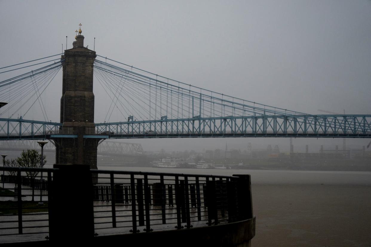
What is the Ohio River level at Cincinnati?
The Ohio River at Cincinnati is at 32.5 feet as of Friday morning, according to the weather service's Advanced Hydrologic Prediction Service, but it is predicted to continue to rise.
By 7 p.m. on Sunday, March 5, the river level will rise to the action stage of 40 feet and will be at 43.1 feet by 7 a.m. on Tuesday, March 7.
The flood stage for the Ohio River at Cincinnati is 52 feet.
Detailed Cincinnati forecast
Friday: Breezy and a high near 62. Showers and possibly a thunderstorm, and some of the storms could produce heavy rain.
Friday night: Cloudy, with a low around 37. Showers and thunderstorms are likely before 11 p.m., then a slight chance of showers between 11 p.m. and midnight. Some of the storms could produce heavy rain and winds could gust as high as 46 mph.
Saturday: Mostly cloudy, then gradually becoming sunny, with a high near 56.
Saturday night: Mostly clear, with a low around 35.
Sunday: Mostly sunny, with a high near 60.
Sunday night: Partly cloudy, with a low around 42.
Monday: Mostly sunny, with a high near 72.
Tuesday: Mostly sunny, with a high near 58.
Wednesday: Mostly sunny, with a high near 49.
Thursday: Partly sunny, with a high near 46.
Source: National Weather Service, Wilmington.
This article originally appeared on Cincinnati Enquirer: Flood warning extended amid severe Cincinnati weather, thunderstorms

