First snowfall heads to Alberta as temperatures drop below seasonal
Are you ready for the chill, Alberta? Much of the province has recently enjoyed short-sleeve weather in a month that’s more accustomed to sweaters as persistent ridging allowed above-seasonal temperatures to reign. But now there's a chill in the air.
The warmer weather has been on borrowed time, with chilly air from the Far North expected to slip down the Rockies and wash over the western Prairies soon. We’re looking at the prospect of more than four solid days below freezing in Calgary, complete with a chance for snow in many areas.
SNEAK PEEK: What El Niño means for Canada's upcoming winter season
October warmth will end in a hurry
It’s been an exceptionally warm month in Calgary so far, where we’ve seen nine days with high temperatures of 20°C or warmer over the past three weeks.
Calgary International Airport maxed out at 25.8°C on Oct. 8 — a high temperature more common in mid-July than mid-October.
This unusual weeks-long vacation from fall’s typical chill will come to a swift end this weekend as a major pattern change sweeps onto the Prairies.
GET READY: Make these simple routine changes to prevent dry, brittle hair in winter
The upper-level pattern that’s kept us warmer-than-normal will finally start to progress eastward, allowing a sharp trough to dig in and take its place. This will open the atmospheric floodgates and allow brisk air from Northern Canada to spill south, sending temperatures crashing down from their lofty heights.
Monday
An Arctic front following the Rockies late Sunday into Monday will flip temperatures from above-seasonal to below-seasonal in just a couple of hours.
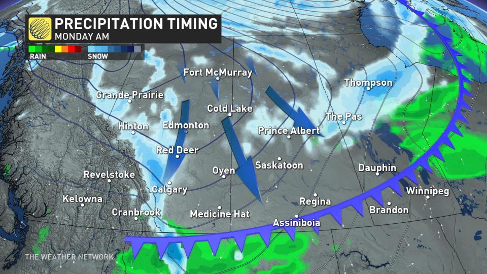
While the cold air is forced up the foothills, folks around the region can expect to see some snow falling for the first time this season. Upsloping snow will develop across the foothills to start the week while a couple of clippers start to form.
An abundance of atmospheric moisture will bump up the snowfall rates and spread the snow toward Calgary and the rest of southern Alberta.
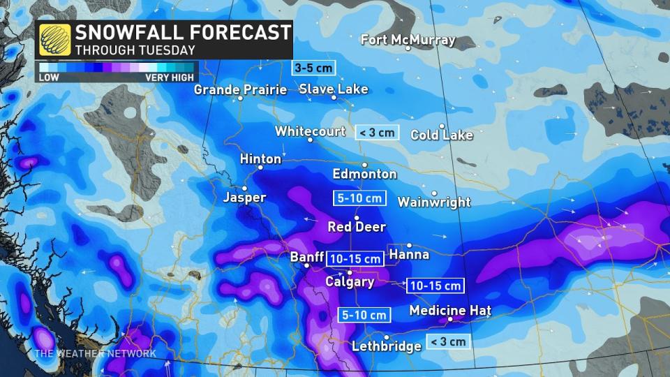
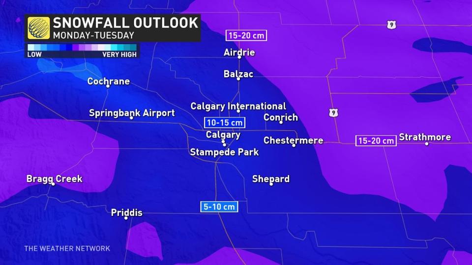
The heaviest snowfall on Monday and Tuesday will set up between Edmonton and Calgary, with some localized totals pushing towards 15 cm of snowfall, with 5-10 cm for most other areas.
DON'T MISS: Largest solar storm ever revealed by ancient tree rings
For the city of Calgary, 5-10 cm of snowfall is the most likely outcome as of now, with increasing totals as you move northward from the city centre.
Tuesday and Wednesday
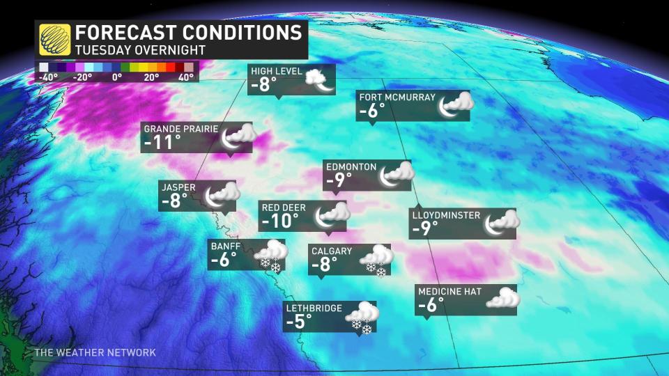
High confidence that Tuesday and Wednesday will produce the coldest daytime highs out of this first fall cold snap, with overnight lows falling into the minus double digits as the snowfall eases, while a band of Arctic air settles in from northern B.C. across central Alberta.
That may not be the end of the snow for next week, either.
Low confidence exists for some additional snowfall late Wednesday into Thursday as an upper trough rolls in off the Pacific, but some computer models show the dense, Arctic air shifting the storm track well south. It will take a couple of days to resolve this feature, and we should have a better idea of this by Monday.
This doesn’t mean Calgary is going to see the snowiest October on record. That record stretches back to just five years ago in 2018 when nearly 50 cm of snowfall fell throughout the month, more than 400 per cent of normal.
Thumbnail courtesy of Maureen Wharton
Keep checking back to The Weather Network for more forecast information and updates on your weather across Alberta.

