Classic nor'easter in the works could be high impact for the East Coast
It’s been a quiet winter so far, in terms of classic nor’easters across Atlantic Canada, that is. You can thank, in part, the lack of arctic air flooding across the continent.
Things are going to change quickly. A classic nor'easter is anticipated to to arrive on the East Coast in time for Valentine's Day. There is a special weather statement in place for all of Nova Scotia, with a winter storm watch expected to be issued at 4 p.m. local time Sunday with additional details on the expected impacts.
RELATED: Pattern flip next week to bring Canada colder air, possible snow
It is expected to fulfill the criteria for a weather bomb. The storm has the potential to be a major snowstorm for parts of the region during Tuesday and Wednesday, and possibly even a blizzard for southeastern Newfoundland.
Prepare to adjust travel plans through the middle of the week. Use the relatively quiet weather Sunday and Monday to prepare for another round of heavy, blowing snow.
Here’s what you need to know about the next storm.
Sunday: Humble beginnings
Before we dive into the details, what is a nor’easter? First, a primer.
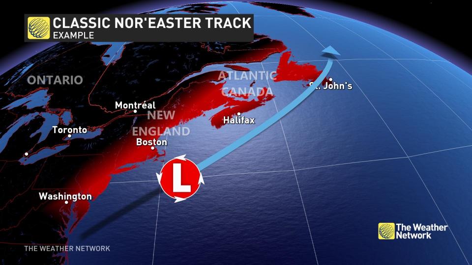
These areas of low pressure are coined by their famous wind direction, but the most important factor is the supply of continental, cold air delivered by the polar jet stream. Once this cold air interacts with warmer flows off the Gulf Stream, a low-pressure system forms generally within a couple hundred kilometres off the U.S. Eastern Seaboard.
Coincidently, they also move northeast and tend to peak in intensity as they hurdle towards Atlantic Canada.
On Sunday, the weather charts highlight a frontal boundary across the U.S. Southeast, with a weak surface low developing in eastern Texas.
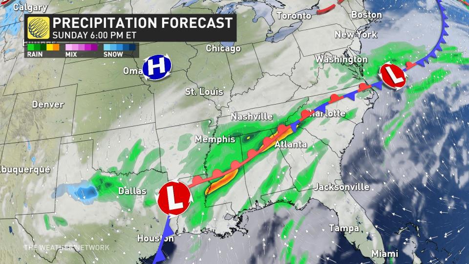
The pieces of the ingredients needed to develop a powerful nor’easter are beginning to coalesce across North America, including the critical ingredient –– cold air.
A healthy supply of cold, continental air is situated over Hudson Bay. We’ll get to this later.
MUST SEE: PHOTOS: Record-setting snowstorm drops 100+ cm of snow on Nova Scotia
Monday: Low ignition
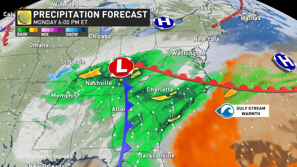
By Monday, the upper-level winds have steered the disturbance out of Texas and over the southeastern U.S., where a more organized low-pressure system has organized.
As the low crosses through the Tennessee Valley and North Carolina, and migrates over the Appalachians, it’s getting closer to the fuse that will begin to rapidly develop the mid-Latitude low. That's the warm Gulf Stream.
Tuesday: Low liftoff and Canadian impacts
By Tuesday morning, the atmospheric pressure is dropping like a rock off the Eastern Seaboard, as the weaker inland low has transformed its energy into a single, powerful, developing nor’easter.
Conditions deteriorate Tuesday afternoon across Nova Scotia, and by the evening, we will see the low make a close pass of the coastal section of the province. That means the Maritimes are guaranteed to remain on the cold side of the low. As a result, there is no risk of mixing or rainfall, just snow.
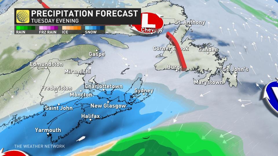
Heavy snowfall, blowing snow and limited visibility are all hazards with this nor’easter, and we’ll revise snowfall forecasts as time progresses. It has the making of a classic nor’easter with widespread issues, so keep checking back with us.
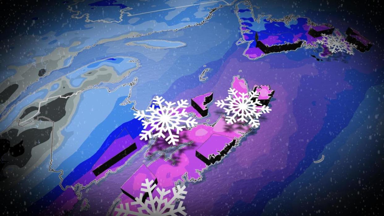
A more precise snowfall map will be available by Monday, but use the map below as a guide for the heaviest totals:
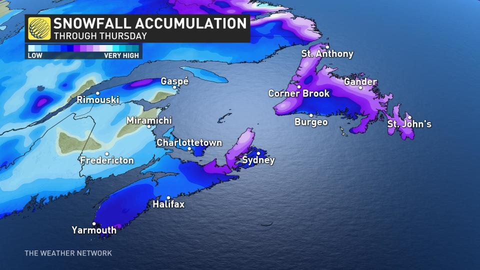
The purple shades represent a high probability of snowfall totals exceeding 20 cm with this event. The Maritimes should complete all storm preparations by Tuesday morning and avoid any unnecessary travel from the evening onwards across the province.
Valentine's Day: Peak intensity
The nor’easter is forecast to reach the deepest low pressure on Wednesday, below 970 hPA as the centre of the low passes south of the Avalon throughout the day.
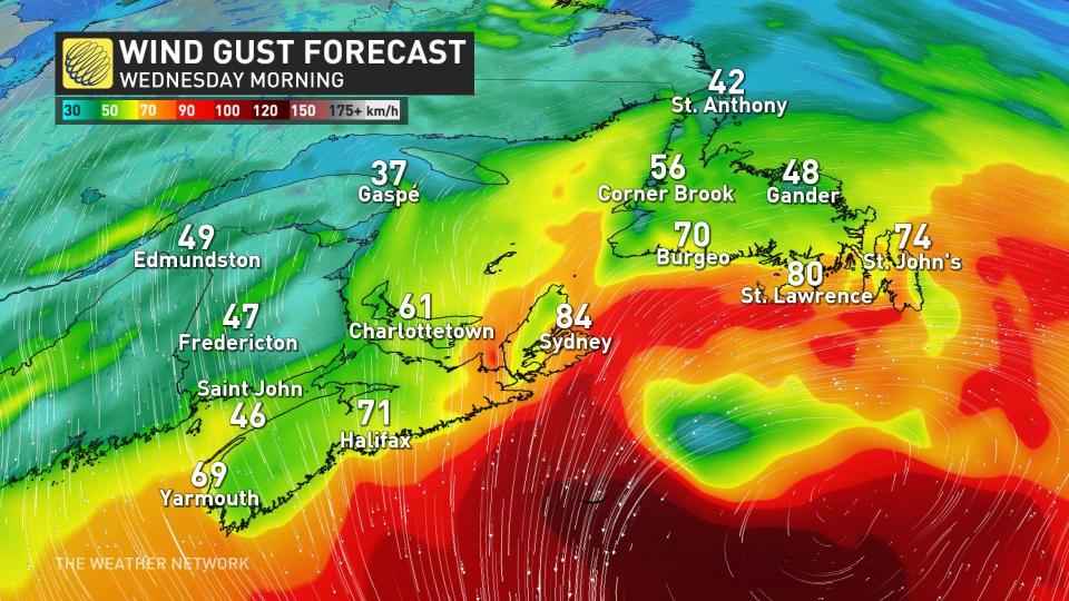
It means very strong winds and even blizzard conditions are possibility triggered during the worst of this storm along exposed coastal sections.
Keep checking back with The Weather Network for the latest forecast updates for Atlantic Canada.

