Climate change brings more floods. Which Great Lakes states are best prepared? Hint: Not Wisconsin.
Climate change is bringing heavier rainfall to the Great Lakes region, increasing the likelihood of flooding. But when it comes to implementing flood policies, a new study shows that some states in the region are doing it better than others.
The study published recently in the journal Climate Policy shows the eight Great Lakes states – Wisconsin, Illinois, Indiana, Michigan, Minnesota, New York, Ohio and Pennsylvania – vary greatly in the flood policies and programs they have in place. New York and Minnesota had the most advanced policies in place, followed by Pennsylvania, Michigan, Wisconsin and Ohio. Illinois and Indiana ranked last compared to other states in the region.
The researchers scored each state on whether it had standard policies or more advanced ones that considered climate change as well as justice and equity. The latter issue takes into account socioeconomic factors such as health, poverty and housing, because flooding can send a family on the margins into a tailspin if it is exposed to untreated storm water and sewage, or stuck at home, unable to get food and medication.
Building in measures that emphasize justice and equity is an important role states can play that will either even the playing field or reinforce inequities, said Sara Hughes, a political scientist at the University of Michigan and author of the study.
The study cannot only help local governments prepare for climate change, but it can serve as a resource for the states that may need more advanced policies in place, she said.
Here’s how the Great Lakes states stack up against each other, how Wisconsin compares to the other states and what’s being done in Milwaukee.
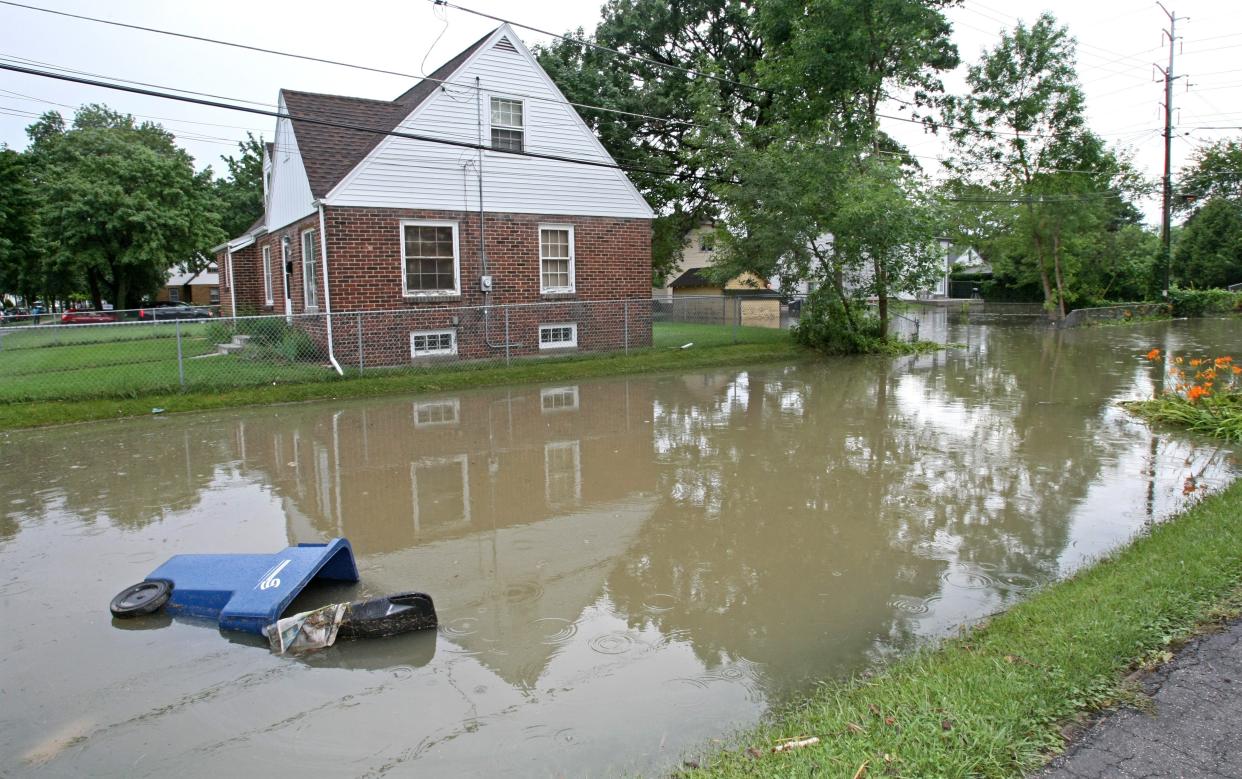
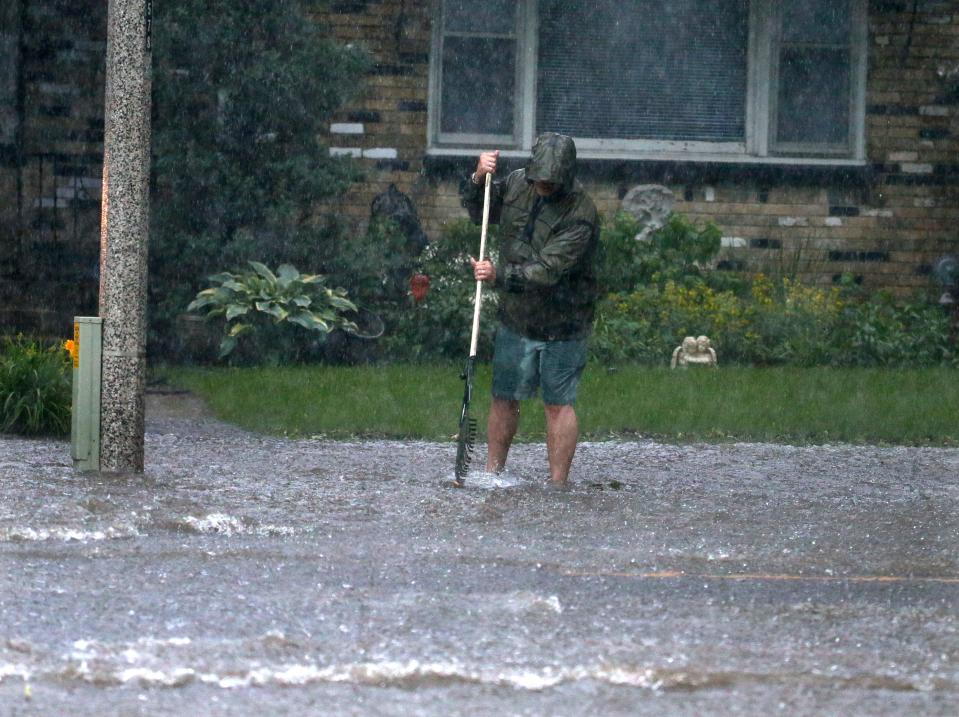
Heavier rain events hitting the Great Lakes region
As the climate continues to warm, the atmosphere can hold onto more water, leading to heavier rain events and flooding.
Between 1900 and 2015, rainfall in the Great Lakes region rose 10%, according to a report by 18 climate scientists around the Great Lakes. The report, published in 2019 by the Environmental Law and Policy Center, found that this was much higher than the nationwide average, which rose by 4%.
The report also showed that winters and springs are expected to become wetter, while summers are becoming drier.
More: What's the state of the Great Lakes? Successful cleanups tempered by new threats from climate change
All but three states included justice and equity in flood policies
Climate change is not experienced equally across the board, said Nancy Retana, program director for the resilient communities program at Clean Wisconsin.
Many of the climate change challenges that historically disenfranchised communities face today can be traced back to past policies put in place by the government, like redlining, she said.
According to the study, the most common ways states include justice and equity in their policies and plans are by doing assessments that identify neighborhoods that are at a greater risk but have fewer resources to respond.
People often assume that multimillion-dollar beach homes are the most at risk from flooding, said Alex Lemann, a law professor at Marquette University who researches flooding and climate change resilience at the national level.
But it’s really low-income communities that don’t have the resources to spend a night at a hotel or money to fix their homes, he said.
According to the study, Michigan, Indiana and Ohio were the only Great Lakes states that did not emphasize justice and equity in state-level flood policies and planning.
Overall, Minnesota had the strongest focus on justice and equity out of all eight states.
Most flood planning happens at the local level
When considering whether a state had standard or more advanced policies that included equity, the researchers scored states on four categories: providing information, planning guidance, regulations and funding.
Michigan, New York and Minnesota ranked the best at providing information that supports local planning. Minnesota was the only state that prioritized equity.
Four states have statewide climate adaptation plans: Minnesota, Wisconsin, Pennsylvania and Michigan.
Climate adaptation plans can identify and prioritize vulnerabilities to climate change as well as actions the state can take, like targets to reduce greenhouse gas emissions.
According to the study, Minnesota’s adaptation plan was the best in terms of justice and equity. Minnesota's Climate Action Framework prioritizes equitable solutions to reduce and manage flooding, according to the study. Wisconsin’s Governor's Task Force on Climate Change includes equity in terms of representation on the task force.
More: A year after its creation, Tony Evers' Office of Environmental Justice remains a mystery
The study found that Pennsylvania and New York have regulations for statewide flood resilience.
New York and Minnesota were the most advanced in terms of providing funding and grant money for local communities.
While the study comparing the Great Lakes states can be helpful in identifying gaps, much more flood planning and resilience efforts happen at the local level, said David Strifling, the director of the Water Law and Policy Initiative at Marquette University.
And while it wasn’t captured in the study, Wisconsin’s Department of Health Services released a flood resilience scorecard earlier this year, he said. The scorecard provides guidance and information so that public officials and local government staff can boost flood resilience in their communities.
The scorecard guides officials through environmental, institutional and social questions. Examples include how much rainfall has increased in the community, has the community mapped previous flood events and are their certain communities where flood risk is more likely.
A patchwork of policies causes problems
The federal government has set a baseline for policies and planning to mitigate the effects of flooding, which is one of the costliest hazards in the U.S. that will likely continue to rise.
But, it’s largely up to the states to develop plans, which has resulted in a patchwork of policies around the country, Lemann said.
The variation among states in the Great Lakes is a problem, Lemann said, because ideally states should be doing the most that they can to prepare for the greater flood risks under climate change. But seeing where states are lagging behind can also be helpful, he said.
Another problem is that flood maps from the Federal Emergency Management Agency – or FEMA – are outdated. The models that it uses are based on historical data that don’t consider what scientists now know about changing rainfall patterns.
“That’s a huge problem,” Lemann said. “What the federal government tells us about flood risk is a backward-looking picture.”
It can mislead people to think they aren’t in a flood zone when they are in fact, he said.
According to a report from the First Street Foundation, there are twice as many Wisconsin homes at risk for flooding compared to FEMA maps.
Green infrastructure boosts flood resilience in Milwaukee
In order to center the voices of people of color and low-income communities who have been historically disenfranchised, state and local governments need to learn about priorities, needs and challenges in adapting to climate change, Retana said.
One of the most effective ways to do this is to partner with community-based organizations, she said.
In the city of Milwaukee, the Milwaukee Metropolitan Sewerage District has partnered with organizations such as Clean Wisconsin to implement green infrastructure in some of the city’s most vulnerable communities.
Green infrastructure are structures that mimic the natural environment and help capture rain and stormwater in urban settings.
Since 2010, the sewerage district and the resilient communities program have planted trees and installed green infrastructure that can capture 70,000 gallons of water in Milwaukee’s northwest side, Retana said. This includes 800 rain barrels, more than 4,300 square feet of rain gardens and nearly 50 storm gardens, which look like raised beds that capture water.
Most of the infrastructure has been installed in private residences, churches and libraries and it’s also free, she said. It can also be put on rental properties with the permission of the homeowner.
More: Interactive map pinpoints Milwaukee areas most at risk for flooding, related health risks
More: Many Milwaukeeans live in a heat island, and 'we can't air condition our way out of this'
Caitlin Looby is a Report for America corps member who writes about the environment and the Great Lakes. Reach her at clooby@gannett.com or follow her on Twitter @caitlooby.
Please consider supporting journalism that informs our democracy with a tax-deductible gift to this reporting effort at jsonline.com/RFA or by check made out to The GroundTruth Project with subject line Report for America Milwaukee Journal Sentinel Campaign. Address: The GroundTruth Project, Lockbox Services, 9450 SW Gemini Dr, PMB 46837, Beaverton, Oregon 97008-7105.
This article originally appeared on Milwaukee Journal Sentinel: New York, Minnesota rank best in Great Lakes for flooding preparation
