The Climate Disaster Era of Global Farming Will Be Defined by Drones
Farming is a freshwater enterprise, but rising sea levels caused by a warming world threaten that—especially in river deltas where the boundary between ocean and estuary are in flux. The Mekong Delta in Vietnam is one such threatened food production site. A 2021 study found that rising sea levels will increase water salinity, or the amount of salt in water. This will exacerbate the problem of salinization caused upstream by mining and road runoff, and greatly reduce the amount of land that can be farmed.
There will be many daunting challenges to facing future populations, and they are as political as they are technological. But for farmers, when it comes to managing business day to day and planning investments in terms of growing seasons more than decades, adopting new technologies will shape the tool kit they have on hand as they adapt to farming in a warming world.
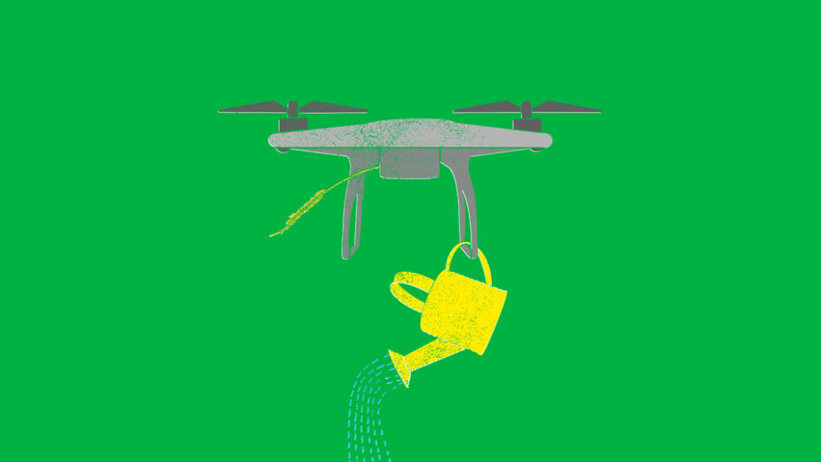
Drone-assisted farming is not a new field, but it is a young one. Much of the attention on camera-equipped drones has focused on high-end expensive military models or the tree-bound crashes of ineptly-piloted holiday gifts. The commercial work of drones and drone pilots—where low-cost flying machines are used as a platform to capture data or deliver field treatments—remains persistently marketed to farmers, and are increasingly used in a variety of roles with the promise of improving profits.
One such example are the drones built by China’s agricultural robotics company XAG, and marketed directly at farmers in Southeast Asia and the Mekong Delta specifically. In early May, XAG announced that its drones were helping farmers in Vietnam “grow more rice using fewer resources,” thanks to drone-delivered seeds and pesticide sprays, as well as drone-plotted fertilizer applications.
A video release by the company in January 2022 illustrates this. In the video, the twin-rotor drone douses a Vietnamese mango field in a chemical spray. The drone flies at the touch of a smartphone app and unlike runway-bound crop-dusters, it can launch and land immediately on a small patch of gravel. By its own telling XAG has been involved in drone-enhanced agriculture since around 2012 and 2013.
“It is a recent application to use drones to distribute agrochemicals, which could be pesticides, micronutrients, or also weed killers,” Giacomo Rambaldi, a senior consultant in digital technologies for agriculture, told The Daily Beast. “Initially drones were used to collect high resolution multi-spectral images to perform crop diagnostics.”
One example of this comes from Sebastopol, California vineyard DRNK, which made news in 2013 for its use of drone photogrammetry to evaluate vine health and grape readiness. DRNK winemaker Ryan Kunde contrasted the use of a drone for mapping with photography from a hired plane.
“You’d have to schedule some company with a plane to fly out at least a week in advance, and you might not know that you want to look at which vineyard at which time,” Kunde told 3D Robotics. In the years since, DRNK has used drone photography to select where to harvest and where to plant.
If ease of use and convenience of timing brought California winemakers to drone farming, it’s the low cost that is enabling its spread to the freshwater-starved Mekong Delta.
“With the drone, we not only save money on labor, we can also be more precise. It’s faster and safer, as we are not exposed to the chemicals, and it can help us deal with climate-change impacts such as less rain more easily,” Manit Boonkhiew, a leader of Thailand’s Ban Mai Community Rice Centre farm, told Reuters.
Watch This Fish-Inspired Drone Swim, Fly, and Hitchhike
The drones used are often just a platform, with a task-specific part acting as a payload. These payloads start at sensors like cameras, but can also include chemical sprayers that can be mounted on the drone’s body and then flown by the remote pilot.
Drones are part of a broader field of precision agriculture, using modern tools to precisely target interventions like pesticide and fertilizer, while sparing humans the work of walking the fields and inspecting before applying a treatment. These interventions save money in labor and materials rather than yield increase, but the ability to only apply interventions where needed is still enough to offset the cost of turning to drones or other such technologies.
A 2021 study of precision agriculture in Italy found that using tools like drones reduced labor cost by 20 percent. This saving came from more effectively directing the labor where it was needed, like only applying extra fertilizer to struggling patches instead of whole fields.
Using drones to estimate yield means creating specific image recognition programs that can determine crop health from pictures. It’s easy to spot healthy oranges in an orchard, where the ripeness of the fruit is largely apparent even to an untrained eye, but it can also be done on other crops where that might not be as obvious.
Climate Change Is Fueling a 5,000-Square-Mile ‘Dead Zone’ in the Gulf of Mexico
“I know of a company that’s working now in Ethiopia to provide the government means to estimate the yield of weed, which is one of the five strategically important key crops in the country,” said Rambaldi. SOWIT is one such precision agriculture company, which has used its drones to assist farmers in Ethiopia as well.
Processing this data can either be done through the cloud on remote servers or by computers on or near the location. For a small farmer who might use their own drone to map a field, the cloud can work if they have reliable internet connections. But for companies that sell precision agriculture as a service, processing in remote areas often becomes part of the package.
“If you do it in the cloud, you need to have huge bandwidth because the data collected by the [Unmanned Aerial System] is huge,” said Rambaldi. He later added that, “connectivity is one of the barriers for this kind of service except if the service provider does local processing.”
While other tasks, like crop dusting, have direct precedent in crewed aviation or by spraying on foot, using drones for data collection developed largely alongside the sensors—without a real industry of digitally-processed aerial photography to replace beforehand. The ability to collect and process data has added a new tool in farmers’ toolkits, one that can sometimes replace the labor of humans walking through fields and spraying for pests.
But it's important to understand the toolkit as just part of a modern approach to agriculture, and not as a revolution on its own.
“I think that there is a big hype about what the technology can do. And there is limited scientific evidence of positive returns to investments,” said Rambaldi. He added, “There is hearsay evidence, and the fact that farmers are paying for the service, obviously is evidence that the farmers have a return to that.”
Rambaldi notes that farmers are generally conservative when it comes to changing approaches and incorporating new technology, preferring to trust food supply to generationally known and trusted techniques. On a warming planet, though, climate will force them to adjust and incorporate new tools to help.
“What your grandfather was doing and which worked, 50 years ago, doesn't work anymore today,” said Rambaldi. “You want to use every single liter of water the best way. And using UAS, you can determine where your crop needs water and apply water accordingly.”
Get the Daily Beast's biggest scoops and scandals delivered right to your inbox. Sign up now.
Stay informed and gain unlimited access to the Daily Beast's unmatched reporting. Subscribe now.

