Climbers Flock to ‘Cathedral of Limestone’ That's Actually a Giant Graveyard
“Mora mora” is what they say in Malagasy, the national language of Madagascar, to remind you to “take it easy” or to “take it slow”. I found similar double-repetition phrases for the same meaning traveling through East Africa—“Poli poli” in Swahili, “Kes bi kes” in Amharic.
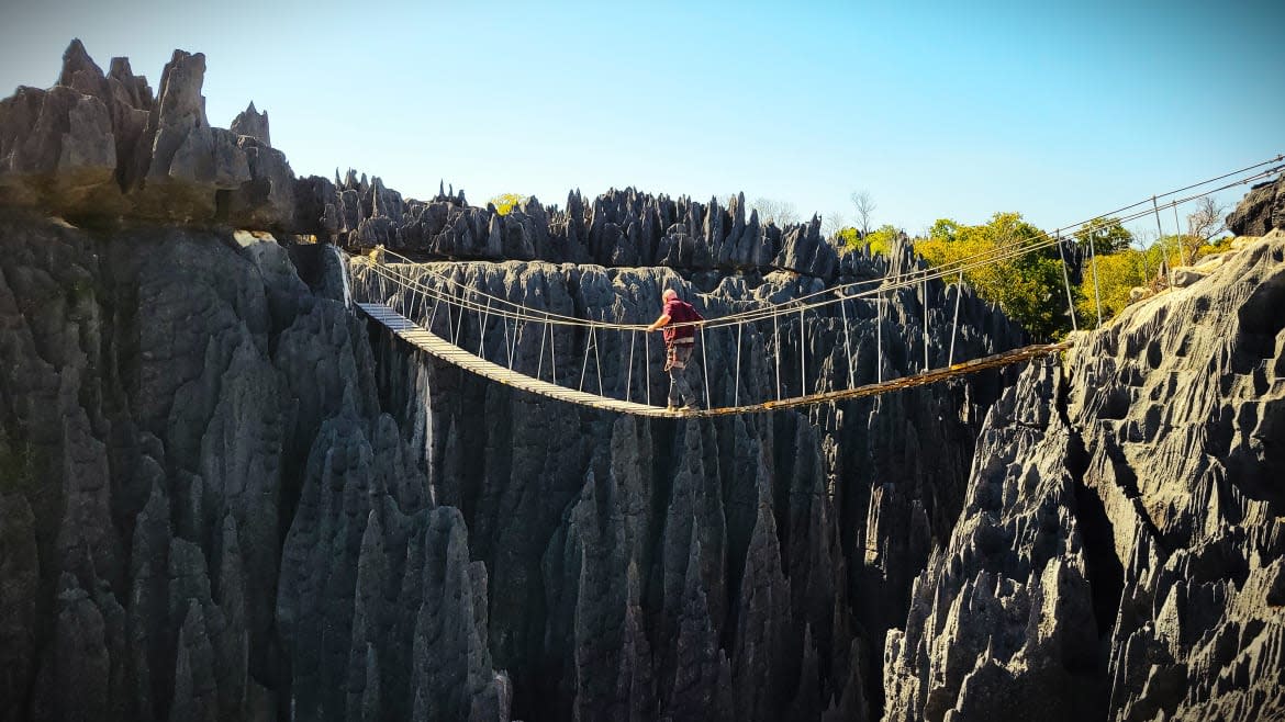
You’ve got to take it easy when traveling through this part of the world. One wrong move could result in a nasty fall. That was certainly the advice of the guide who helped point out exactly where the best footing was while climbing the jagged limestone formations of the Tsingy de Bemaraha in West Madagascar.

A view from the peak of the Tsingy de Bemaraha
“Tsingy tsingy” is a Malagasy term meaning “to walk slowly on one’s tiptoes”—the only reasonable way to reach the summit of this 2,600-foot cathedral of limestone that is a UNESCO World Heritage site. The limestone formations are needlepoint and jagged, and it takes a rope and harness to reach the top. Small areas between the jagged spears are the only areas you can use to gain any kind of footing, hence the ancestral name for the formation—“Tsingy”.
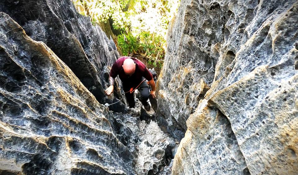
Climbing to the peak of Tsingy de Bemaraha
The entire area is spectacular, containing endemic species of flora and fauna, like rare lemurs who live in the forest below. The national park is divided into “Grand Tsingy” and “Small Tsingy”, the grand being more difficult to climb, even with a required rope and harness. The lesser version is geared for small children and older adults, or those who wouldn’t dare risk the ascent over sharp and jagged limestone formations.
According to NASA, these natural limestone formations began some 200 million years ago after multiple layers of calcite at the bottom of a lagoon formed a thick limestone bed. Tectonic activity pushed the limestone formations upward, and millions of years of rainfall carved the stones into stalagmite-shaped formations.
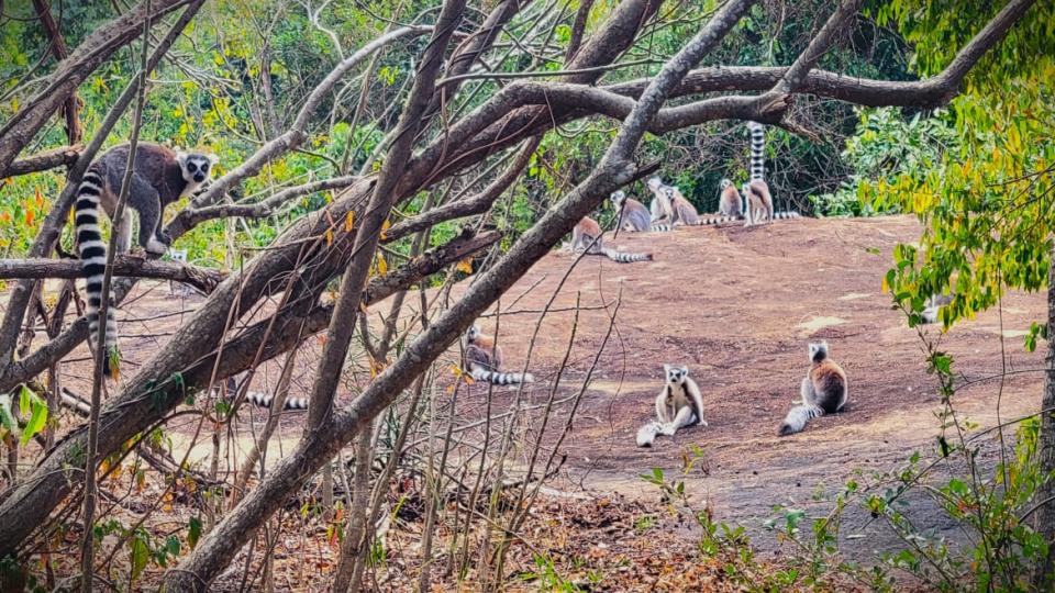
A group of endangered ring-tailed lemurs lounging at the base of the park
Thousands of years of trickling water eventually carved out caves and hidden pools, perfect for wildlife endemic to the area. Eleven species of lemur make their home here for this reason, as well as rapacious species of birds and insects you can only find on the Red Island.
But that’s not all that resides here within this national park. For hundreds of years, well before this site would become a state-sanctioned national park or UNESCO World Heritage site, local peoples crossed the Manambolo River and buried the bones of their beloved in the highest caverns of these formations, carried only by skilled climbers who, at the time, had no such harnesses or safety equipment.
Visitors to this area will be reminded never to point with their finger into the caverns, as it is a sign of disrespect to their ancestors. My guide specifically reminded me of this, using his first knuckle to explain directions or point out an interesting feature within the Park.
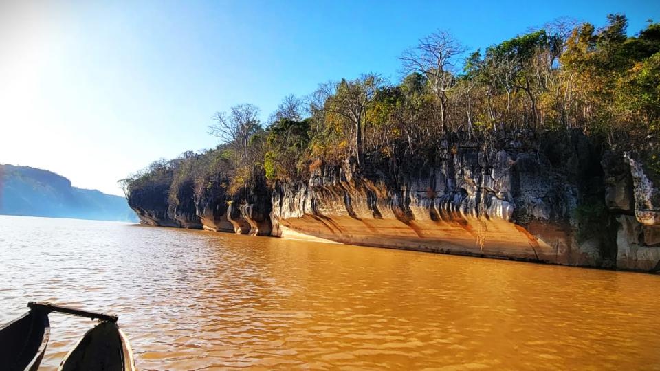
I was crossing the Manambolo River with a group of French tourists when I asked the guide if there was a way to see these gravesites up close. He hesitated, and lifted an eyebrow, and politely explained it wouldn’t be possible. Every year, these guides’ sole job is to shuttle tourists from the capital to the banks of the Manambolo, ferry them over to Tsingy, help them through one of the two chosen levels of the park, and bring them home. It’s always a good idea to tip the locals, and a tip for this sort of guidance on the local market should fall anywhere between US$50-100.
I gently pressed him further, explaining that I deeply respected but would very much regret not being able to visit such a fascinating aspect of local history. I doubled his tip, and when the French tourists exited the ferry, we stayed behind, taking a dual-headed canoe further down the Manambolo.
Driving a dual-headed canoe down the Manambolo River
As we traveled down the river, the engines of the 4x4s faded away. Surrounded by giant red walls of clay and rock through which this river carved itself, we made our way toward caverns where he explained tourists don’t go.
“They just don’t really know about it,” he said, “We don’t take tourists here.” I imagine it had something to do with the tourism guidebooks suggesting UNESCO World Heritage landmarks over local ancestral gravesites. That, and the last thing the Malagasy probably want is for their burial lands to be infiltrated by the hordes of camera-wielding great-grandchildren of their former colonizers.
My guide used his knuckles to point out the areas where these graves were. I used a zoom lens to get a closer look, careful never to point around. This area surrounding the Tsingy was once home to a people called the Vazimba, the first people to inhabit the Island of Madagascar. The stories, myths, and folklore that pervade the island stem from this group of settlers who left very few traces of their existence outside of these tombs.
As I zoomed in with my camera, I could make out the skulls and bones on the edge of cavern openings, hundreds of feet above me. I attempted to trace backwards how a human could have even gotten there without a rope or harness, and it was difficult to form a blueprint in my mind. Some Malagasy myths hold that the Vazimba were a supernatural force, having since been warded off along with European colonizers by the forces of salt.
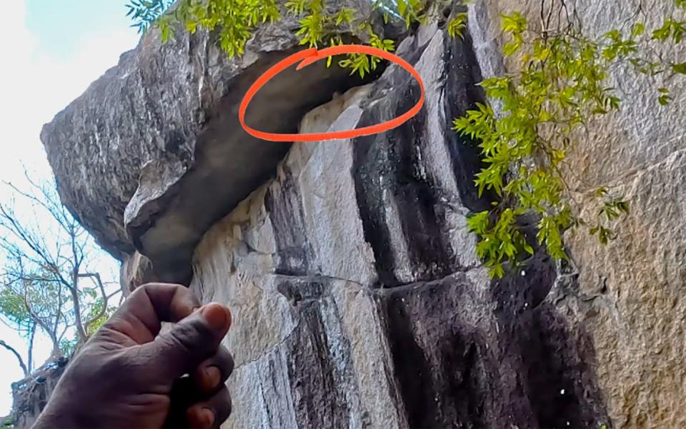
My guide uses his hand’s knuckle to indicate the location of a skull lying inside a high cavern
We passed several gravesites as we turned the canoe around, heading back toward Tsingy. Leaving the canoes, I approached this massive limestone structure, observing the French tourists at the summit, now making their way back down. I would be going it alone, but not before my guide showed me one last burial site at the base of the Tsingy de Bemaraha.
After getting through families of curious lemurs, the spying eyes of chameleon species in this seemingly open-air terrarium, we came upon a dark cave. Three human skulls sat atop the opening, perhaps as a warning, that this was once a home to the Vazimba.
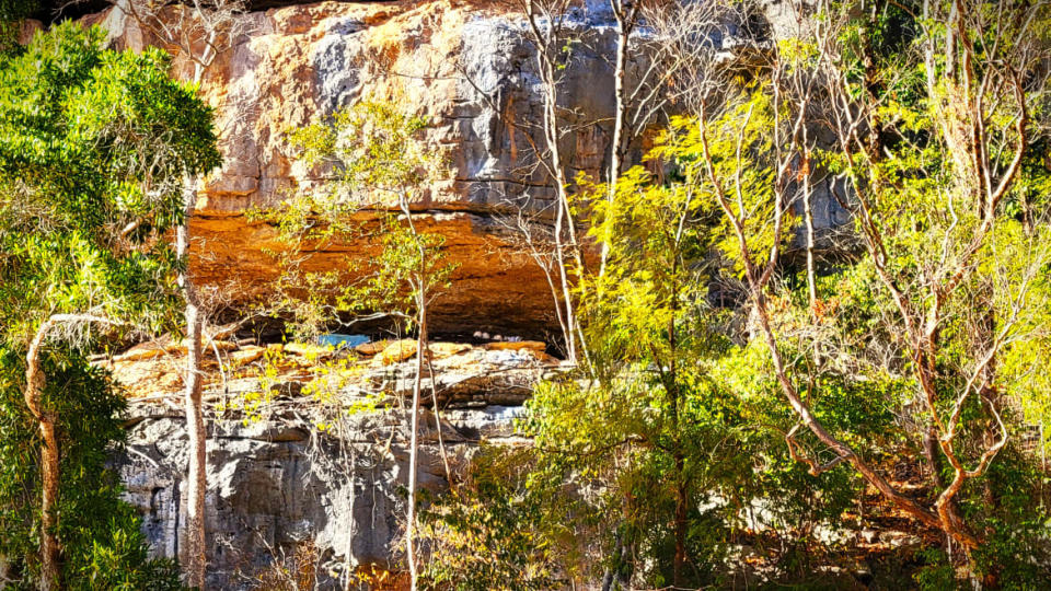
Human skull and bones of the Vazimba laid to rest high above, protected from potential human interaction
We stood in silence for a moment, the guide still as affected as if this was his first time showing this special place.
Afterward we made our way up the Tsingy alone, and as I reached the peak, I saw the French tourists driving away. They never knew what they had just climbed through.
Get the Daily Beast's biggest scoops and scandals delivered right to your inbox. Sign up now.
Stay informed and gain unlimited access to the Daily Beast's unmatched reporting. Subscribe now.

