Coachella Valley hiking guide: 26 trails in the valley, high desert and forest
The Coachella Valley is known for its desert landscape, palm trees, pools and unique home designs, but it's also a treasure trove for hiking. From Joshua trees and stunning rock formations to waterfalls and palm tree oases, there's a scenic hike for all skill levels within reach of the valley.
This guide provides a sampling of top hikes in the area that Desert Sun reporters Erin Rode, Ema Sasic and Janet Wilson recommend to locals and visitors alike.
Note: For trails without specific hours and prices listed, readers should assume the trail is open dawn to dusk and free to enjoy.
Coachella Valley hikes

Indian Canyons
Mileage: 60 plus miles
Address: 38-520 S. Palm Canyon Drive, Palm Springs
Indian Canyon and Palm Canyon feature five dozen miles of trails, and while easier access ones can be crowded, all offer a real sense of what this area was like pre-major development, when Cahuilla people wisely retreated from the scorching valley floor to cool palm oases and higher ground for the summer months. But exposed areas can be hot year round.
Information Open daily 8 a.m. to 5 p.m., last vehicle in at 4 p.m. Oct. 1-July 4. Open Friday, Saturday, Sunday only July 5-Sept. 30, same hours. Adults $12, seniors 62+ and students $7, children 6-12 $6, military free with ID, equestrian $11.
More info: www.indian-canyons.com/hours
Top trails include:
Palm Canyon
Mileage: 12 miles
Palm Canyon serves as a backbone trail, with options to loop back on other trails at various points. Its abundant Washingtonia filifera (California Fan Palm) offer a cool, shaded contrast to stark gorges and barren desert lands beyond. A moderately graded foot path during the first few miles winds down into the canyon for picnicking streamside, hiking or horseback riding.
Andreas Canyon
Mileage: 1 mile
Address: 38-520 S. Palm Canyon Drive, Palm Springs
Andreas Canyon is considered the world’s second largest California Fan Palm oasis, and a half-mile, easy hike will take you there, alongside a year-round creek of the same name. In addition to those mighty fan palms, hikers are quickly rewarded with unique rock formations, sycamores, cottonwoods and willows, and more than 150 species of plants. Feel like you've been transported to a distant land and time. If you want to spend more time in the area, Murray Canyon is an easy hike south from Andreas Canyon.
Information: Open 8 a.m. to 5 p.m. daily Oct. 1 through July 4; 8 a.m. to 5 p.m. Friday, Saturday and Sunday July 5 through Sept. 30. Entry is $12 for adults, $7 for seniors ages 62 and older, $7 for students (with student ID) and $6 for children ages 6 to 12.
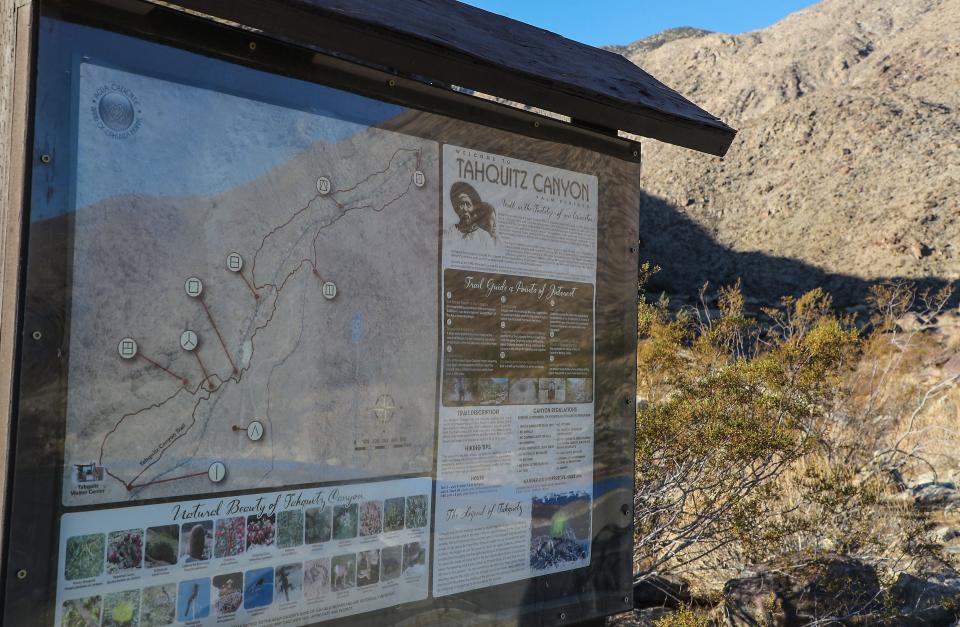
Tahquitz Canyon
Mileage: 1.8 miles
Address: 500 W. Mesquite Ave., Palm Springs
A classic Palm Springs hike, the Tahquitz Canyon Trail takes you up rock steps along a creek to a seasonal 60-foot waterfall. The canyon is one of the most culturally sensitive areas of the Agua Caliente Band of Cahuilla Indians Reservation, and the trail also leads past ancient irrigation systems and other culturally significant sites. The Agua Caliente Band of Cahuilla Indians warns that the trail is “strenuous,” with a steep and rocky trail that is exposed to the sun.
Information: Open 7:30 a.m.-5 p.m. daily Oct. 1-July 4. Open the same hours but only on Fridays, Saturdays and Sundays July 5 - Sept. 30. Admission is $15 for adults, $7 for children and free for military with military I.D.
Murray Canyon
Mileage: 4.7 miles
Address: 38-520 S. Palm Canyon Drive, Palm Springs
For a longer hike and less-visited trail than Tahquitz and Andreas Canyon, check out Murray Canyon, a 4.7-mile trail that ends at the Seven Sisters Waterfall. The trail leads across open desert with views of the San Jacinto and Santa Rosa Mountains before entering Murray Canyon, where you'll pass through lush palm oases and follow a seasonal creek to the waterfall. In the winter and spring months, when Murray Canyon Creek is running, you'll cross the creek several times before reaching Seven Sisters. The trail begins from the same trailhead as Andreas Canyon, so you could double up on hikes for a roughly 6-mile day on the trail.
Information: Open 8 a.m. to 5 p.m. daily Oct. 1 through July 4; 8 a.m. to 5 p.m. Friday, Saturday and Sunday July 5 through Sept. 30. Entry is $12 for adults, $7 for seniors ages 62 and older, $7 for students (with student ID) and $6 for children ages 6 to 12.
Museum Trail
Mileage: 1.7 miles
Address: Trail begins in the parking lot of the Palm Springs Art Museum, 101 Museum Drive, Palm Springs
This short — but steep and difficult — trail begins at the back corner of the Palm Springs Art Museum parking lot, and provides expansive views of Palm Springs and beyond within minutes after starting up the rocky path. After hiking up for about .8 miles, you’ll reach picnic tables at the top, a great spot to eat a packed lunch or just to rest before eating at one of the many restaurant options in downtown Palm Springs down below.
Araby Trail
Mileage: 4.1 miles
Address: Southridge Drive, Palm Springs
Though you start this trail off in a residential area, it quickly turns into a peaceful hike with great views as you enter the Santa Rosa and San Jacinto Mountains National Monument. You even get a peek of Bob Hope's stunning flying saucer-shaped home and Steve McQueen’s glass-and-beam midcentury modern home. Other trails in the area include Araby West Loop (5.4 miles), Araby and Berns Trail Loop (4.8 miles), and Araby Trail to Goat Hill (11.7 miles), according to Visit Palm Springs.
Information: Be respectful and do not trespass on private property. Dogs are allowed on one part of the trail, and a sign will tell you where they are not. Horses are allowed on the trail. If you choose to do this hike in the summertime, it's best to get a head start early in the morning.
South Lykken Trail
Mileage: 2.2 miles or 7.3 miles
Address: South Lykken, Palm Springs
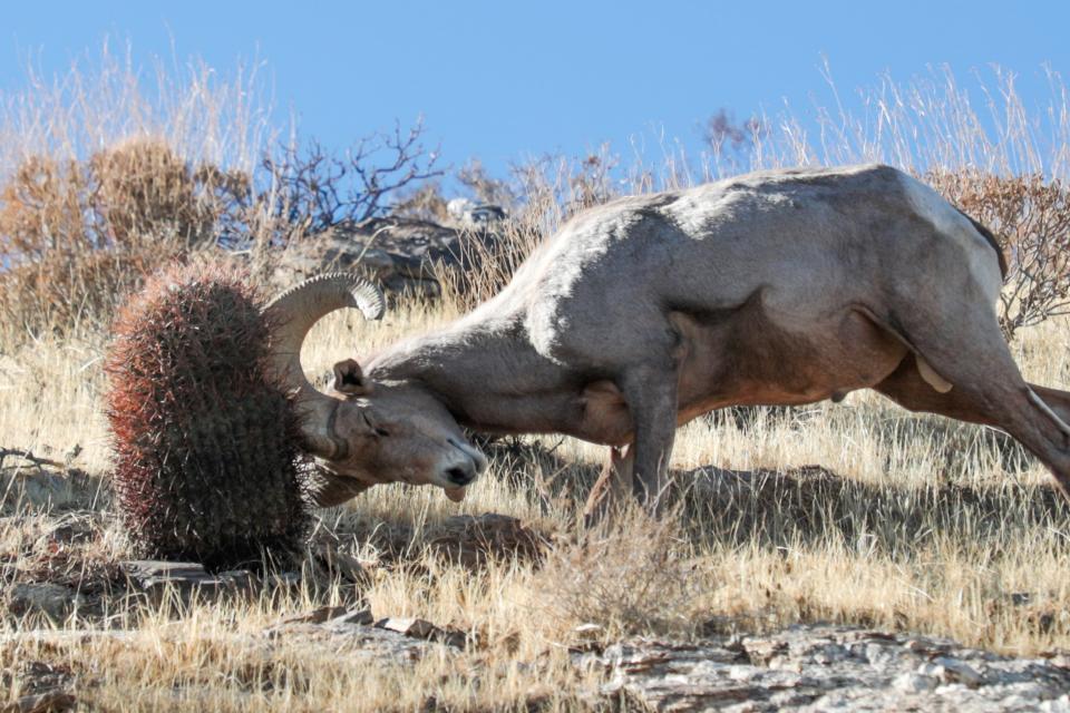
The South Lykken Trail is a favorite among Coachella Valley residents and visitors for its views. Though the switchbacks may take your breath away, you'll often be rewarded with colorful wildflowers (typically November through April), interesting cacti and sometimes even bighorn sheep. Depending on how long you want to be on the trail, you can reach a scenic picnic spot in approximately 1.1 miles and head back down the same way, or take on an approximately 2.5 hours hike that totals 7.3 miles, according to Visit Palm Springs' Hiking Guide.
Information: There are not many shaded areas on this trail, so pack sunscreen, hats and lots of water.
Whitewater Preserve
Mileage: 3.5-4 miles
Address: 9160 Whitewater Canyon Road, Whitewater
Whitewater Preserve features the year-round Whitewater River, with lush riparian habitat and views of San Gorgonio. The protected canyon serves as a wildlife corridor between the San Bernardino and San Jacinto Mountains, allowing animals like bighorn sheep to travel between the two regions, according to the Wildlands Conservancy. The preserve has a few different trail options, but popular trails include the 3.5-mile Canyon View Loop trail, which runs alongside the river for a while before turning and climbing up a ridge for views of the canyon, windmills in San Gorgonio Pass and the surrounding mountain ranges. Another option is the trail to Red Dome, a 4-mile round trip that leads to an outcrop of red rock near the river.
Information: Open 8 a.m.-5 p.m. daily. Free admission. Check the Wildlands Conservancy website for special hours on holidays: https://wildlandsconservancy.org/preserves/whitewater.
Mission Creek Preserve
Mileage: 3.2 miles
Address: 60-550 Mission Creek Road, Desert Hot Springs
The Mission Creek Preserve is a lush wetland with views of San Gorgonio and painted hills with hues of light pinks, purples and greens. Just after entering the preserve, you’ll see the ruins of three stone houses. The wide trail parallels a streambed, and a 2-mile round-trip will get you views of the painted hills. Continuing onward for the full 3.2-mile trail will bring you to the Stone House Picnic Area. The trail continues for an additional two miles past the picnic area, where it meets up with the iconic Pacific Crest Trail. The preserve is also home to a variety of wildlife, including bears, deer, bighorn sheep and mountain lions, and in wet years is home to spring wildflower blooms, according to the Wildlands Conservancy.
Information: After exiting Highway 62 on Mission Creek Road, you’ll drive for about two miles along a dirt road before reaching the preserve entrance.
Kim Nicol Trail
Mileage: 5.6 miles
Address: Intersection of 20th Avenue and Corkhill Road, Desert Edge
The Kim Nicol Trail was named after biologist Kim Nicol, who spent three decades advocating and protecting the valley's endangered species and open space, ultimately becoming California Department of Fish and Game’s regional manager. It’s a mostly gentle hike with a steep climb at the beginning but otherwise mild elevation gains. The hike will reward you with views of snow-capped mountains (depending on the season), spinning windmills and open desert stretching in all directions.
Information: There is practically no shade on the trail, so pack plenty of sunscreen and water.
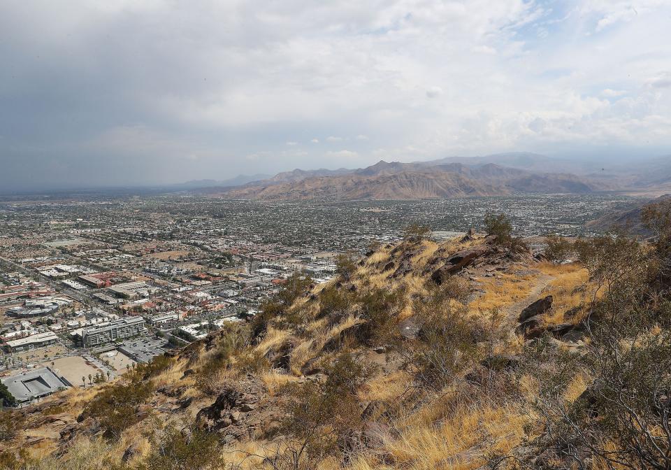
Bump & Grind
Mileage: 3 miles
Address: Trail begins on Painters Path behind the Desert Crossing Shopping Center, Fred Waring Drive and Highway 111, Palm Desert
This three-mile loop with views of Coachella Valley cities is considered the most popular low-elevation trail in the Santa Rosa and San Jacinto Mountains National Monument, used by those looking for a heart-pumping workout from the trail’s steep ascent, which climbs nearly 1,000 feet and intersects with other trails, offering the opportunity to extend the workout.

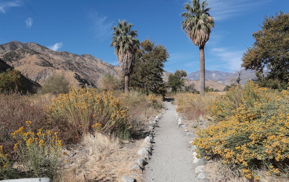
Thousand Palms Oasis/Coachella Valley Preserve
Mileage: .5 mile to 2 miles
Address: 29-200 Thousand Palms Canyon Road, Thousand Palms
The 880-acre preserve offers largely flat, easy access to a wonder of the desert: scores of dense, tall Washington fan palms crowd together in pools that spring out of a San Andreas side fault. Kids and adults alike love the thick palms, which resemble a cluster of shaggy “cousin itts” for those old enough to remember the Addams family TV show. Easy hikes are possible out of the oasis, which sits at the heart of the larger Coachella Valley Preserve System, affording sweeping views of the Little San Bernardino Mountains and Joshua Tree National Park.
Information: Open (generally) 7-5 p.m. Thursday-Sunday in winter months. Free admission, but donations appreciated. Park on side of road and walk in. Check webpage for hours before you go, often closed for special events, maintenance.

Indio Hills Trail
Mileage: 5 miles
Address: Golf Center Parkway, Indio
Tucked in the hills overlooking the Golf Club at Terra Lago, the Indio Hills Trail is one of the east valley's outdoor jewels with its sweeping views, ease with parking and expansive terrain that is inviting to plenty of hikers. In order to access the trail — which is also known as the Indio Hills Badlands Trail, the East Indio Hills Trail or the Golf Center Trail — hikers can park at Avenue 42 and Golf Center Parkway. From there, they can follow the trail markers to complete the five-mile loop.
Ladder Canyon and Painted Canyon Trail
Mileage: 5 miles
Address: Painted Canyon Road, Mecca
Colorful, gigantic rock formations representing millions of years of earth’s history are the backdrop in Painted Canyon. The breathtaking journey will have you climbing up ladders to fully witness and take in the natural beauty around you. Sturdy hiking shoes are a must if you go on this trail. When you come across a giant rock arrow, swing left so you catch the most scenic and beautiful parts of this ladder-filled wonder.
Information: Be prepared for a lot of climbing.
Hikes to beat the heat
Ernie Maxwell Scenic Trail
Mileage: 5 miles
Address: Humber Park, 24-559 Fern Valley Road, Idyllwild-Pine Cove
This is the perfect hike for a relaxing walk in the forest, for those days when you’re sizzling in the desert and decide you absolutely need to see some pine trees immediately. The easy roughly 5-mile hike begins at Humber Park and descends 700 feet over 2.6 miles through the San Jacinto Wilderness to Tahquitz View Drive, where you turn around and head back up the way you came. The trail provides views of Suicide Rock and Lily Rock, crosses seasonal streams and has plenty of greenery.
Information: An Adventure Pass is required to park at the trailhead. Passes cost $5 and are available at various local stores, list available here.
Desert View Trail
Mileage: 1.5 miles
Address: Palm Springs Aerial Tramway, 1 Tram Way, Palm Springs
If you're heading up the Palm Springs Aerial Tramway for a day, the Desert View Trail is one option suitable for people of all ages. The trail leads to a number of scenic overlooks of the valley floor without being too strenuous. There are even guided nature walks of this trail, and the Long Valley Nature Trail (a three-fourth mile trail), Saturdays and Sundays from Memorial Day weekend through Labor Day weekend. Because you're at a higher elevation in the mountains, this trail is one way you can escape the desert heat in the summer.
Information: When the guided walks are in session, no advanced registration is required and there is no charge.
Tahquitz Peak
Mileage: 9 miles
Address: Humber Park, 24-559 Fern Valley Road, Idyllwild-Pine Cove
This hike through the San Jacinto Wilderness leads to Tahquitz Peak and the Tahquitz Peak Fire Lookout, which at 8,846 feet is the highest fire lookout within the San Bernardino National Forest. The peak offers vistas of Southern California, from Palomar Mountain in San Diego County to the Salton Sea. Tahquitz is also home to Lily Rock (also called Tahquitz Rock), a white-colored rock formation that can be seen from the town of Idyllwild.
Information: An Adventure Pass is required to park at the trailhead. Passes cost $5 and are available at various local stores, list available here. A free Wilderness Permit is also required.
High desert hikes
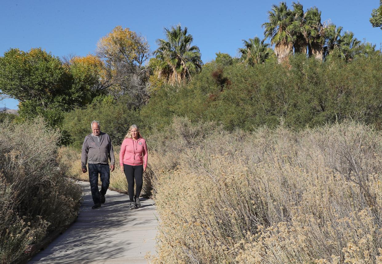
Big Morongo Canyon Preserve
Mileage: Trails/walks range from easy .3 mile to tough 11 mile round-trip.
Address: Entrance 1 block south of Highway 62, Morongo Valley
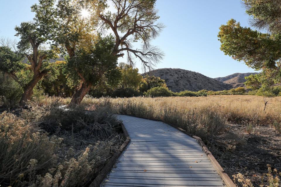
The preserve offers bird lovers and others a chance to quickly escape the blazing open desert, though serious hikers can trek up 3,000 feet from the cooler canyon floor to ridgetops. Several trails, including boardwalks through the wetland and stream habitats, meander through the Preserve. The one-half mile Marsh Trail is wheelchair-accessible.
Information Open daily throughout the year from 7:30 a.m. to sunset, but ideal months to visit are in fall, winter, and spring. Admission is free, but donations are welcome.
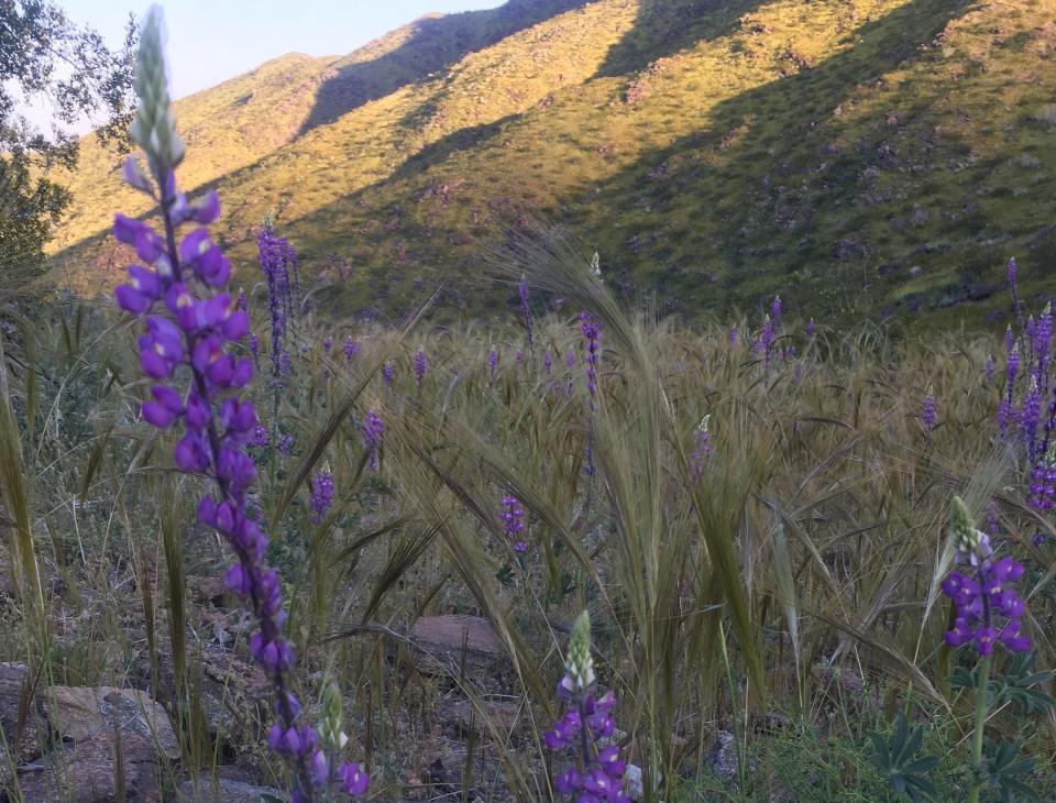
Pioneertown Preserve
Mileage: 4.2 to 8 mile loops.
Address: 51-010 Pipes Canyon Road, Pioneertown
The Pioneertown Preserve offers three substantial hikes, one of which, the Sawtooth Trail, is easy and offers interesting rock formations. The Indian Trail Loop out of Pipe’s Canyon is a high-desert adventure with a variety of landscapes, a little scrambling and steep climbs and descents, rock formations, and a great viewpoint. Chaparrosa Peak Trail features beautiful wild flowers and nice, often shaded views up and back. It is best from March until October. Dogs are also able to use this trail, but must be kept on leash.
Information: Open dawn to dusk. Admission is free, and you can swing by Pappy and Harriet’s in nearby Pioneertown and see if Paul MCartney or any other celebs are hanging around.
Joshua Tree National Park
There are an abundance of hikes for all skill levels in this high-desert national park, but we’ve compiled a few of our favorites below. The National Park Service also maintains a full list of hikes in the park, sorted by difficulty.
Information: Joshua Tree National Park has an entrance fee of $30 per vehicle.
Hidden Valley Nature Trail
Mileage: 1 mile
Address: Located off Park Boulevard near the Hidden Valley Campground, Joshua Tree National Park
This crowd-pleasing family friendly hike has it all: Joshua Trees, unique rock formations, wildlife, and desert history. Homesteader and rancher William Keys blasted through Joshua Tree bounders so his cattle could graze on what was then grassland in Hidden Valley in the first half of the 20th century.
Barker Dam
Mileage: 1.1 miles
Address: Barker Dam Parking Area, Joshua Tree National Park
Just across Park Boulevard from the Hidden Valley Nature Trail is the Barker Dam Trail, a loop that also has ties to the region’s history before it was a national park. The trail with minimal elevation gain leads to a water tank built by early cattle ranchers, with opportunities to possibly spot bighorn sheep. In addition to Joshua Tree woodlands, the trail winds through pinyon-oak woodlands and desert willows.
Lost Horse Mine
Mileage: 4 miles
Address: Lost Horse Mine Trailhead off Keys View Road, Joshua Tree National Park
At one point, the area that is now Joshua Tree National Park was home to about 300 mines, although most were unsuccessful. This trail leads to one of the few exceptions, the Lost Horse Mine, which produced more than 10,000 ounces of gold and 16,000 ounces of silver between 1894 and 1931. The four-mile round-trip trail follows the road that was developed to bring supplies to the mine, and leads to the preserved Lost Horse Mill.
Lost Palms Oasis
Mileage: 7.5 miles
Address: Cottonwood Spring Parking Area, Joshua Tree National Park
This rolling trail heads down into a canyon to a remote fan palm oasis in the southeastern portion of the park. The hike back out of the canyon is strenuous. Coachella Valley residents can access this trailhead by using the park’s southern entrance off Interstate 10, avoiding the often-bigger crowds and line at the northern entrance in Twentynine Palms.
Trails for experienced hikers
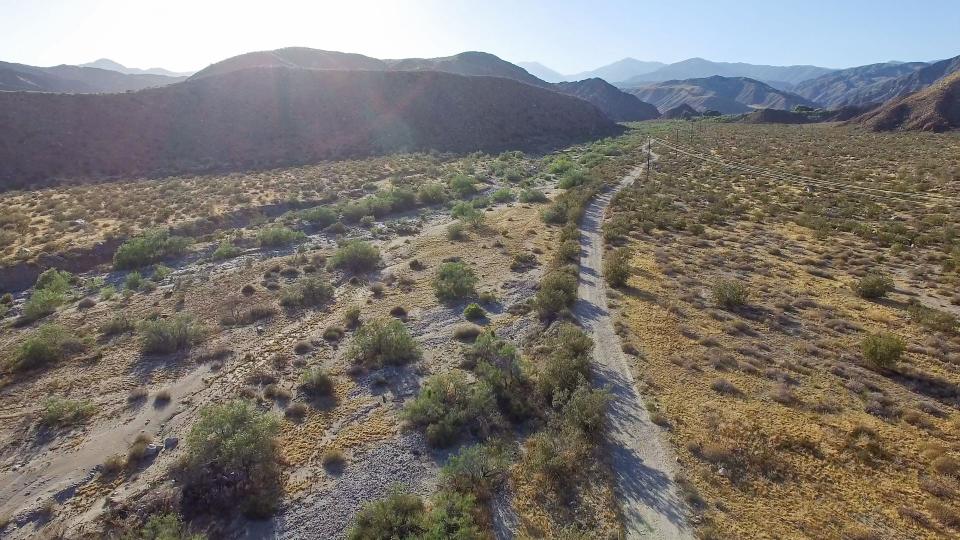
Long Canyon
Mileage: 12 miles (one-way)
Address: Trailhead is located on the dirt portion of Long Canyon Road, off the intersection of Hacienda Avenue and Long Canyon Road in Desert Hot Springs.
If you really want to avoid the Joshua Tree crowds, you can enter a rarely-visited portion of the park from a new trailhead in Desert Hot Springs, which is the southernmost and westernmost entrance into the park. The Long Canyon trail enters the national park about a mile into the 12-mile one-way trip, and ends in Yucca Valley. Explore Long Canyon by setting up a shuttle and leaving a second car in Yucca Valley, or just walk as far along the trail as you’d like before turning around.
San Jacinto Peak
The best part of reaching the 10,834-foot summit of San Jacinto Peak? The mountain looms over the Coachella Valley, so you can easily brag about the tough hike you did by simply pointing and saying “I climbed up that.” There are two main routes to the summit, one via the Palm Springs Aerial Tramway and the other coming from the Idyllwild side of the mountain: The summit offers stunning views straight down to the desert floor and beyond.
Tramway to San Jacinto Peak
Mileage: 12 miles
Address: Palm Springs Aerial Tramway, 1 Tram Way, Palm Springs (Park at the tramway and take the tram to the trailhead)
This route starting at the Mountain Station of the Palm Springs Aerial Tramway is the easiest and most popular hike to San Jacinto Peak, according to the Forest Service, but with 12 miles and 2,300 feet of elevation gain, the hike is still considered strenuous.
Information: The tram costs $28.95 for adults, $16.95 for children, and $26.95 for seniors. Hours of operation and other information are available here: https://pstramway.com/about-us/hours/. After leaving the Mountain Station, stop at the Mount San Jacinto State Park ranger station to obtain a free wilderness permit.
Marion Mountain to San Jacinto Peak
Mileage: 11.2 miles
Address: Turn off Highway 243 at Forest Service Route 4S02 toward Fern Basin Campground and Marion Mountain Campground. The trailhead is located on Marion Mountain Campground Road just before reaching the campground.
This route to San Jacinto is shorter than the Tram route, but it’s also steeper. Instead of cutting off some of your elevation gain via a fun rotating tram car, you’re on your own for the 4,500-foot climb up Marion Ridge. But the reward is a heavily-forested route with fewer crowds.
Information: The trail enters San Jacinto Wilderness, so a Wilderness Permit is required.
Cactus to Clouds Trail
Mileage: 22 miles
Address: 101 N. Museum Drive, Palm Springs
The Cactus to Clouds Trail — also known as the Skyline Trail — is not for the faint of heart. This 22-mile, 12-hour hike has people starting from the valley floor, continuing to the summit of Mt. San Jacinto and ending at the Palm Springs Aerial Tramway's Mountain Station. Hikers who attempt the 16-mile trek from the valley floor to the mountain peak climb about 10,400 feet. It's a 6-mile, downhill hike from the summit to the Mountain Station. The safest and best time of year to do the trail is October and November, when Palm Springs cools down, but there’s still no snow in the mountains. The trail can be done in the winter and spring months, but only if hikers are experienced in snow/ice hiking. The majority of rescues and deaths happen during the summertime — when temperatures in Palm Springs can reach 120 degrees — so it’s best to avoid the hike then.
Information: Having ample water is crucial. Many hikers say they have brought 1 1/2 gallons. Layers of clothing, trekking poles, plenty of snacks and a headlamp/flashlight are all good things to bring too.
Before you go:
Share your trip plan in advance with at least one person. Don’t count on cell service.
Print out a map of the trail in advance if possible, or download a map onto your phone so you can look at it while out of cell service.
Stay on the trail. You may get lost with no cell service, and will damage fragile desert terrain if you wander.
Hydrate, hydrate, hydrate. Whatever water you’re thinking of bringing, bring more!
Wear sturdy, flat-heeled shoes. Many trails are not doable in anything else.
Sunscreen and a hat are a must in the desert.
Don't approach wildlife. It could be dangerous, and it’s bad for them to get used to humans.
Bring snacks or lunch. You could easily be out there longer than you think.
For longer hikes, carry a basic first-aid kit, a flashlight and a map, compass, GPS.
Leave it cleaner than you found it. This old Girl Scout rule will help you and others enjoy the trails for years to come.
Erin Rode covers the environment for The Desert Sun. Reach her at erin.rode@desertsun.com or on Twitter at @RodeErin. Janet Wilson is senior environment reporter for the Desert Sun. Reach her at janet.wilson@desertsun.com or on Twitter @janetwilson66. Ema Sasic covers entertainment and health for The Desert Sun. Reach her at ema.sasic@desertsun.com or on Twitter @ema_sasic.
This article originally appeared on Palm Springs Desert Sun: Coachella Valley hiking guide: 26 trails in the valley, high desert and forest
