Codorus Greenway will offer new West Bank trail, engage York community
Historian Jeff Kirkland stood before a dozen or more students in an enrichment class at Crispus Attucks Community Center in July and told a story of two York neighborhoods.
One neighborhood, he said, was gathered mostly along South Penn Street just west of the Codorus Creek bridgehead. The kids in this close-knit Codorus Street neighborhood came from Black families, many from the Bamberg region of South Carolina. They played on the street and in others’ houses. If you acted up, the mother next door would discipline you as if you were her own child.
People looked out for each other. They celebrated — and grieved — together.
Together, that is, until urban renewal initiatives around 1960 leveled the neighborhood. Redlining and other discriminatory government programs had discouraged investment in the neighborhoods. Then some dwellings were judged to be so dilapidated that demolition won the day.
The families were dispersed throughout York and beyond. Many succeeded, but the stuff that formed community was dissolved. That old neighborhood is marked today by Martin Luther King Jr. Park.
The second neighborhood, on West Princess Street around the Princess Street School, was similar to Codorus Street’s in its families and activities. Its families produced judges, schoolteachers and college professors. The bulldozer stayed away from that neighborhood, and its children grew up there, graduated from York High and college. Many became leaders in their fields.
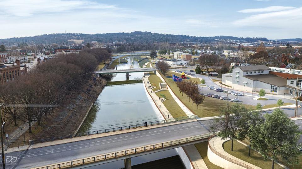
Kirkland’s Codorus Corridor Summer Enrichment Program students were learning in the field and classroom about the waterway. In fact, the goal of the program is to connect the students with the Codorus Greenway project and the professionals working on this 1.4-mile infrastructural initiative to improve creek access, decrease flooding and add recreational amenities.
The plan calls for construction of a park-to-park trail, possibly to be called the “West Bank Trail” or “Creekside Trail.”
The summer enrichment program is part of a larger initiative to engage the community in the Codorus Greenway project that will elevate the creek’s prominence. And perhaps one or many of the students will go from this enrichment course to serve someday, say, as an engineer on the project.
Trail to foster discovery
The students also heard stories from Kirkland about other neighborhoods near the creek and events that happened on its west bank. (I taught the course with Jeff.)
Kirkland’s story of two neighborhoods illustrates the type of stories that can be told to an expanded audience when the West Bank Trail (we’ll call it that here) is completed connecting Bantz Park just off Richland Avenue in York’s west end with Foundry Park between Market and Philadelphia streets.
That access will give users of the trail an opportunity to experience the creek — and the neighborhoods along or near the waterway. It could open up the city’s west end to discovery and storytelling in the same way that the York County Heritage Rail Trail has made towns and their stories along its path — Seven Valleys, Glen Rock, New Freedom — accessible to bikers and walkers.
The trail will run on the Codorus’ west bank in the city, parallel to the Heritage Rail Trail on its east bank. The two will eventually intersect near the old North George Street armory — Keystone Kidspace today.
A creekside walk
Even today, it’s possible to walk near the creek from Bantz to Foundry parks, albeit with more effort than promised when the West Bank Trail goes in.
My son Joe and I started in Bantz Park, green space set aside in 1933 by businessman C. Ernest Bantz in honor of his mother, Julia Hartman Bantz, an example of the stories a trail will unlock.
We walked past the old wading pool and paused at a rain garden, specially designed to absorb runoff from the blacktopped area near it.
We could have descended to creek level through weeds and woods, but I wanted to investigate the block of former Dentsply buildings. If these large structures become rentals or condos, a creek trail would be handy for recreation or as a means to walk to work elsewhere in the city.
We talked with a longtime resident who said the neighborhood is quiet compared to the day — a century — in which Dentsply workers produced artificial teeth for the world. Today, those teeth and many other dental products are made outside York County.
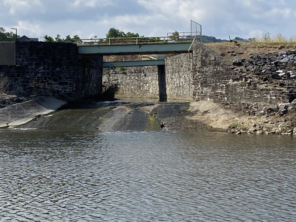
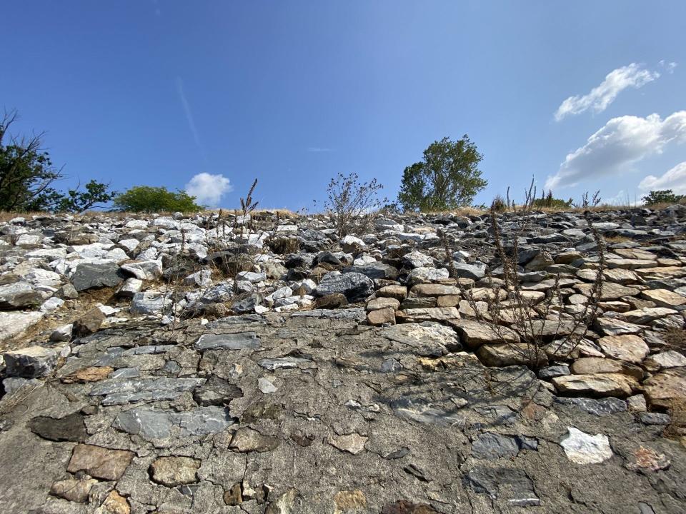
We descended to creek level at the Grantley Street Bridge, and the challenge of making this bleak environment — built for flood control — winsome for trail users was apparent. The Depression-era workers, many living in the Codorus Street neighborhood above where we walked, had created a formidable rocky bank that towered over us.
Pressed for time, we climbed up to street level at the Penn Street Bridge and walked back to Bantz Park along city streets. Some days later, we resumed our walk along green space behind the Homes at Thackston Park — the former site of a landfill — to the College Avenue Bridge. We crossed the road and worked our way through Logos Academy’s campus and a series of streets to Foundry Park.
That park and boat basin is an interesting artifact of history, growing from the “Back to City Movement” in the aftermath of Tropical Storm Agnes in 1972. The park adapted space from the old Eyster-Weiser Foundry and gave users access to the creek, a rarity in a city with the waterway’s banks built up for flood control. Codorus Greenway will attempt to fix this lack of creek access with the West Bank Trail and other work.
Some in the Black community view this investment and post-Agnes housing rehabilitation along Newberry Street as work that did not go deep enough into west-end neighborhoods.
More: Plans call for investment in this York neighborhood after decades of neglect
West Bank or Creekside Trail
The Codorus Greenway project is designed to connect city residents, visitors and trail users with the creek, while maintaining flood control features.
The York County Economic Alliance’s Silas Chamberlin, a trails expert, said the West Bank Trail is a central piece of the Codorus Greenway design and is included in its first phase, fully funded and awaiting final permit review by the Army Corps of Engineers.
He provided this summary of the trail project – showing a considerably more user-friendly path than that afforded those, like my son and me, who try to walk it today:
“The route of the ‘West Bank Trail’ or ‘Creekside Trail’ (name is still undecided) is subject to change as the final design is refined during the permitting process, but in general it will begin at Bantz Park, cross Grantley, follow along the top of the bank of the levee along the Dentsply property and the Cookes House, continue past Homes at Thackston Park Phases 1 and 2 and come back down within the levee system at the Food Bank, past Logos Academy, past Murphy & Dittenhafer, past 270 W. Market and end at Foundry Plaza.
“For now, that’s the terminus. In future phases it will continue along the west bank the whole way to the Army Corps access ramp behind Kidspace, where it connects to the Heritage Rail Trail. There will be numerous places where the creekside trail on the west bank has steps or ADA accessible switchbacks connecting city streets and bridges, so trail users can access adjacent neighborhood destinations or cross the creek to the Heritage Rail Trail. The trail follows the top of the levee system in some areas and is on a cantilever within the levee system itself in certain sections, which helps to avoid historic properties adjacent to the creek and bring users closer to the creek itself.
“In addition to recreation, the new trail will create safe, off-street connections between neighborhoods, businesses, schools, the downtown, the Rabbittransit hub and other destinations — complementing and deepening the connectivity already provided by the Heritage Rail Trail. These trail connections are especially important because 27% of the households in the adjacent neighborhoods are carless and rely on walking, biking and public transit to get around town.”
More: It’s time – past time – for investment in York’s Penn Street corridor
West bank finds investment
In the big picture, the West Bank Trail will be an example of investment in city neighborhoods — and in residents of those places — that, as Jeff Kirkland has pointed out, need such attention.
Kirkland has long argued — he did so with the enrichment class at Crispus Attucks — that parts of Penn Street and other bordering neighborhoods have not seen substantial investment since the York race riots of the late 1960s. That part of the city was the center of that violence.
Since then, most investment has gone into the east bank — the Yorktowne Hotel and baseball stadium are two ready examples.
That is changing. Earlier this year, a group put together a Penn Street Vision Plan that underscores west-end needs and highlights investment opportunities.
Investment on the Codorus’ east side came forth a century ago when the city was considering a promenade along the creek south from West Market Street. This is the area covered by the rail trail, which was completed in the city in 1999 — about 90 years later. The west bank would have received but a barrier of trees to provide greenery in the distance.
In fact, famed landscape architect Frederick Law Olmsted was contracted to tell how a promenade could be done.
Tight-fisted city officials chose not to spend the money, and the practical impact of that decision was that city residents never gained use of the creek. The engineers took their place and high-water control became the only goal, especially after the damaging flood of 1933.
The Codorus Greenway plan, originally estimated at $75 million, would seek to marry beautification, water quality, public access and flood control — the same things Olmsted had in mind.
But it includes one thing that he didn’t account for.
Investment on the west bank and its people, at last.
Jim McClure is a retired editor of the York Daily Record and has authored or co-authored nine books on York County history. Reach him at jimmcclure21@outlook.com.
This article originally appeared on York Daily Record: Codorus Greenway offers new West Bank trail, engage York PA community
