Cold front in Florida has temps in upper 40s to mid-70s, a welcome break from October heat
A cold front is bringing a welcome chill to the air across Florida this week delivering the coolest air of autumn, according to the Florida Division of Emergency Management.
Temperatures 10- to 15-degrees below normal for this time of year can be expected for some locations.
On Monday, residents across the state took to social media to react to the cooler temperatures.
High temperatures will remain in the middle- to upper 60s across North Florida and the lower to middle 70s across Central Florida.
Temperatures could drop as low as the upper 50s in South Florida, while temperatures in some North Florida locations could dip into the upper 40s.
Daily lowest maximum temperatures could be set or tied today across east central Florida, the National Weather Service Melbourne tweeted.
Most of the state will see breezy conditions, with winds of 10 mph to 15 mph expected today and wind gusts reaching 20 mph to 25 mph statewide.
Temperatures will climb steadily throughout the week, but remain below those record highs seen previously.
'Not built for this kind of cold.' Florida cold front, temps in 50s prompt tweets, TikToks
Cold weather alerts issued in Florida
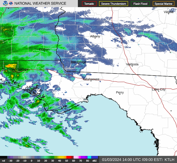
Weather radar and weather forecast for Pensacola, Florida

Follow National Weather Service Mobile on Twitter
Lows Sunday night dropped into the upper 40s or low 50s across the western Panhandle. Here's what to expect the rest of the week.
Monday: High 69; low 50. Sunny. North wind around 15 mph, with gusts as high as 20 mph.
Tuesday: High 72; low 55. Sunny. North wind 5 to 10 mph.
Wednesday: High 74; low 59. Sunny. Northeast wind 5 to 10 mph becoming southeast in the afternoon.
Thursday: High 76; low 65. Mostly sunny. East wind 5 to 10 mph becoming south in the afternoon.
Friday: High 80; low 59. A chance of showers and thunderstorms before 1 p.m., then a slight chance of showers. West wind 10 to 15 mph, with gusts as high as 25 mph. Chance of precipitation is 30%.
Saturday: High 77; low 56. Sunny.
Sunday: High 85. Sunny.
Weather radar and weather forecast for Tallahassee, Florida
Follow the National Weather Service Tallahassee on Twitter
Under mostly sunny skies today, highs are expected to reach the mid- to upper 60s. It'll be breezy, with wind gusts of 20 to 25 mph.
Monday: High 67; low 48. North-northwest wind 10 to 15 mph.
Tuesday: High 69; low 47. Sunny. North wind around 5 mph.
Wednesday: High 73; low 52. Sunny. Calm wind becoming east northeast around 5 mph in the afternoon.
Thursday: High 77; low 58. Sunny.
Friday: High 78; low 57. A 40 percent chance of showers and thunderstorms.
Saturday: High 75; low 52. Sunny.
Sunday: High 74. Sunny.
Weather radar and weather forecast for Jacksonville, Florida

Follow the National Weather Service Jacksonville on Twitter
"Break out your sweaters!" the National Weather Service Jacksonville tweeted. Monday night lows were expected to drop into the 40s, with high temperatures forecast to reach the mid- to upper 60s. "Enjoy the beautiful weather."
Monday: High 68; low 50. Mostly sunny. Breezy, with a northwest wind 11 to 15 mph.
Tuesday: High 70; low 53. Sunny. North wind 8 to 10 mph.
Wednesday: High 74; low 59. Sunny. Northeast wind 6 to 13 mph.
Thursday: High 78; low 60. A 20 percent chance of showers.
Friday: High 80; low 59. A 40 percent chance of showers and thunderstorms.
Saturday: High 76; low 55. Sunny. Breezy.
Sunday: High 77. Sunny.
Weather radar and weather forecast for Daytona Beach, Florida

Follow the National Weather Service Melbourne on Twitter
"Fall weather fans rejoice!" the National Weather Service Melbourne tweeted. "Much cooler air has moved in and highs are only forecast to reach the low to mid 70s today. "We could even see some daily lowest max temp records be set/tied."
Cold front on the way: Another taste of fall weather headed to Volusia, Flagler
Monday: High 71; low 54. Mostly sunny. West northwest wind 10 to 15 mph, with gusts as high as 20 mph.
Tuesday: High 70; low 59. Sunny. Northwest wind around 10 mph.
Wednesday: High 76; low 64. Mostly sunny. North northeast wind 5 to 10 mph.
Thursday: High 78; low 64. Mostly sunny. North northeast wind 5 to 10 mph.
Friday: High 80; low 63. A 30 percent chance of showers and thunderstorms after 9 a.m. Mostly sunny. West southwest wind 5 to 15 mph.
Saturday: High 78; low 60. A 30 percent chance of showers and thunderstorms. West northwest wind 10 to 15 mph, with gusts as high as 20 mph.
Sunday: High 77. Sunny.
Weather radar and weather forecast for Melbourne, Florida
Follow the National Weather Service Melbourne on Twitter
By this evening, small craft advisory conditions will become generally confined to the Gulf Stream north of Sebastian Inlet.
Boating conditions will remain poor in the Gulf Stream on Tuesday due to seas of 4 to 6 feet.
Isolated lightning storms are possible Friday and Friday night as a cold front passes through the state.
Monday: High 75; low 58. Mostly sunny. West northwest wind 10 to 15 mph, with gusts as high as 20 mph.
Tuesday: High 75; low 63. Sunny. Northwest wind around 10 mph.
Wednesday: High 80; low 69. Sunny. North northwest wind around 10 mph.
Thursday: High 82; low 68. Mostly sunny. Northeast wind 5 to 10 mph.
Friday: High 83; low 67. A 30 percent chance of showers and thunderstorms after 9 a.m. Southwest wind around 10 mph.
Saturday: High 81; low 63. A 30 percent chance of showers and thunderstorms. West wind around 15 mph, with gusts as high as 20 mph.
Sunday: Sunny, with a high near 81. West northwest wind around 10 mph.
Weather radar and weather forecast for Port St. Lucie, Florida
Follow the National Weather Service Melbourne on Twitter
Boating conditions will remain poor in the Gulf Stream on Tuesday due to seas of 4 to 6 feet.
Isolated lightning storms are possible Friday and Friday night as a cold front passes through the state.
Monday: High 76; low 55. Partly sunny. West northwest wind 10 to 15 mph, with gusts as high as 20 mph.
Tuesday: High 76; low 60. Sunny. Northwest wind around 10 mph.
Wednesday: High 81; low 66. Sunny. North northwest wind 5 to 10 mph.
Thursday: High 82; low 68. Mostly sunny. East northeast wind 5 to 10 mph.
Friday: High 84; low 66. A slight chance of showers, then a chance of showers and thunderstorms after 9 a.m. North northwest wind 5 to 10 mph becoming west southwest in the morning. Chance of precipitation is 30%.
Saturday: High 82; low 61. A 30 percent chance of showers and thunderstorms. West wind 10 to 15 mph, with gusts as high as 20 mph.
Sunday: High 81. Sunny. West northwest wind around 10 mph.
Weather radar and weather forecast for West Palm Beach, Florida

Follow the National Weather Service Miami on Twitter
"A welcome change for weather across South Florida, with a cold front sweeping through the region today!" tweeted the National Weather Service Miami. "Max temperatures will struggle to exceed 80 degrees across many locations today. For tonight, brisk min temps ranging from the mid 50s to lower 60s can be expected."
Monday: High 76; low 63. Breezy, with a west wind 14 to 16 mph, with gusts as high as 24 mph.
Tuesday: High 76; low 68. Sunny. Breezy, with a north wind 14 to 18 mph, with gusts as high as 21 mph.
Wednesday: High 79; low 74. Mostly sunny. Northeast wind around 14 mph.
Thursday: High 81; low 75. Mostly sunny. Northeast wind 10 to 14 mph.
Friday: High 83; low 72. A 30 percent chance of showers and thunderstorms.Northeast wind around 9 mph becoming southwest in the afternoon.
Saturday: High 82; low 69. A 10 percent chance of showers and thunderstorms.
Sunday: High 80. Sunny.
Weather radar and weather forecast for Naples, Florida
Follow the National Weather Service Miami on Twitter
Much cooler and dry conditions expected through the early to mid-week from the cold front.
Minor coastal flooding may continue into the middle of the week along the Atlantic coast due to king tides.
An elevated risk of rip currents will continue into early this upcoming week along Collier County and Palm Beach county beaches.
Monday: High 78; low 59. Partly sunny. Northwest wind 10 to 15 mph, with gusts as high as 18 mph.
Tuesday: High 78; low 59. Sunny. North wind around 10 mph.
Wednesday: High 84; low 66. Sunny. Northeast wind 7 to 10 mph.
Thursday: High 86; low 69. Sunny. Northeast wind around 11 mph.
Friday: High 84; low 72. Mostly sunny 84. Northeast wind 7 to 11 mph becoming west in the afternoon.
Saturday: High 84; low 66. Sunny.
Sunday: High 83. Sunny.
Weather radar and weather forecast for Fort Myers, Florida

Follow the National Weather Service Tampa Bay on Twitter
Monday: High 76; low 56. Isolated sprinkles before 11 a.m. Mostly sunny. Northwest wind 7 to 13 mph, with gusts as high as 18 mph.
Tuesday: High 75; low 57. Sunny. North wind around 9 mph.
Wednesday: High 81; low 64. Sunny. Northeast wind 6 to 9 mph.
Thursday: High 84; low 67. Sunny. East northeast wind 8 to 10 mph.
Friday: High 82; low 70. Isolated showers. Mostly sunny. Northeast wind 6 to 10 mph becoming west in the afternoon. Chance of precipitation is 20%.
Saturday: High 82; low 63. Sunny and breezy.
Sunday: High 81. Sunny.
Weather radar and weather forecast for Sarasota, Florida
Follow the National Weather Service Tampa Bay on Twitter
Monday: High 75; low 58. Isolated sprinkles before 11 a.m. Partly sunny. Windy, with a northwest wind 16 to 20 mph.
Tuesday: High 75; low 58. Sunny. North northeast wind around 11 mph.
Wednesday: High 81; low 63. Sunny. Northeast wind 8 to 10 mph.
Thursday: High 85; low 67. Sunny. Northeast wind around 10 mph.
Friday: High 82; low 70. Mostly sunny. East wind 6 to 11 mph becoming west in the morning. Winds could gust as high as 18 mph.
Saturday: High 82; low 65. Sunny and breezy.
Sunday: High 81. Sunny.
This article originally appeared on Treasure Coast Newspapers: Florida weather: Cooler temperatures from Pensacola to West Palm Beach
