Cold front moving through Florida brings threat of tornadoes, strong storms
A cold front moving through east Central Florida today is bringing a threat for some severe weather to several counties.
A tornado warning was issued for portions of Sarasota and Manatee counties just before noon as radar indication rotation as a strong storm moved east.
The main threats with the strongest storms will be wind gusts of 40 to 60 mph, a brief tornado or two this morning,large hail mainly in the afternoon to the south, frequent cloud to ground lightning strikes, and heavy downpours, according to the National Weather Service Melbourne.
Some storms could be severe, and a brief tornado is possible, according to the National Weather Service, Jacksonville.
Showers and lightning storms will move toward the east around 25 mph into northern Lake and Volusia counties through sunrise.
Tornado warning:Tornado warning issued for parts of Sarasota, Manatee through noon
'The cities were paralyzed': Photos show historic blizzard that pounded Northeast 135 years ago
A few storms will be strong to possibly severe, containing wind gusts up to 60 mph, small hail and heavy downpours in North Florida. A brief tornado is possible.
The showers and storms will move south over the metro Orlando area and north Brevard County later thismorning, then south to Osceola, southern Brevard, Okeechobee and the Treasure Coast this afternoon.
A flood advisory is in effect until 7:30 a.m. for Flagler, Putnam, Alachua and Marion counties. Flooding caused by excessive rainfall is expected.
Weather watches and warnings issued for your city
If you can't see any local weather warnings here, you'll need to open this story in a web browser.
Weather alerts issued in Florida
Weather radar and forecast for Jacksonville

Monday: Showers likely, mainly before noon. Cloudy, with a high near 73. West wind 6 to 9 mph becoming north in the morning. Chance of precipitation is 70%. New precipitation amounts between a quarter and half of an inch possible.
Tuesday: Sunny, with a high near 64. North wind 11 to 13 mph.
Follow the National Weather Service Jacksonville on Twitter
Weather radar and forecast for Daytona Beach
Special weather statement: Scattered to numerous rain showers and isolated strong to marginally severe thunderstorms are forecast to drift ahead of and along a cold front advancing southeast through east centralFlorida today.
The main threats with the strongest storms will be wind gusts of 40 to 60 mph, a brief tornado or two this morning,large hail mainly in the afternoon to the south, frequent cloud to ground lightning strikes, and heavy downpours.
Monday: Showers likely and possibly a thunderstorm before 5 p.m., then a chance of showers and thunderstorms after 5 p.m. Mostly cloudy, with a high near 76. Southwest wind 10 to 15 mph becoming north northwest in the afternoon. Chance of precipitation is 70%. New rainfall amounts between a half and three quarters of an inch possible.
Tuesday: Sunny, with a high near 64. North wind 10 to 15 mph.
Follow the National Weather Service Melbourne on Twitter
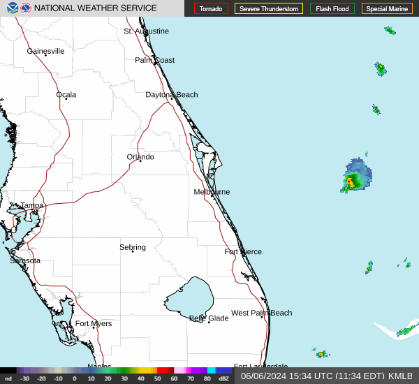
Weather radar, forecast for Melbourne
Special weather statement: Scattered to numerous rain showers and isolated strong to marginally severe thunderstorms are forecast to drift ahead of and along a cold front advancing southeastward through east centralFlorida today.
The main threats with the strongest storms will be wind gusts of 40 to 60 mph, a brief tornado or two this morning,large hail mainly in the afternoon to the south, frequent cloud to ground lightning strikes, and heavy downpours.
Showers and lightning storms will move toward the east around 25 mph into northern Lake and Volusia counties through sunrise. A few storms will be strong to possibly severe, containing wind gusts up to 60 mph, small hail and heavy downpours. A brief tornado is also possible. The showers and storms will develop southward overthe metro Orlando area and north Brevard County later this morning,
Monday: A slight chance of showers before 11 a.m., then a chance of showers and thunderstorms between 11 a.m. and 2 p.m., then showers likely and possibly a thunderstorm after 2 p.m. Increasing clouds, with a high near 84. West wind 10 to 15 mph, with gusts as high as 25 mph. Chance of precipitation is 70%. New rainfall amounts between a quarter and half of an inch possible.
Tuesday: Sunny, with a high near 72. North wind 10 to 15 mph.
Follow the National Weather Service Melbourne on Twitter
Weather radar, forecast for Port St. Lucie
Special weather statement: Scattered to numerous rain showers and isolated strong to marginally severe thunderstorms are forecast to drift ahead of and along a cold front advancing southeastward through east central Florida today. The main threats with the strongest storms will be wind gusts of 40 to 60 mph, a brief tornado or two this morning, large hail mainly in the afternoon to the south, frequent cloud to ground lightning strikes, and heavy downpours.
The showers and storms will move south and could arrive in southern Brevard, Okeechobee and the Treasure Coast counties this afternoon.
Monday: A chance of showers and thunderstorms between 11 a.m. and 5 p.m., then showers likely and possibly a thunderstorm after 5 p.m. Mostly sunny, with a high near 87. West southwest wind 5 to 10 mph increasing to 10 to 15 mph in the afternoon. Winds could gust as high as 25 mph. Chance of precipitation is 60%. New rainfall amounts of less than a tenth of an inch, except higher amounts possible in thunderstorms.
Tuesday: Showers and thunderstorms likely before 11 p.m., then a slight chance of showers between 11 p.m. and 2 a.m. Mostly cloudy, with a low around 59. West wind around 10 mph becoming north northwest after midnight. Chance of precipitation is 60%. New precipitation amounts of less than a tenth of an inch, except higher amounts possible in thunderstorms.
Follow the National Weather Service Melbourne on Twitter
This article originally appeared on The Daytona Beach News-Journal: Florida weather radar: Severe storms, possible tornado, heavy rain
