Chances for more rain overnight; Warmer than normal temperatures this week
QUICK-LOOK FORECAST:
Tracking more chances for rain
Overall, warm temperatures
Few flurries possible Friday
>> TRACK THE CONDITIONS WITH LIVE DOPPLER 7
DETAILED FORECAST:
OVERNIGHT: Storm Center 7 Meteorologist Austin Chaney says rain showers move through tonight and overnight.
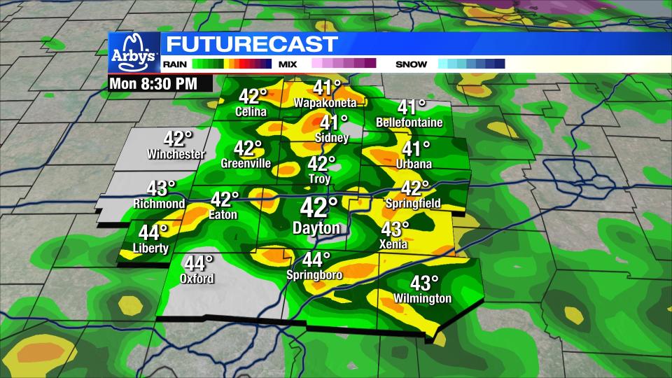
Temperatures will be steady or slightly rising through the night in the 40s.


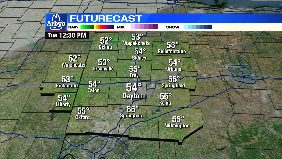
TOMORROW: Showers exit in the morning.
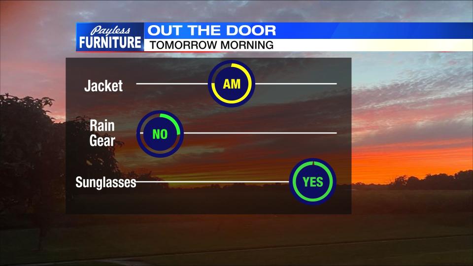
Gradual clearing expected before clouds return again Tuesday night. A very warm day by January standards with highs in the low 50s.
WEDNESDAY: Dry start. Warmer than normal in the upper 40s. Clouds increase with rain returning again at night.
THURSDAY: Rain showers in the morning. Cloudy with a few lingering showers through the day. Highs in the middle 50s. Turning colder quickly at night. Flurries possible late.
FRIDAY: Flurries in the morning. Mostly cloudy and colder day. Highs in the upper 30s.
SATURDAY: Dry and partly cloudy with temperatures a little closer to normal. Low 40s.
SUNDAY: Another storm will bring rain through the day. As cold air arrives it can change to snow at night. This is a long way out, so much can change. Highs near 40, lows at or below freezing.
MONDAY: Rain or snow in the morning. Precipitation type will depend on the track and temperatures with this system. Stay turned and we get a clearer picture on that. Highs in the mid to upper 30s.

