The cold, snow headed to Springfield and central Illinois is 'straight out of the Arctic'
After last week's wet weather, Springfield isn't going to get a reprieve from nasty weather anytime soon.
Snow and frigid temperatures are forecast to enter the area starting Wednesday with blowing snow and blizzard-like conditions expected to stay around through the later part of the week. Bitter cold will come alongside that with wind chills to go well below zero into the weekend.
All of this will put Springfield and Illinois' traffic and public works departments to the test as they try to keep roads safe and make sure that those who need to travel get where they need to go just in time for Christmas.
More:Candidate filing deadline arrives; three D186 subdistricts have contested races
Here's a look at what you should expect from this week's wintry blast.
What's the forecast?
After relatively clear skies on Tuesday, conditions are expected to get cloudier with the first batch of snow falling Wednesday evening. According to the National Weather Service in Lincoln, the snow will team up with rain early Thursday morning and wind gusts will begin to pick up towards 20 miles per hour.
The rain/snow mix will change over to all snow about noon Thursday with winds gusting up to 37 mph by the end of the day. While the high temperature is expected to reach 33 degrees according to NWS, that will drop significantly as the day goes on to the low-to-mid teens by the end of the day.
By Thursday night, snow will continue until midnight, with high winds bringing blowing snow early Friday morning. Temperatures will be brutally cold. Lows will go below zero to -5 degrees in some areas.
Friday will remain cold, but with blowing snow and wind gusts up to 47 mph. High temperatures will barely get above zero, with lows continuing below zero.
Winds will stay high into the weekend, with the blowing snow becoming patchier into Saturday. While Christmas Day will be clear, it will likely be extremely cold.
Why will it be so snowy and cold?
According to Rebekka Delaney, a meteorologist with the NWS, a low-pressure system in the Great Plains, backed up by an Arctic cold front, is ready to bring the nasty weather this way.
"There is a low-pressure system that is forming in the Plains and it'll be sweeping up through our area, bringing a cold front," Delaney said. "This cold front will be bringing the high winds, the snow and the very cold temperatures. The cold air is coming straight out of the Arctic."
One day prior to the system hitting central Illinois, Delaney said that NWS still hadn't finalized an expected snow total, although the current projection was for 2-5 inches of snow to have accumulated starting Thursday.
"Currently, that is up in the air," Delaney said. "Our confidence in the amount is very low."
NWS has more confidence in the projected wind chills, with the amounts likely approaching -30 degrees, in a range of -28 to -34. The bitter cold also means the potential for frostbite, with Delaney saying that the temperatures could lead to unprotected people getting it in less than 30 minutes.
Blowing snow will make travel difficult
Paul Wappel, spokesperson for the Illinois Department of Transportation, said that crews were preparing for the storm and cold temperatures to come. He's said people who are making plans to travel this weekend should check the forecast and road conditions before heading out.
"You may want to consider adjusting your travel from earlier rather than later, like in the next couple of days before the storm hits," Wappel said.
He also recommends that people go to gettingaroundillinois.com, an IDOT-sponsored website that provides information on road conditions throughout the state.
Wappel said that how IDOT addresses storms depends on how conditions shape up on the roadways and that they change how they look at various conditions based on what the weather is doing on at a given time.
"Every weather event is different," Wappel said. "Do we pretreat the roads? It depends on what the weather looks like, it depends on the temperature (and) whether we're getting snow, sleet, freezing rain. When it gets really cold, salt isn't as effective and if you get wind, then the salt blows right off."
Because NWS is projecting "blizzard-like" conditions with wind gusts hitting 55 mph, Delaney said that if people don't need to drive, they shouldn't, as changing visibilities will make it difficult on drivers even if roads are clear of snow and ice.
However, Delaney and Wappel recommend that people be prepared for possibly being stranded on roadways if they do have to get out. Take along an emergency kit, dress in layers, and even have a blanket with them for maximum warmth and protection.
Pretreating roads begins Wednesday
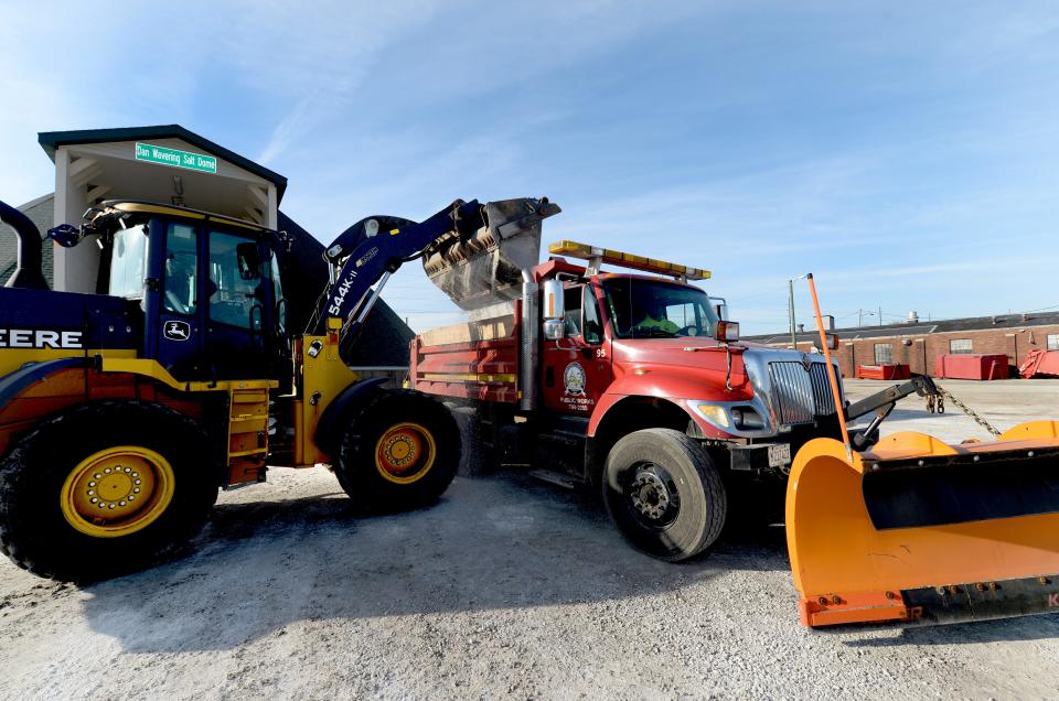
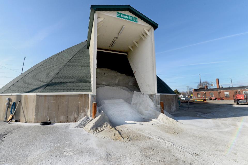
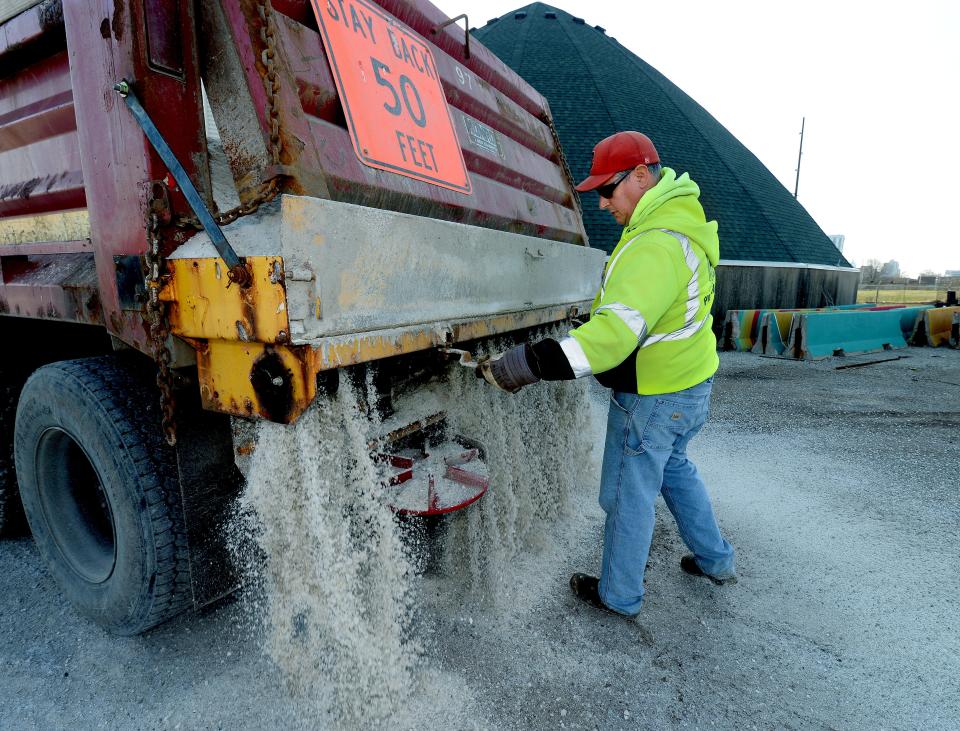
Springfield Public Works Director Nate Bottom said that the city will pretreat roads on Wednesday prior to the system coming into the area. Once the snow hits, Bottom said that the crews will begin clearing the roads, with main arterial roadways being the top priority to get cleared first.
"Our main streets are the top priority; basically anything within a quarter-mile of a main road," Bottom said. "Our focus is to clear those first. Then we will move into secondary streets after we get the mains cleared – major roads leading in and out (of the city), connecting subdivisions as well as commercial areas. Then we'll move into subdivisions as needed."
Usually, the main and secondary roads are salted, but not the subdivisions, as Bottom pointed out that the price of salting those roads adds up.
"Salt's fairly pricey," Bottom said. "We try to keep the loads down, especially in the older areas (because) the salt actually goes to the Sangamon County Water Reclamation District plant and it increases our salt loads because they have to treat it."
More:Auburn community makes a wish come true for a 'sassy, spunky' 3-year-old battling cancer
With the potential for high winds, Bottom said that it can be difficult for his teams to get out and clear the roads, with snow fencing being used by Public Works in order to prevent drifting in certain areas.
"It's just a balancing act," Bottom said. "We do have a contractor that can use a grader on some of those roads if there is any drifting or we can use our own equipment to help plow that as needed."
Public Works divides up the city into seven districts – six numbered and one for the central business district downtown, with resources divided up to address needs in those areas.
"We have those broken down because that works operationally with how many plow drivers we have as well as operators," Bottom said. "We optimize our snow districts so we can plow as efficiently as possible, balancing the mains as well as the secondary streets and subdivisions."
What's going to happen to my flight?
Mark Hanna, executive director of Abraham Lincoln Capital Airport, said that many airlines will make their decisions as to whether to cancel flights on Wednesday. He said that people should keep an eye on their flights by downloading their airline's app and checking the flight status.
"Turn on all notifications as it pertains to your flight because you will get real-time updates," Hanna said.
In addition, Hanna said that many airlines will be providing no-cost transfers or flight changes for those affected by the winter storms.
"If you want to leave earlier or change your flight from later to earlier, they're letting you make those changes without putting any additional charges on your ticket," Hanna said.
At the airport, Hanna said that they would be implementing their control plan for snow and ice this week, with equipment and personnel ready to keep the runways clear of any danger.
"At a certain point in time, we will be pre-treating the airport surfaces and also monitoring the wind directions and the snowfall to anticipate any drifting that we may need to battle in order to keep the runways open," Hanna said. "We do anticipate the winds shifting 24 hours into the event to the northwest, almost in alignment with our crosswind runways. Hopefully, that should allow for a smoother landing and takeoff at the airport during that period of time."
Will there be a white Christmas Day?
While conditions may still be merry and bright, it will still be cold Christmas Day, with temperatures in the teens.
Delaney said that a white Christmas is usually not common in central Illinois. One Christmas in the past 10 years has had at least an inch of snow on the ground.
According to data from the National Oceanic and Atmospheric Administration – NWS' parent company – there is a 24% chance of fresh snow for a white Christmas in Springfield.
This article originally appeared on State Journal-Register: Here's what the Arctic air will bring to Springfield, central Illinois

