Flurries fade this evening, skies clear; Sunshine returns this weekend
QUICK-LOOK FORECAST:
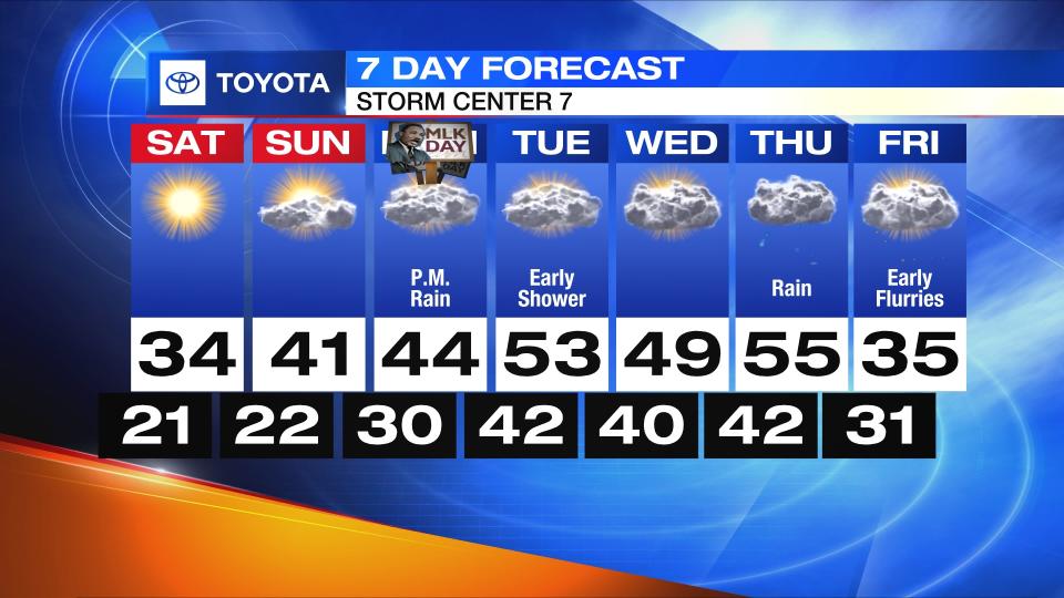
Flurries fade and skies eventually clear
Sunshine returns this weekend
Mild again next week
>> TRACK THE CONDITIONS WITH LIVE DOPPLER 7
DETAILED FORECAST:
TONIGHT: Flurries fade and clouds will eventually clear as winds diminish.

Storm Center 7 Meteorologist Robert Gauthreaux says a light breeze will remain creating wind chills in the teens by Saturday morning.
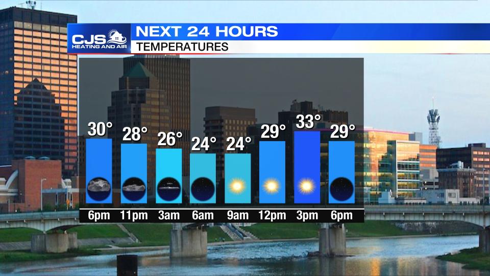
Temperatures in the low 20s, while some places may reach the teens.
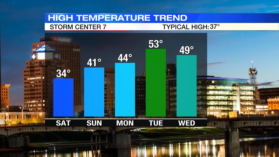
SATURDAY: A cold start to the weekend with temperatures in the 20s early in the day.

The upside to the forecast is the amount of sunshine we will see. Highs in the afternoon will be seasonably cool in the middle 30s.
SUNDAY: Another cold morning in the 20s, but temperatures will be a bit milder for the afternoon as they reach the lower 40s. Sunshine early will give way to more clouds throughout the day.
MONDAY: Monday will start out dry with some sunshine, but clouds increase quickly and then showers arrive in the afternoon and evening. Despite the rain, temperatures will rise to the upper 40s. It will be a bit breezy, too.
TUESDAY: Some showers will linger into Tuesday morning otherwise it will be a mostly cloudy and mild day with highs in the lower 50s.
WEDNESDAY: Warmer than average temperatures are expected again on Wednesday with highs in the lower 50s. Right now, Wednesday appears to be dry during the day with the chance for rain returning Wednesday night.
THURSDAY: Rain likely, especially in the morning. Windy at times and mild with temperatures in the mid 50s.
FRIDAY: Some early flurries possible, otherwise mostly cloudy and colder. Highs in the mid 30s.

