'Colder than normal' January could lead to above average Great Lakes ice cover
As the winter days continue to get colder, more ice is beginning to form on the Great Lakes.
While Northern Michigan residents have experienced multiple below-zero days in the past month, the comparatively warm days have still stayed below freezing, making conditions right for daily ice formation on the lakes, weather experts said.
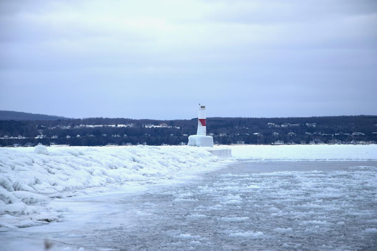
Ice cover over the Great Lakes has been steadily increasing throughout the season. While still below average, the recent low temperatures suggest the ice could be getting close to the average or even surpass it.
According to the National Oceanic and Atmospheric Association’s Great Lakes Environmental Research lab, the long-term average ice cover is around 55%, since the lab first started collecting data in 1973. The average for 2021 sat just below that with 45.8% average ice cover and 2019 was well below the average with 19.5%.
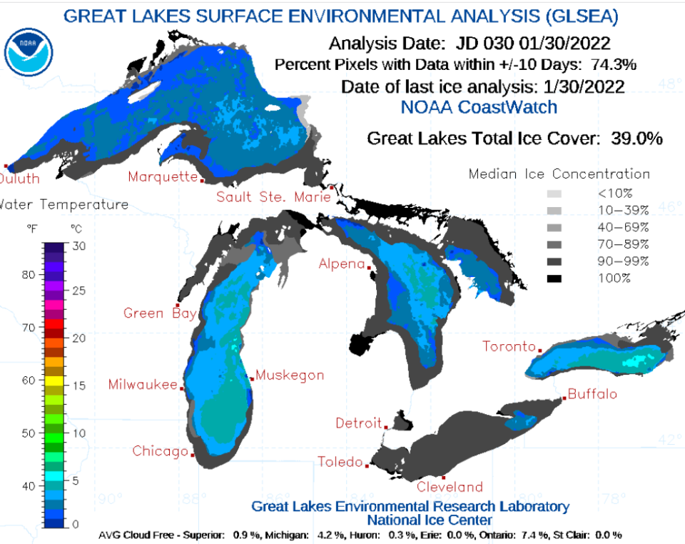
This year, the month of January has seen a steady increase in ice cover across all of the Great Lakes. Starting 2022 off on Jan. 1 with 2.35% ice cover, to the most recent data from the research lab, showing 39% on Jan. 30. Also on Jan. 30, the agency reported that Lake Superior had about 24% ice coverage, Lake Michigan was 33%, Lake Huron was 50.5%, Lake Erie was 87% and Lake Ontario was 27.8% frozen.
“January is where the ice really starts to develop in most winters and January has been colder than normal. So we've been developing a lot of ice,” said Patrick Bak, meteorologist with the National Weather Service office in Gaylord.
According to Bak, the average temperature for January in Petoskey was 13.1 degrees Fahrenheit, compared to 23.6 degrees the previous year.
Bak said one of the factors that goes into ice cover is freezing degree days.
“If you take your high temperature and low temperature for the day and average them together and it's below 32 (degrees), that means you're going to be supporting ice development," he said. "If you average the high and low and that temperature today is above freezing, it's towards the melting of ice.”
Bak said most January days tend to be below freezing, building up more ice cover on the lakes. That weather normally continues into March before starting to thaw.
The month of January has seen average temperatures fluctuating between the mid 20s to below zero, according to data from the National Weather Association. One of these fluctuations from Jan. 10 to Jan. 11, shows a temperature drop from 17 degrees to 8 degrees. This corresponds with data from the research lab showing an increase in ice cover from 6.8% to 13% on the same days, one of the largest increases in the month.
“We should continue to develop ice fairly rapidly. At this point, there is at least potential for us to be above normal for ice cover this year,” Bak said. “We're already at 30 (percent) and we still have another six weeks or so of what would typically be a good ice growth year. Chances are that we could get some pretty decent ice coverage this year.”
This article originally appeared on The Petoskey News-Review: Below-freezing temperatures could lead to above average ice cover

