'Coldest temperatures of the season': Snow and chill in Cape Cod weekend forecast
The next chapter of winter weather on Cape Cod will really feel like winter.
According to the National Weather Service forecast discussion, a "coastal storm passing to our south could bring minor accumulations of snow to eastern and southeast New England Friday into Saturday, but significant accumulations are not expected. Much colder temperatures by this weekend before temperatures moderate into early next week."
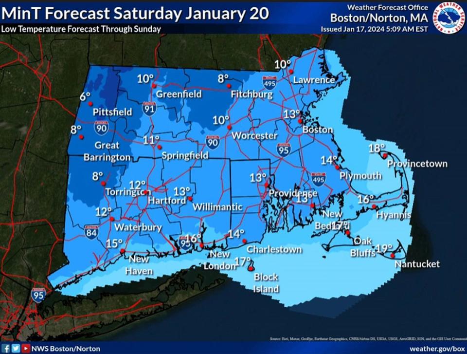
The Arctic air mass will bring the "coldest temperatures of the season to southern New England through the weekend," according to the forecast discussion. Low temperatures on Friday and Saturday night are expected to be in the neighborhood of 15 degrees on the Cape.
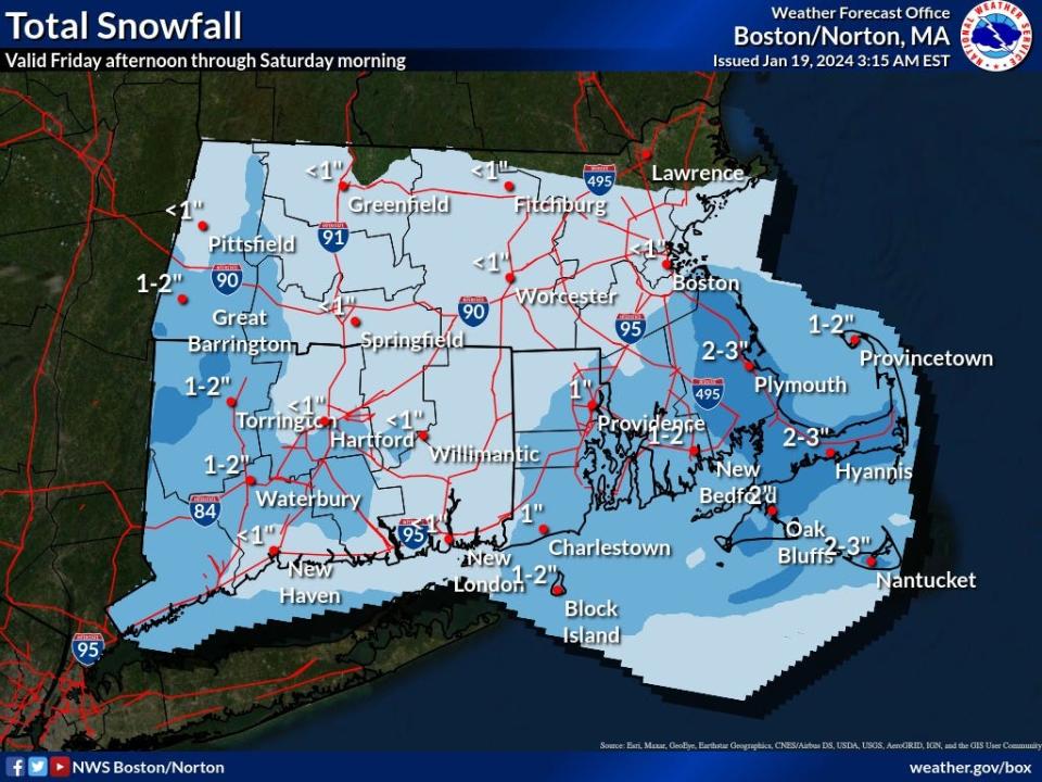
In the snow department, locations south and east of the I-95 may receive two to five inches of snow, "with the higher totals running along Barnstable County (and) north/northwest along the Route 3 corridor of Plymouth County," according to the National Weather Service forecast discussion.
A bit of wind is expected to jump on the bandwagon, possibly creating blustery conditions around the Cape. North and northwest winds are expected to be around 15 mph during the weekend.
On the bright side, if the Cape receives several inches of snow, the chilly temperatures mean it will stick around for a couple of days. It may be possible to break out sleds and cross-country skis from their long slumber in sheds and garages.
But any snow will likely melt away as we move into next week. High temperatures are expected to be around 40 degrees on Monday, Tuesday and Wednesday.
Here is the Hyannis forecast from the National Weather Service:
Friday: Snow, mainly after 2 p.m. High near 32. North wind 5 to 10 mph. Chance of precipitation is 80%. Total daytime snow accumulation of 1 to 2 inches possible.
Friday night: Snow, mainly before 11 p.m. Low around 17. North wind 13 to 15 mph. Chance of precipitation is 90%. New snow accumulation of 1 to 2 inches possible.
Saturday: Mostly cloudy, with a high near 23. Northwest wind 11 to 14 mph.
Saturday night: A slight chance of snow between 8 p.m. and 1 a.m. Mostly cloudy, with a low around 14. Northwest wind 10 to 13 mph. Chance of precipitation is 20%.
Sunday: Mostly sunny, with a high near 29. Northwest wind 10 to 13 mph.
Sunday night: Mostly clear, with a low around 19. Northwest wind around 14 mph.
Monday: Sunny, with a high near 38. Southwest wind 10 to 18 mph.
Eric Williams, when not solving Curious Cape Cod mysteries, writes about a variety of ways to enjoy the Cape, the weather, wildlife and other subjects. Contact him at ewilliams@capecodonline.com. Follow him on X: @capecast.
Thanks to our subscribers, who help make this coverage possible. If you are not a subscriber, please consider supporting quality local journalism with a Cape Cod Times subscription. Here are our subscription plans.
This article originally appeared on Cape Cod Times: Cape Cod weekend weather forecast: Cold temperatures and snow likely

